View historic maps of Everton and Scottie Road. Simply hover to zoom on any map, or click to enlarge!
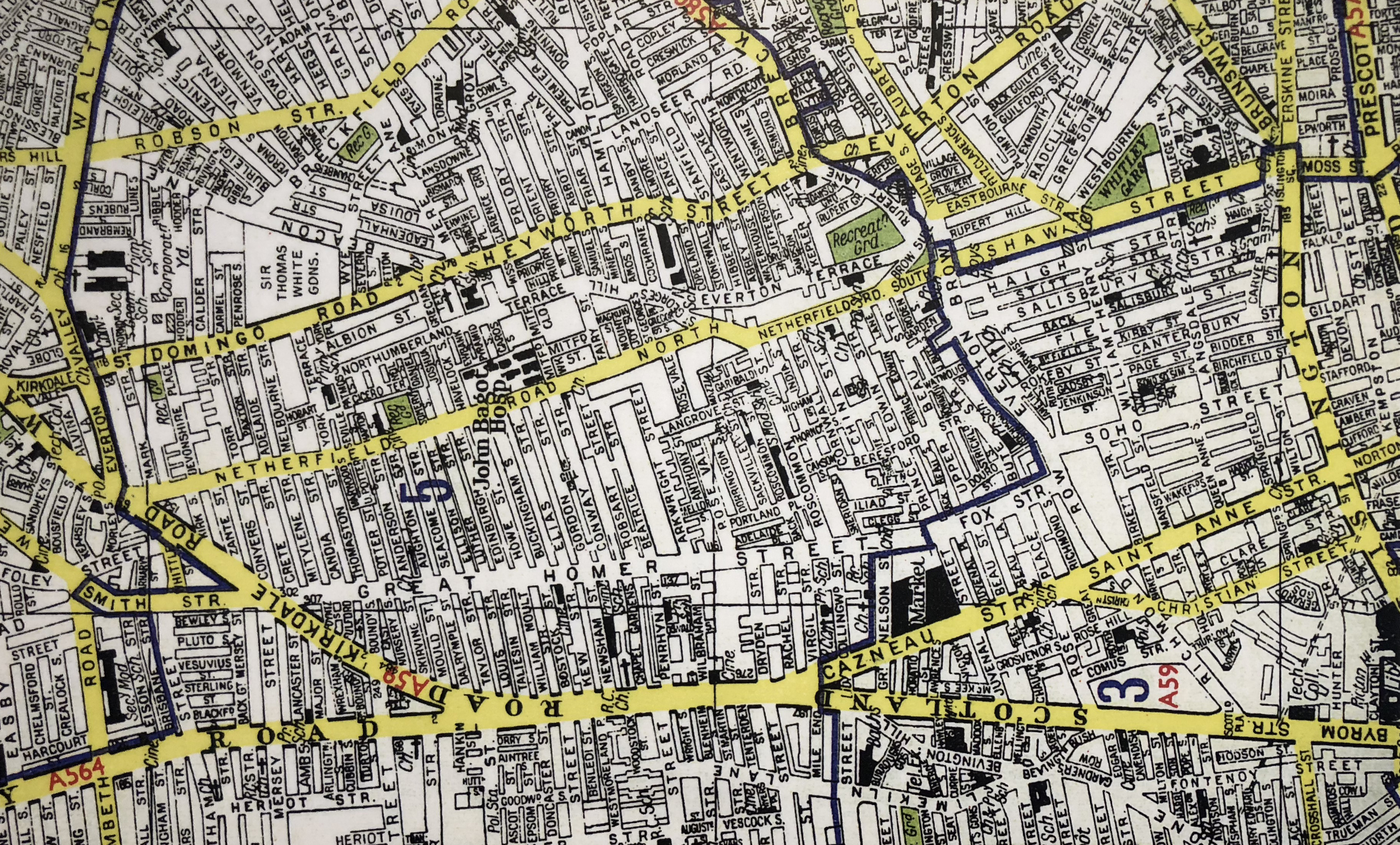
1960: This shows all of the old streets still intact before the bulldozers moved in to create the ‘Lost Tribe of Everton & Scottie Road’. Images courtesy: Liverpool Records Office.
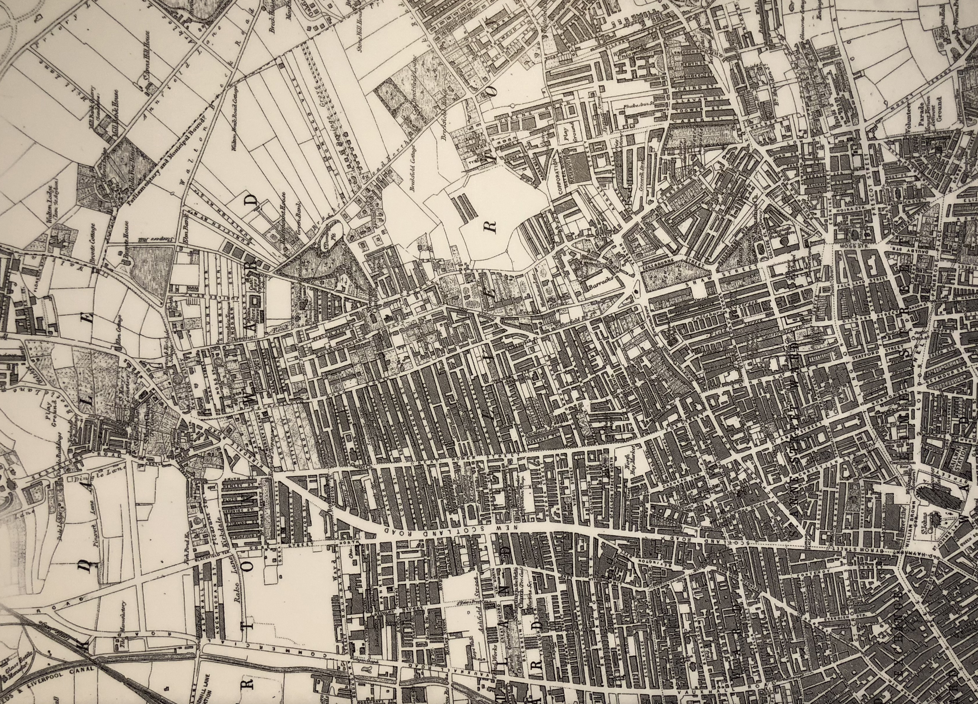
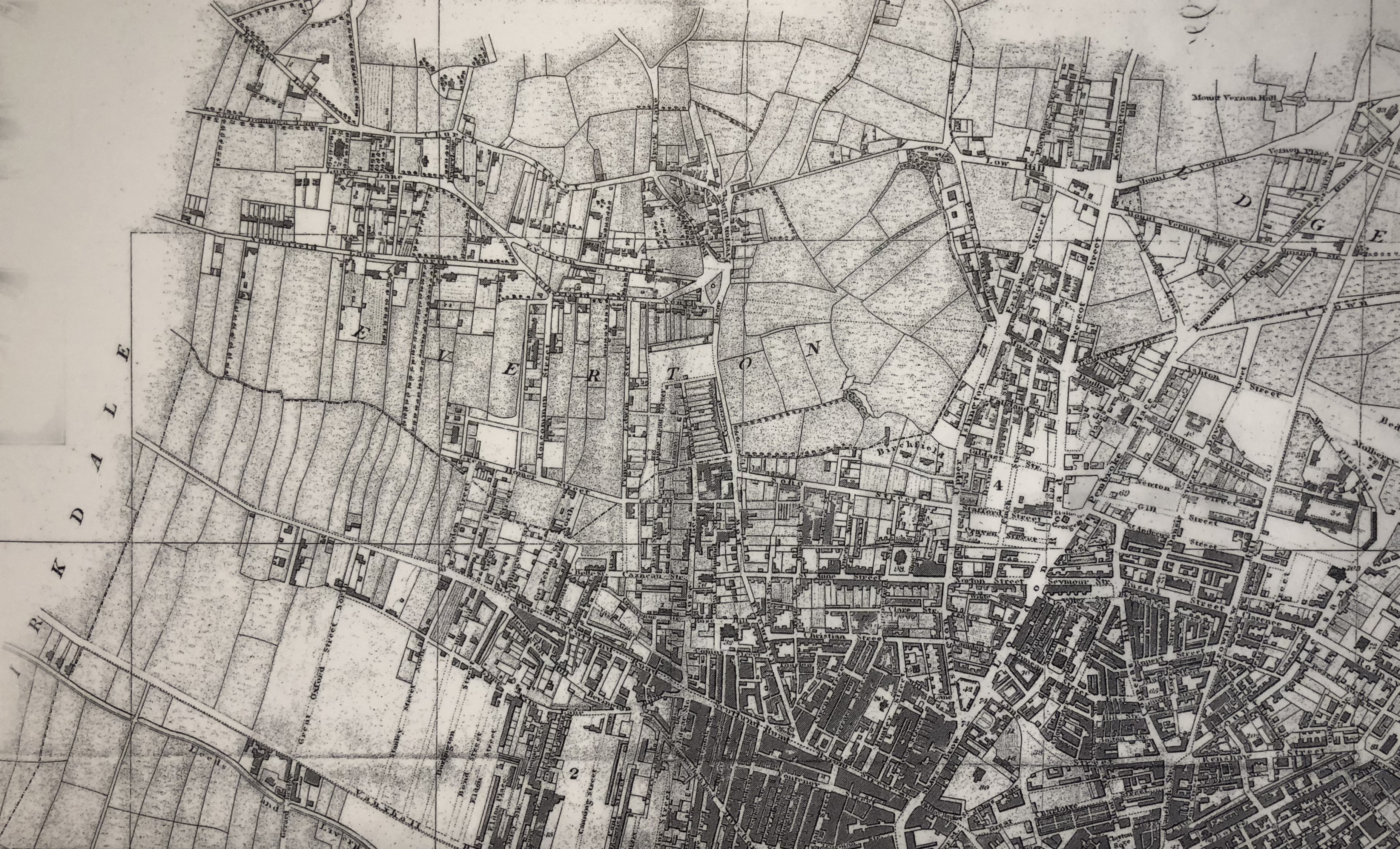
1863: John Dower’s map highlights 40 years of dramatic change with the west side of Netherfield Road now fully developed. The concrete jungle of terraced streets has reached the top ridge. Images courtesy: Liverpool Records Office.
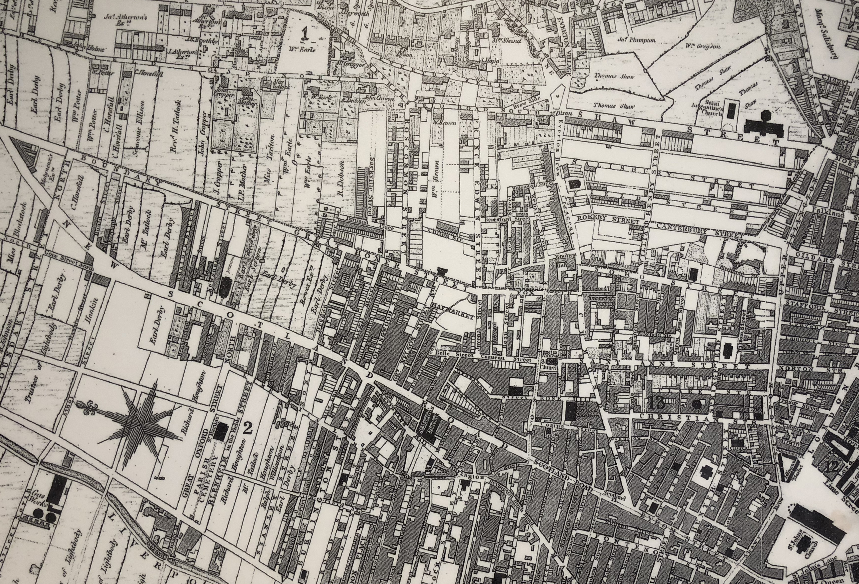
1841: Bennison's 1841 Map shows further encroachment on the green slopes of Everton by new terraced streets. Images courtesy: Liverpool Records Office.
1829: 'Stranger In Liverpool' Map. Images courtesy: Liverpool Records Office.
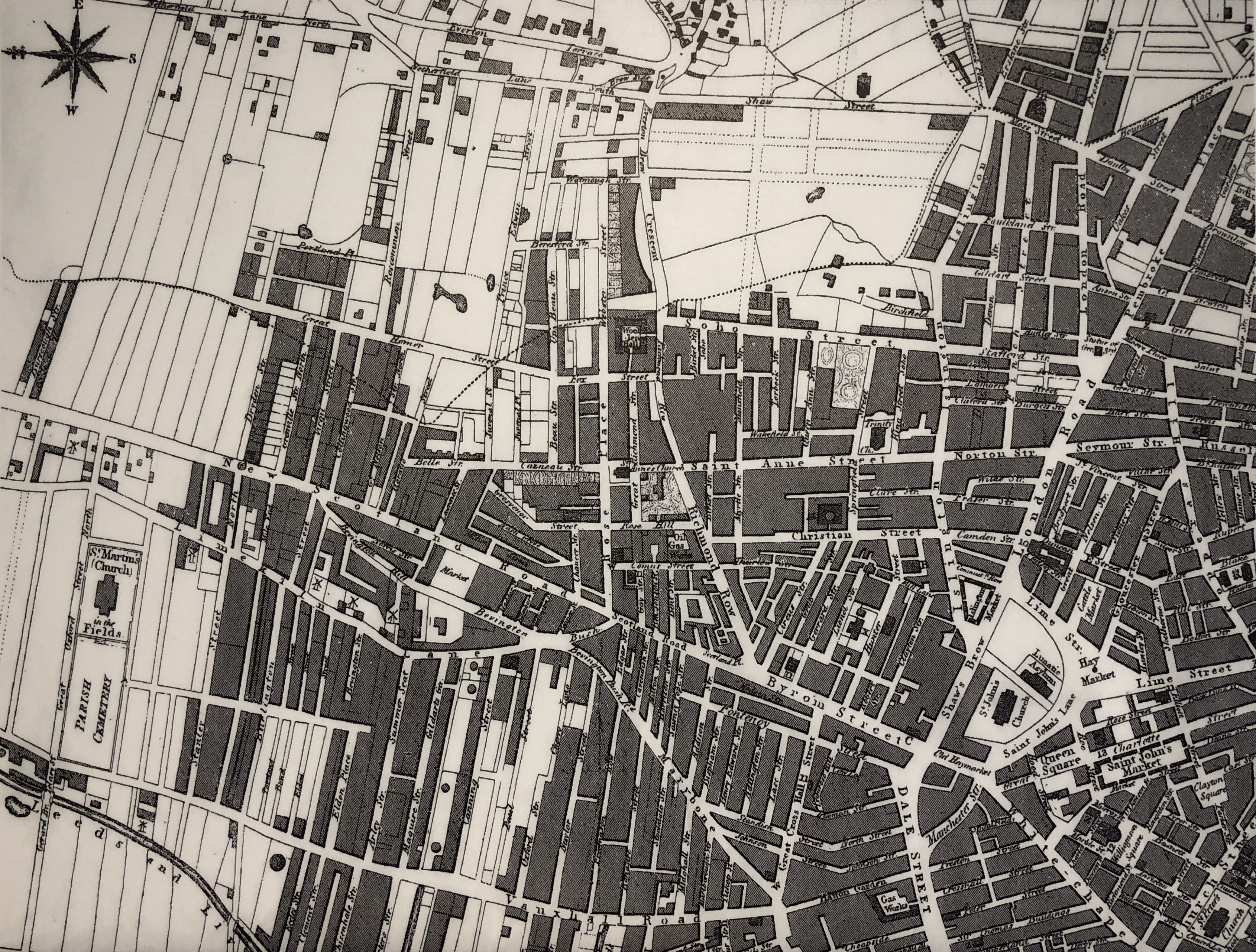
1823: Swire's map shows nothing but fields and countryside north of Dryden Street on ‘New Scotland Road’ although new mansions are beginning to appear high on Everton slopes. Images courtesy: Liverpool Records Office.