Mitford Street
-
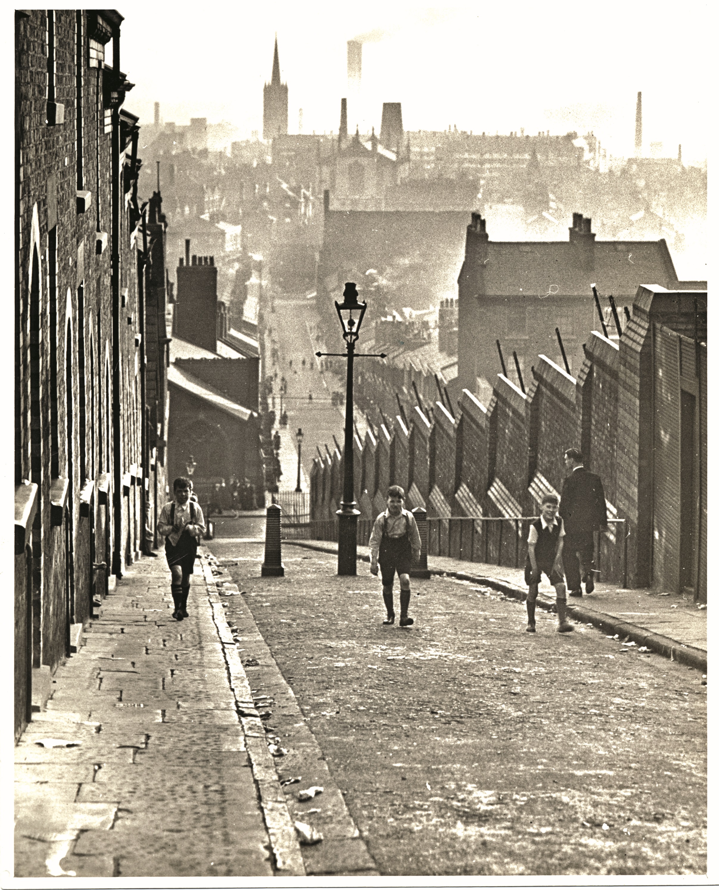
An old photo of the long gone Upper High Street looking down to Mitford Street.. The image with the two lads shows the street after WW2 with the post war blitz clearances underway.

-
Mitford Street pre-1960s clearances, see second caption below.

-
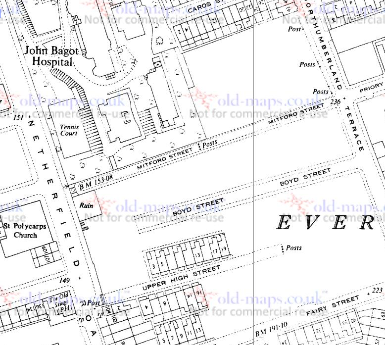
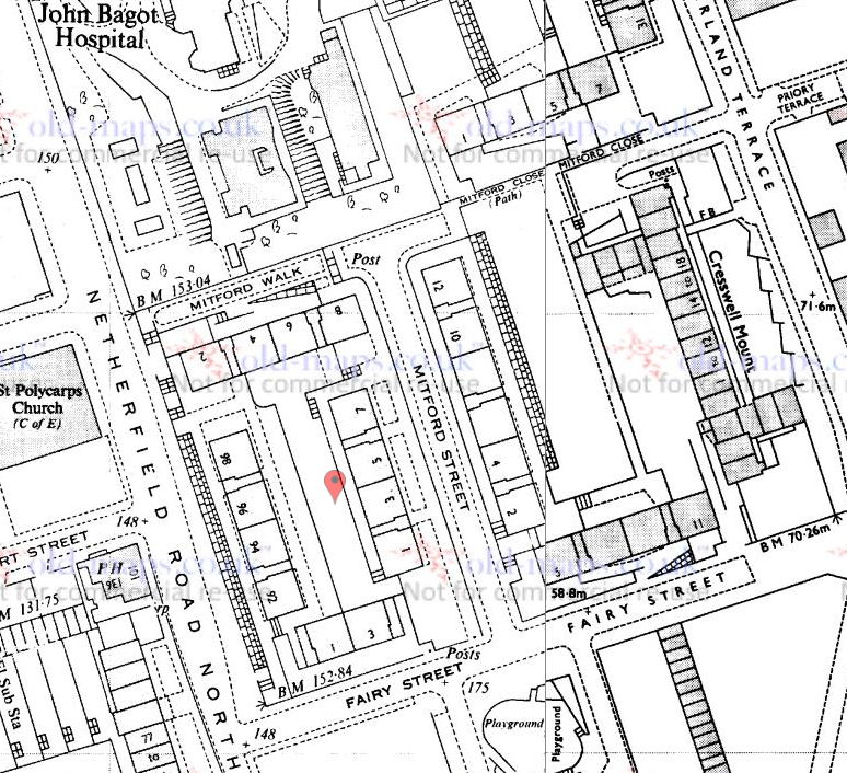
My thanks to Denis Hargreaves from the Netherfield Road & District Facebook platform who has cleared up some confusion in my mind regrading Mitford Street, Mitford Walk and Mitford Close. In this image reel is the dramatic picture of the very steep Mitford Street with three boys climbing up towards its summit, used as the much-discussed front cover on my 2010 'Lost Tribe of Everton & Scottie Road' book. I had originally sourced it from the extensive archive of the Liverpool Daily Post & Echo. In looking again recently at the 1960s map of Everton (available on this site) it seemed to be suggesting that the street running up from Netherfield Road alongside the John Bagot Hospital wall (that still stands) was Mitford Walk with Mitford Street running from it in horizontal fashion towards Fairy Street. Over to Denis for clarification: "The photo on your book cover is correct. The boys are in the steep Mitford Street, pre- the WW2 blitz. Mitford Walk and Mitford Close were created when the area was rebuilt in the 1960s. Mitford Street was realigned,joining Mitford Walk with Fairy Street. It can be explained here by the two maps, one post 60s, the other the original terraced street lay-out." Many thanks for the clarification, Denis. It was also interesting to see the former Upper High Street off Netherfield Road North towards the bottom of the first map, the rears of which can be seen in a picture of Mitford Street desolation further down this reel with a lone lady walking up what had been the top of Mitford Street approaching Northumberland Terrace.

-
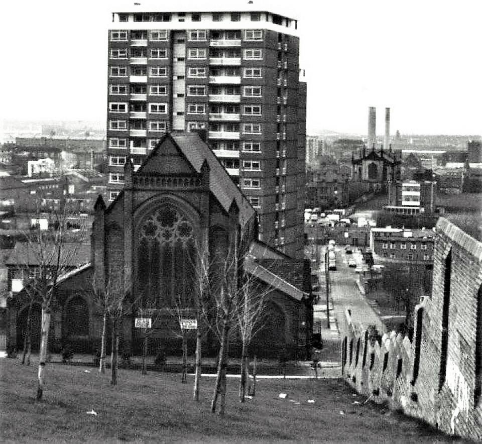
The former steep Mitford Street, sadly lacking its old terraced houses. Thankfully, the St Polycarp's building is still standing, as is the old wall to he former John Bagot Hospital on the right.

-
What a contrast of the way it was and what happened after the 19670s clearances, a tale of two very different pictures.The one above, so vibrant and happy, was featured on the front of my first Lost Tribe of Everton & Scottie Road book. The second, an image of solace and desolation after the clearances around this particularly steep bit of old Everton, features a woman walking up Mitford Street towards Northumberland Terrace. This was submitted to the Netherfield Road Facebook platform by Irene Delaney Edgar. Denis Hargreaves points out that to the left of the woman are the rears of Upper High Street.


Thank you for your contribution!
Please check back in 24 hours to see if your photo has been approved.
Return