Netherfield Road
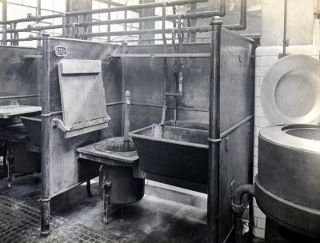
Netherfield Road had a famous wash house close to St George’s Hill. This inside picture was taken in 1920.
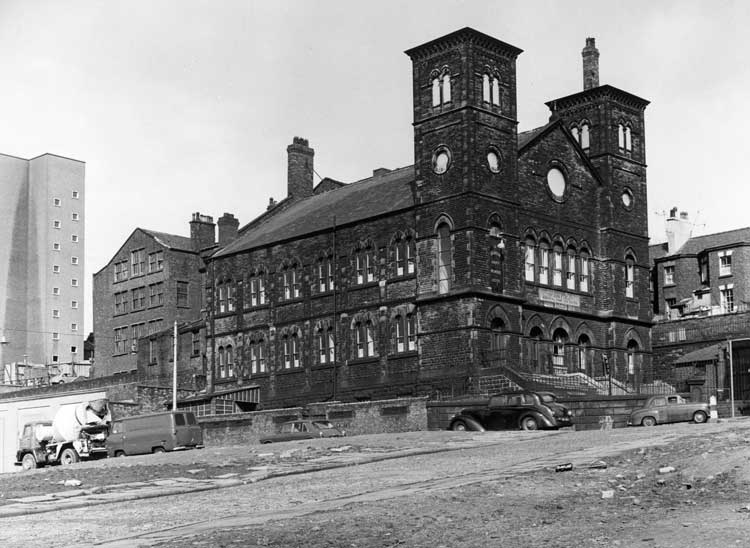
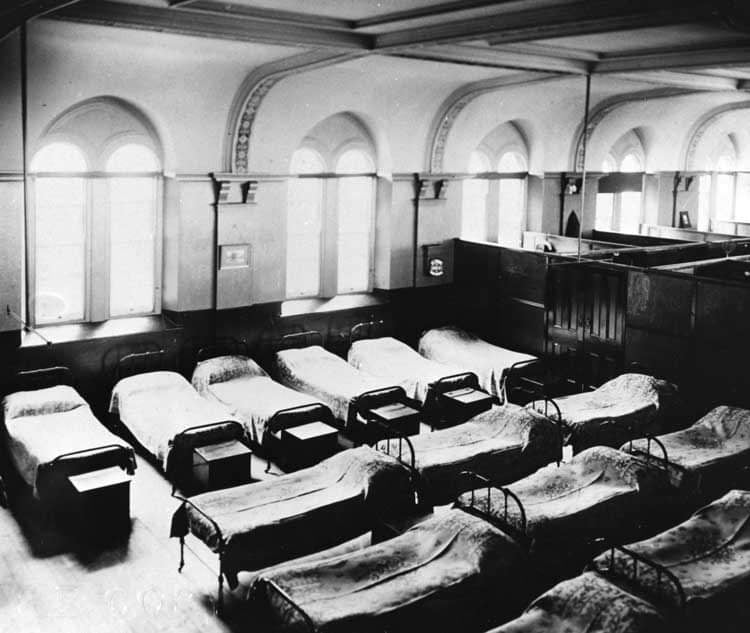
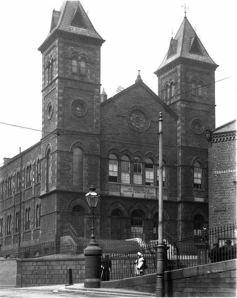
In Netherfield Road South, the Ann Fowler Home for Women gave crucial respite for those in need over many decades.
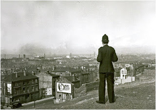
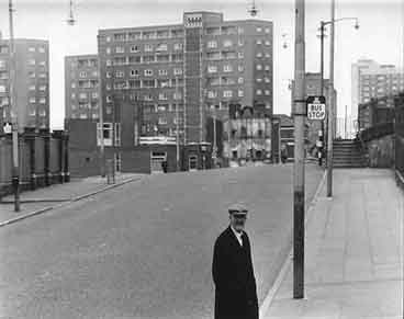
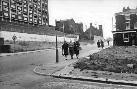
Netherfield Road North has had better days, but this ‘Bobby’ is still proud to look down on his famous patch.
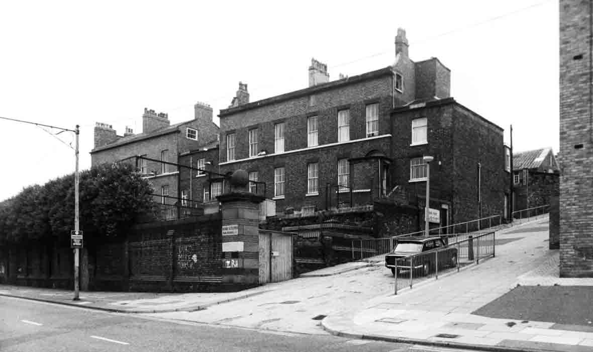
Netherfield Road North was home to the Victoria Settlement Youth Centre that stood on the extremely steep York Terrace. This was originally the mansion home of Canon Major Lester who gave his name to a famous local school.
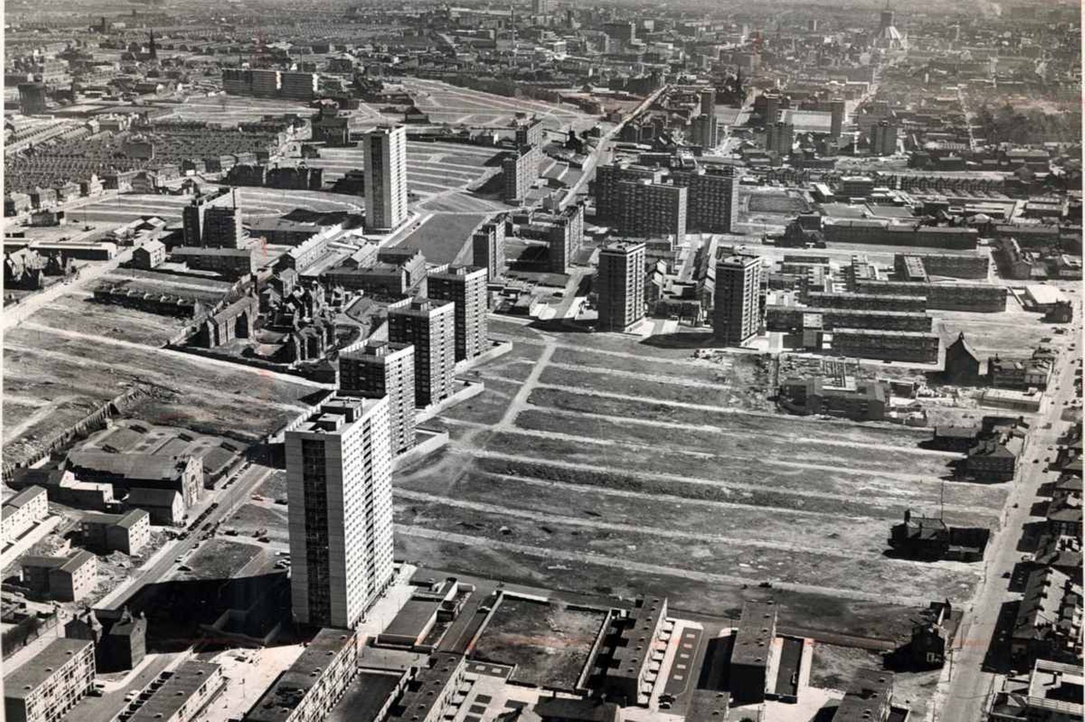
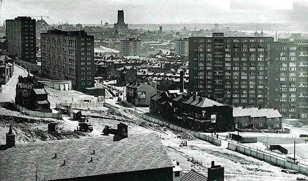
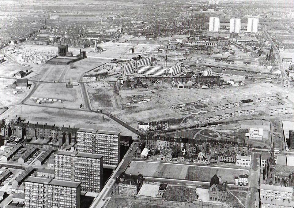
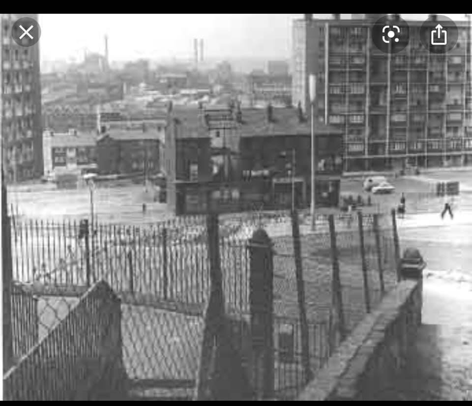
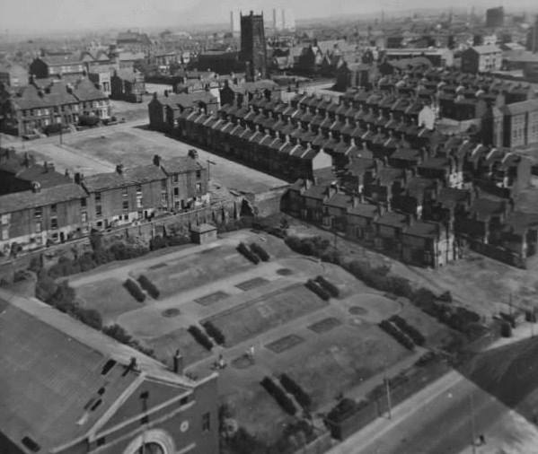
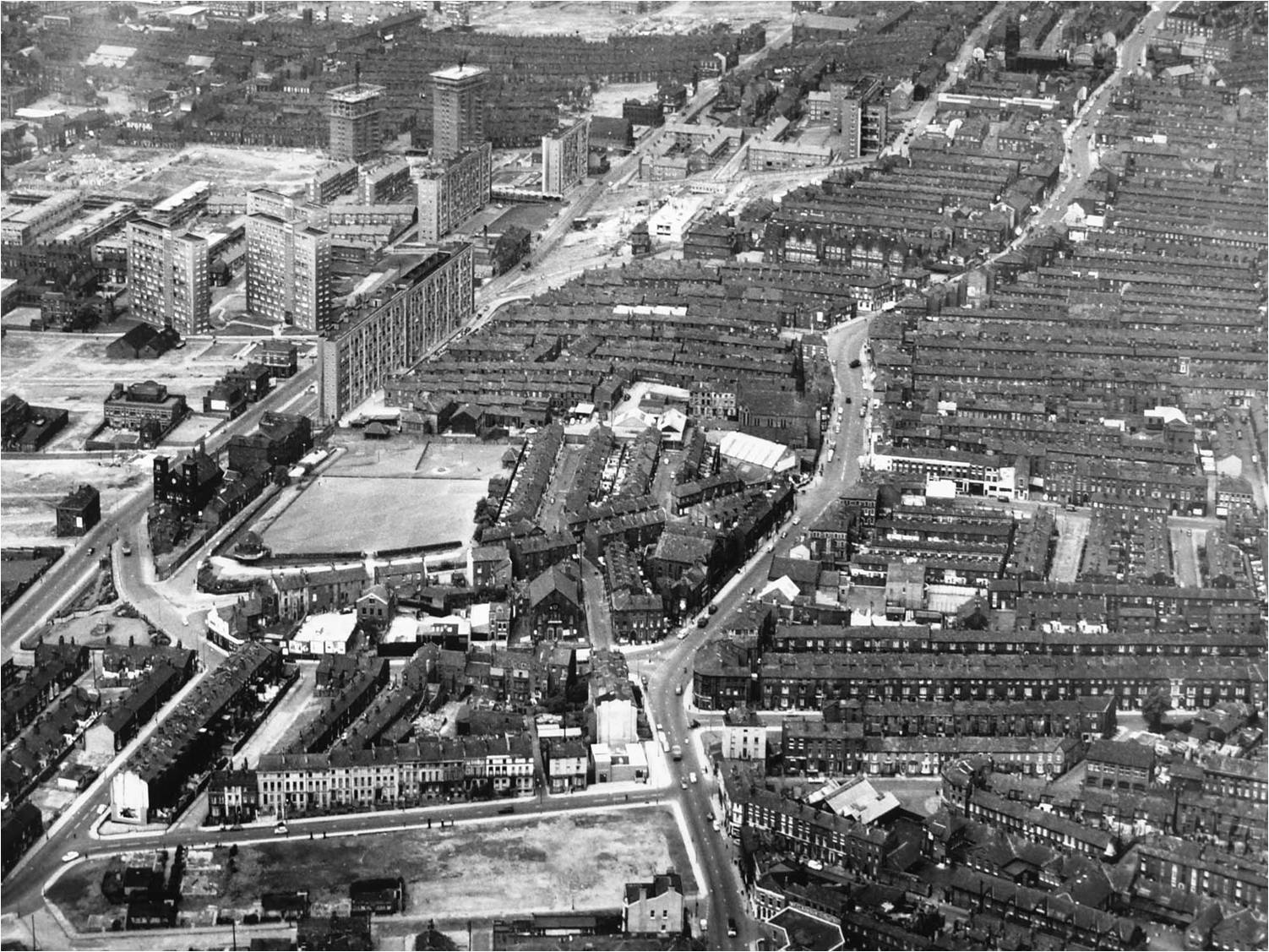
This remarkable aerial shot taken high above Netherfield Road North shows the John Bagot fever hospital still standing (centre left) as well as the Popular Cinema (bottom left). But the high rise flats are now casting a huge shadow with most of the famous terraced streets now demolished.
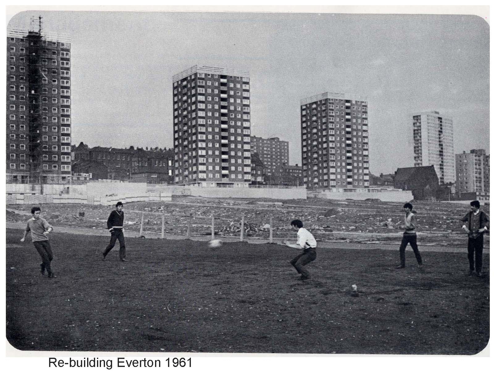
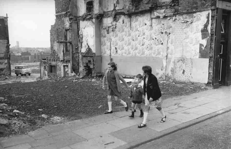
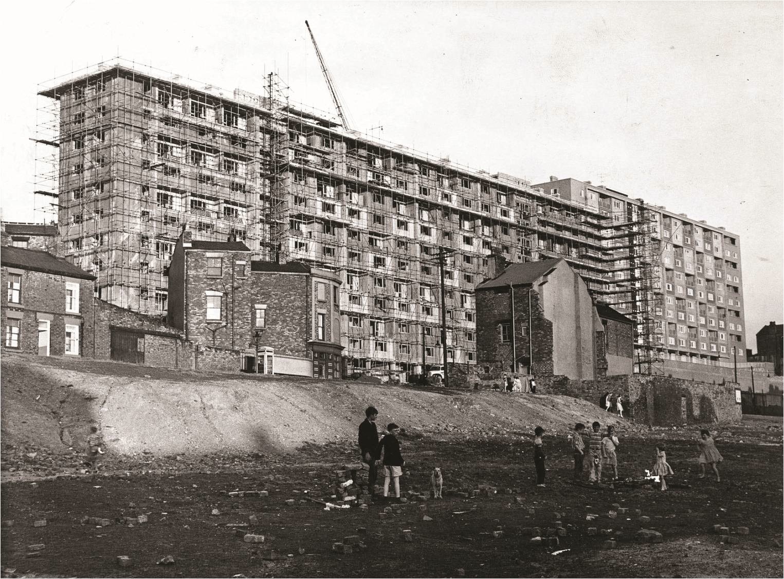
The kids played on while demolition continued in Everton. It’s 1961 and boys play football on wasteland below Netherfield Road North.
The famous Netherfield Road washhouse is still standing with demolition devastation all around.
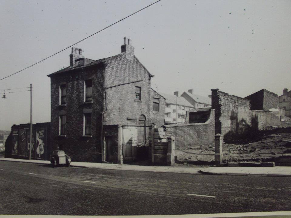
This image shows the back of the old Popular ‘Pop’ Cinema on Netherfield Road North with demolition well underway in the adjacent streets which feel almost ghostly.
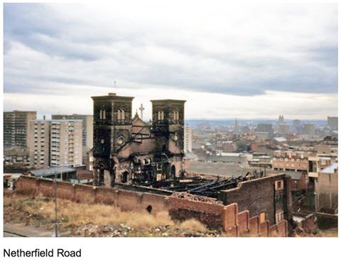
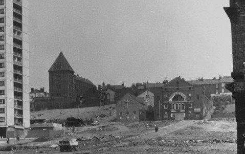
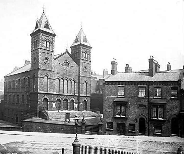
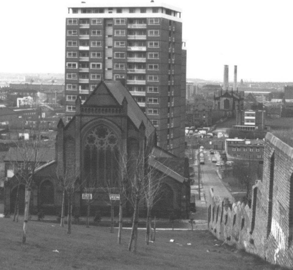
This wonderful colour image shows the back of the famous Ann Fowler Home for Women on Netherfield Road South, close to the Everton Lock-Up Tower. This had been a Welsh Congregational Church and this image gives you a feel for its former grandeur. Sadly, it also highlights perfectly the demolition derby that was going on across the district with famous landmarks swept aside.
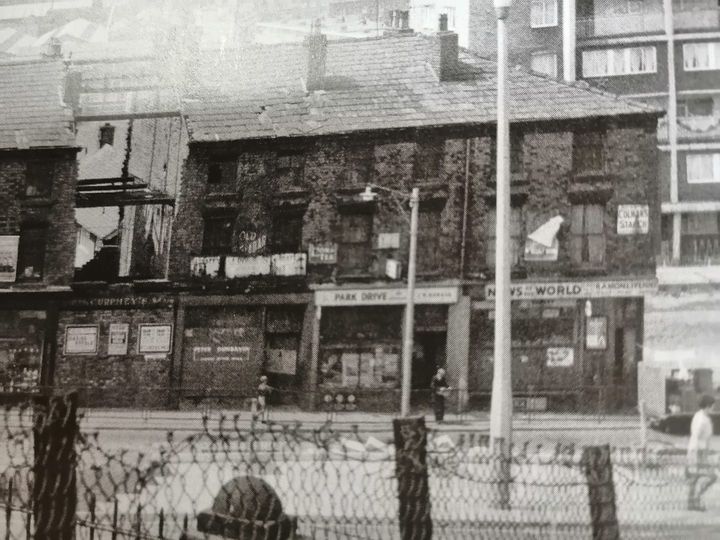
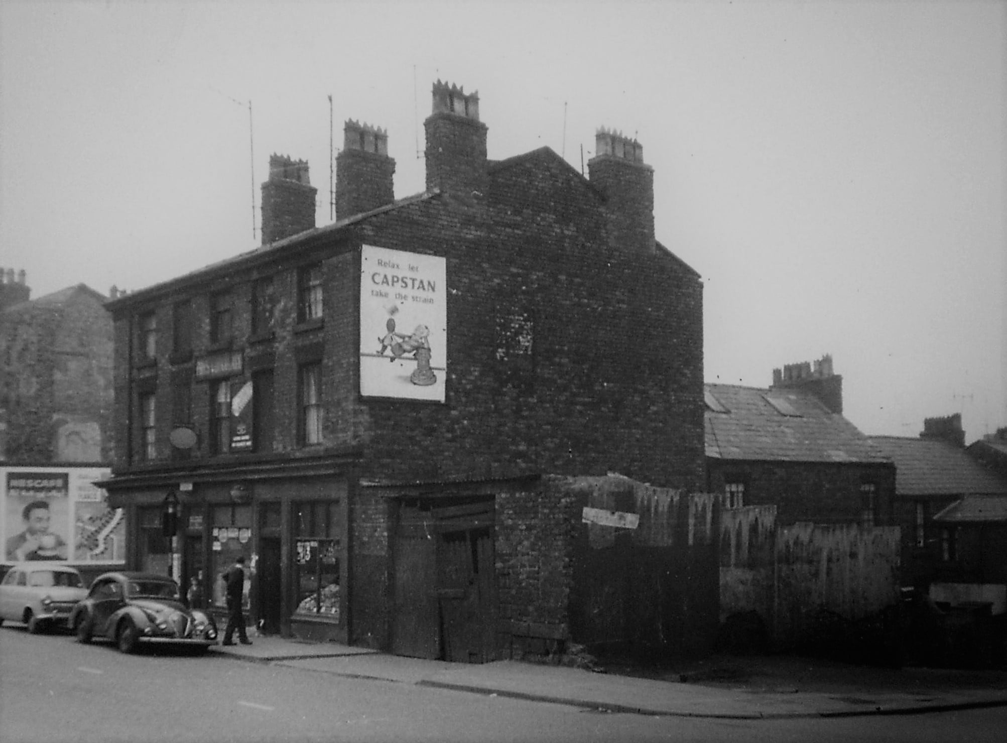
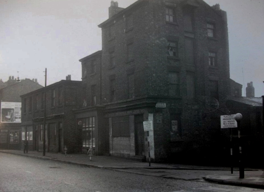
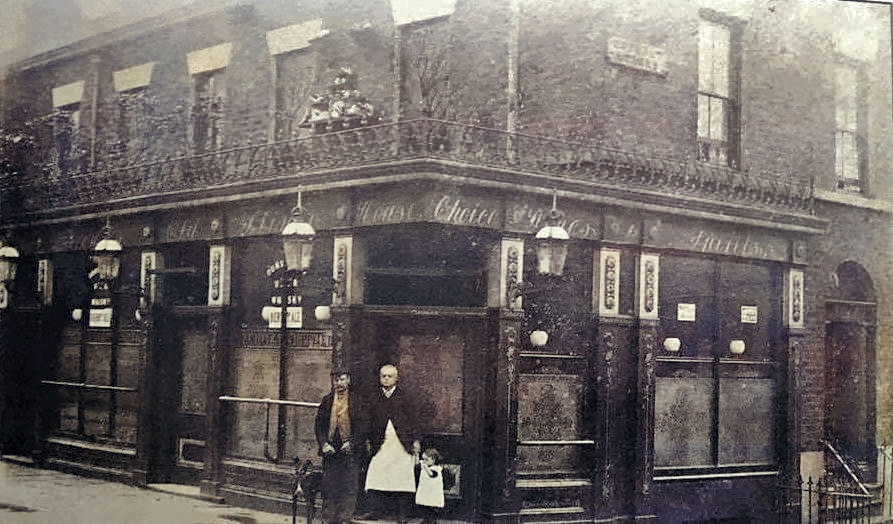
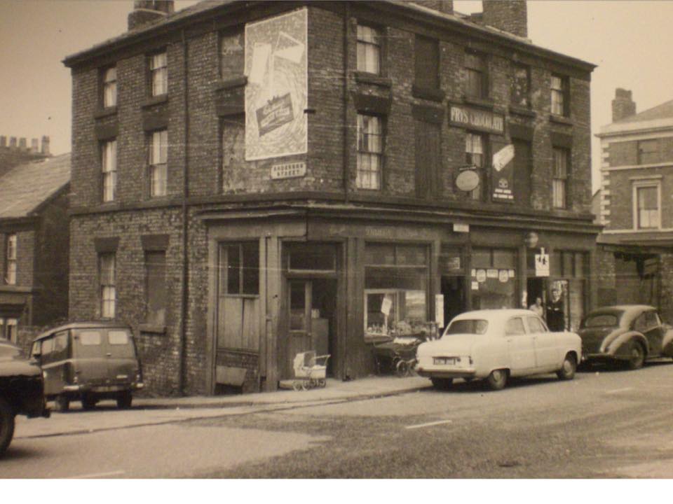
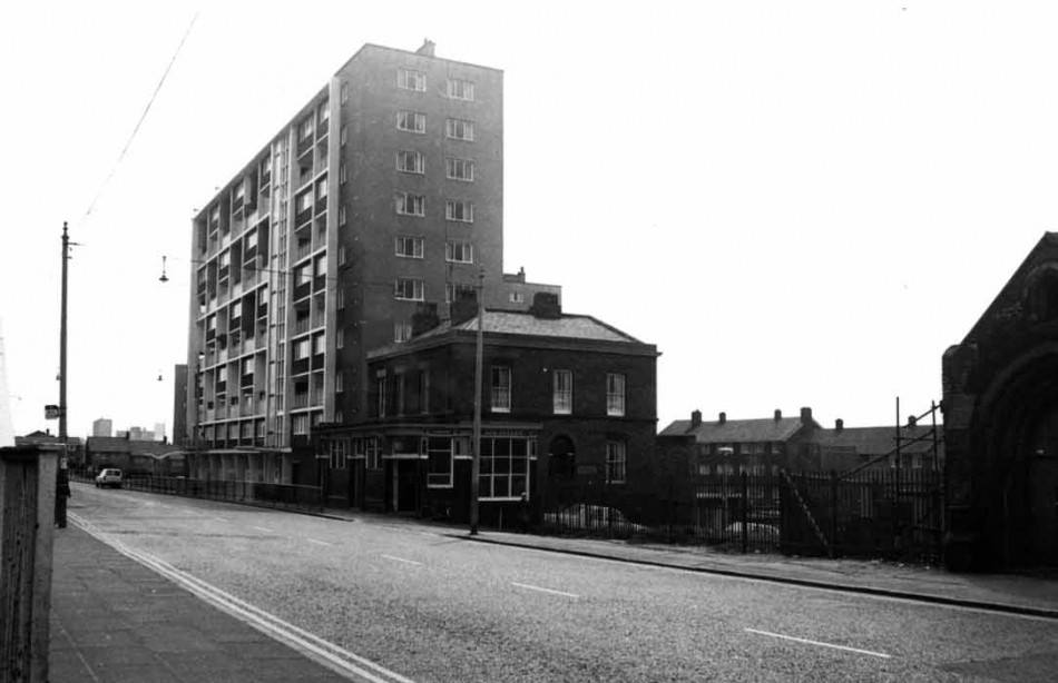
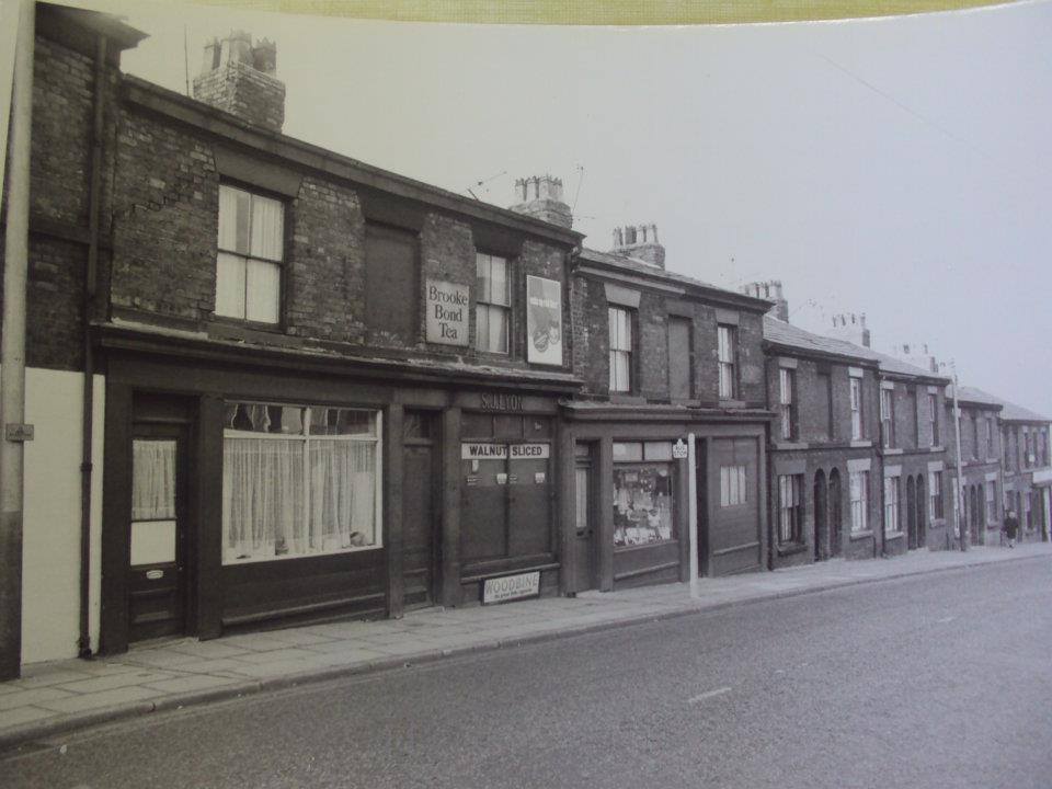
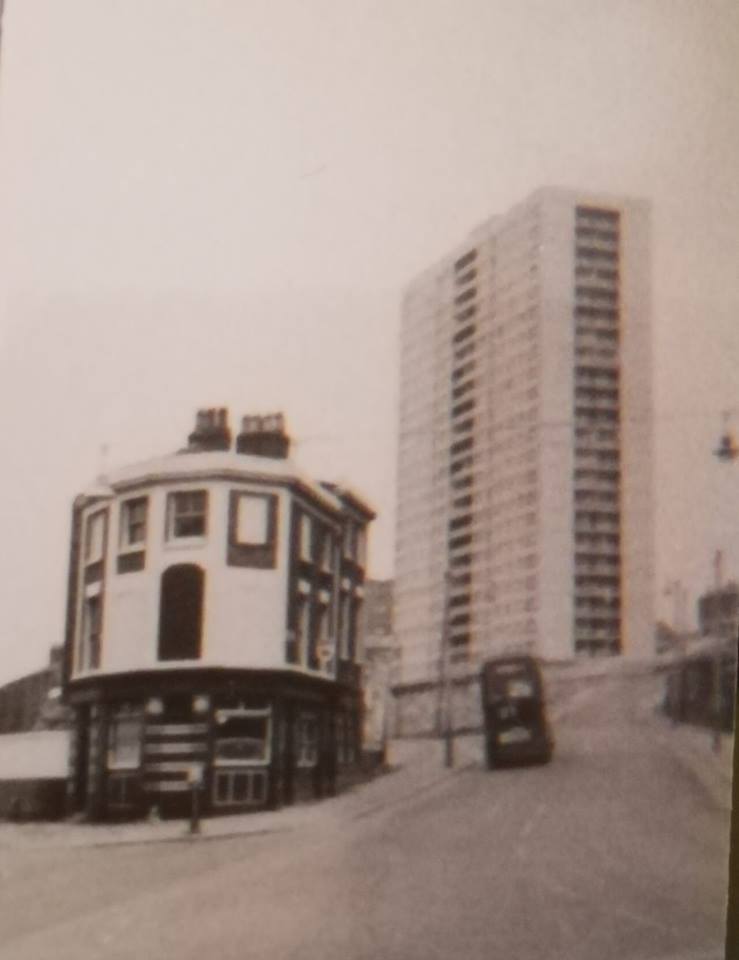
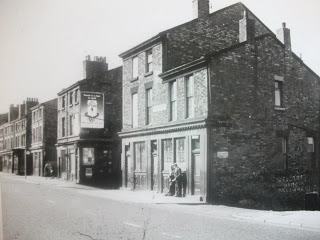
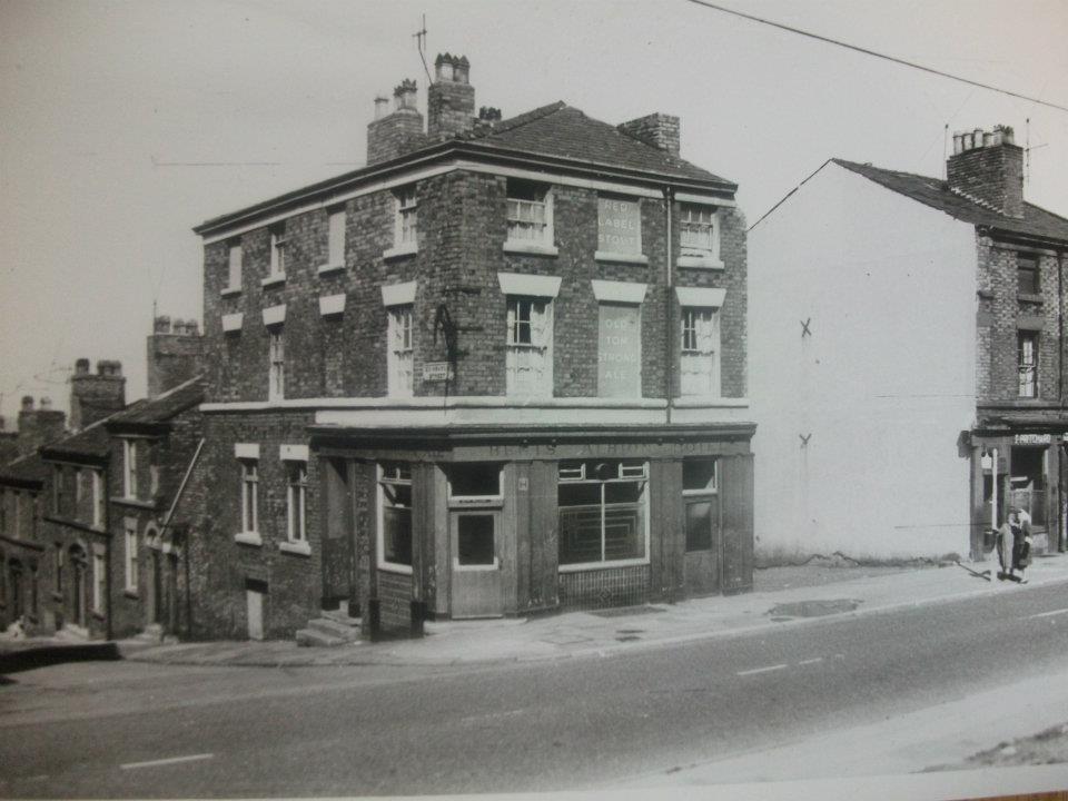
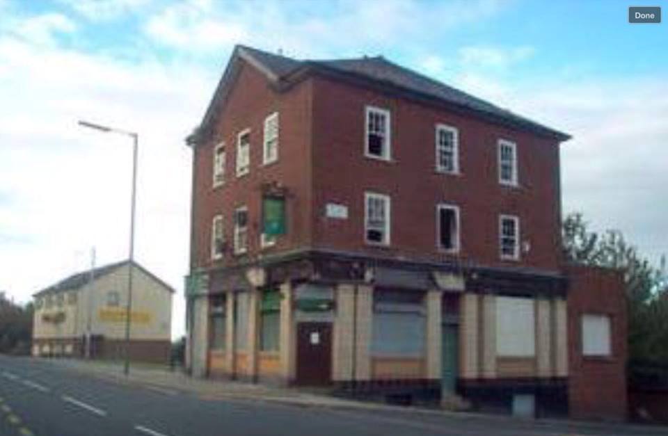
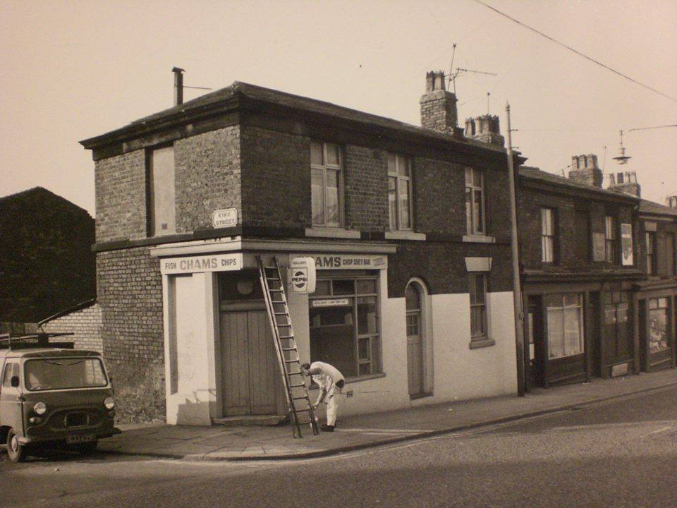
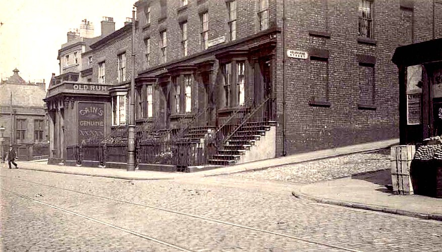
The heart of every terraced street area was the corner pub and shop, here captured perfectly on Netherfield Road.
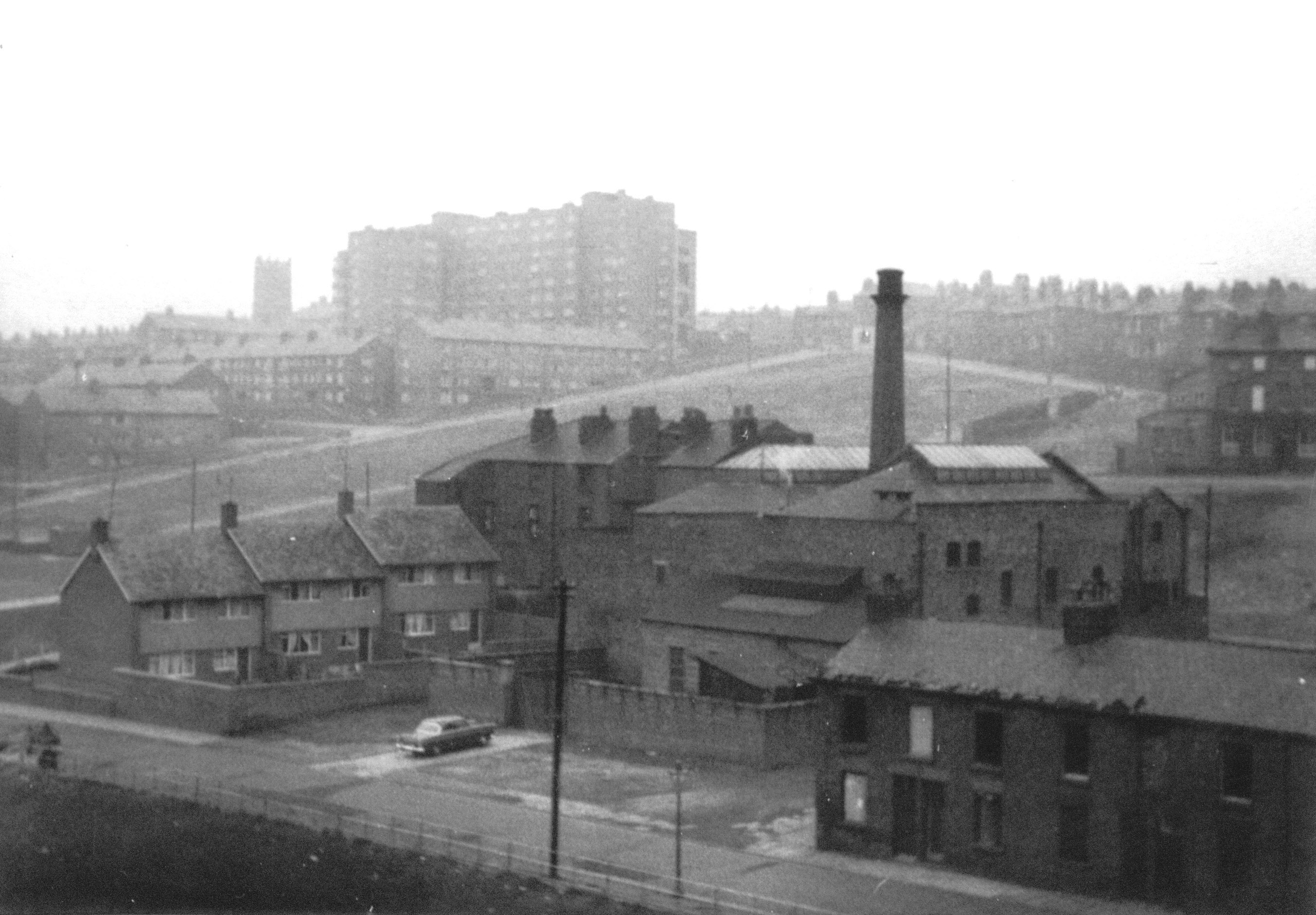
Netherfield Road North looking down towards Everton Valley and its large former Post Office site.
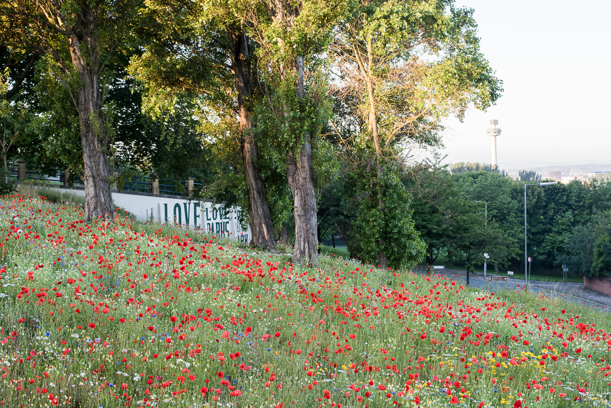
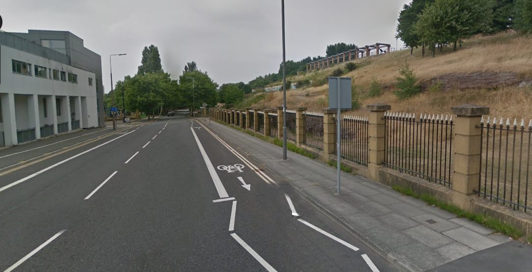
The district of Everton has been constantly changing. Here the ‘Love Parks’ wall on Netherfied Road features wildflowers where there was once a concrete jungle.
-
I have come across an image of the merchant houses on Everton Terrace when I search this term (though it does not appear in the narrative). Would you kindly grant permission for me to use this in a biography of a merchant /shipowner who served his apprenticeship with a cotton merchant (Miles Barton) who lived there. The manuscript is presently with a publishing company but can be updated. Due credit will be included of course.

-
My dad and his family lived in Potter Street, their surname was Cruise. Dad was Richie and his brother was Joe, Ellen his mum and dad Dick. Ellen, or Nellie as she was called, ended up living in John F. Kennedy Heights on Everton Brow. Nellie's family, the Brierleys, originally lived in Crealock Street, Kirkdale.
-
Looking across Brow Side you can see the famous Everton Lock-Up Tower, Beyond (to the right) stands the famous Ann Fowler Salvation Army Home, not for 'fallen women' as is often suggested, but for working women who might have found themselves on hard times. This building was formerly a large Welsh Congregational Church built in Victorian times and reflective of the large Welsh community in Everton. Its impressive twin towered facade looked like a mini version of Paris's Notre Dame Cathedral.

-
When the trams stopped going along netherfield road, The rails were taken up and the residents had a field day removing the wooden blocks from the road, As not all of the cobble's were stone. The blocks had a layer of tar and made a fine source of heat for those that couldn't afford coal every day.
-
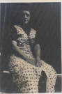
This was my Great Grandmother Gouldson. My maternal Nana's mum. My maternal Nana was Ann Potter (nee Gouldson), my Grandad was Thomas Potter. My mum Margaret was born in Conyers Street off Netherfield Road in 1943 and her siblings were Ann, Dot, Phyllis, Tommy, Jimmy, Billy and Georgie. Poor Georgie was fatally stabbed on the ferry boat when he was only 16 which obviously devastated the whole family and from what my mum says there were hundreds lined the neighbouring streets on the day of his funeral. My mum talks about her childhood around Conyers Street a lot and says things were much better in them days which I find shocking given that was just after the war and people had nothing.
-
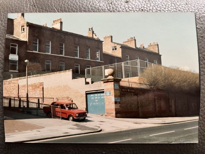
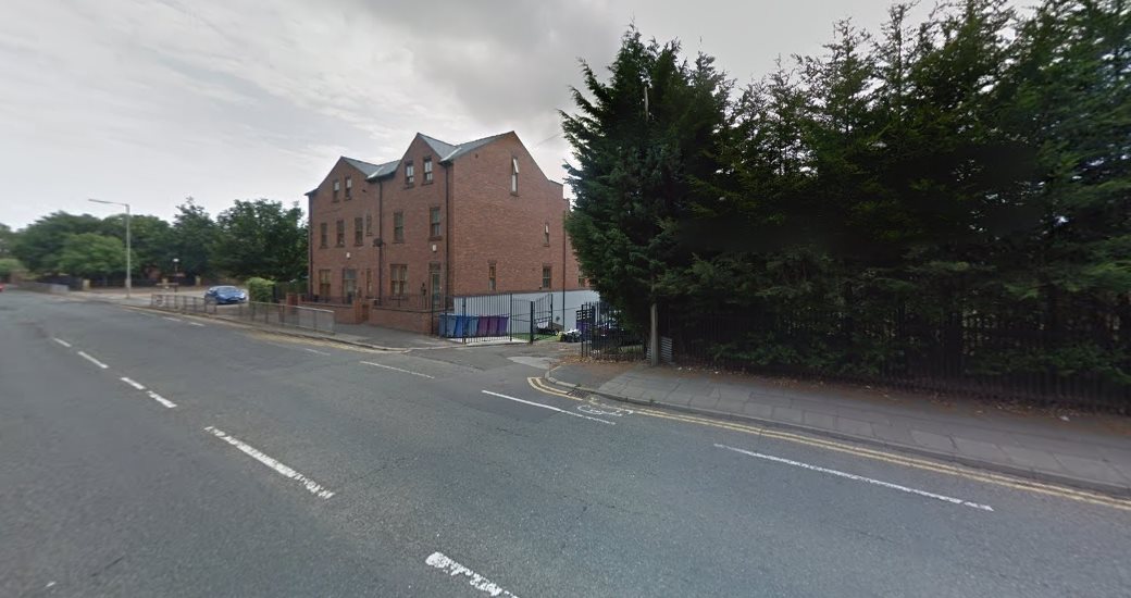
View of the Victoria settlement from Netherfield Road in April 1986. I think the modern street on the left was Melbourne Street, now incorrectly named Patmos Street by the council.
-
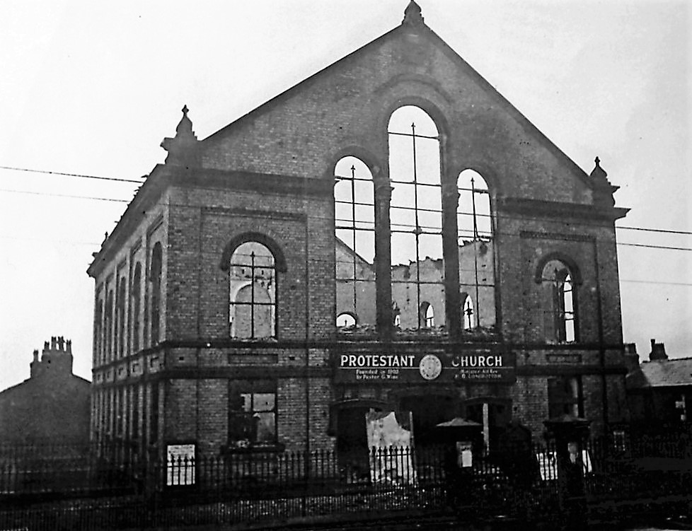
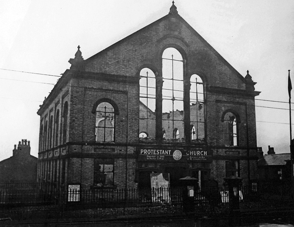
Netherfield Road Protestant Reformers Church which was blitzed during WW2. Researched by Denis Hargreaves.
-
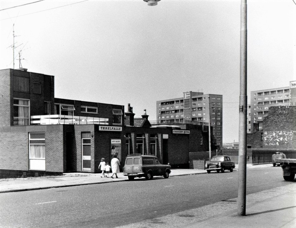
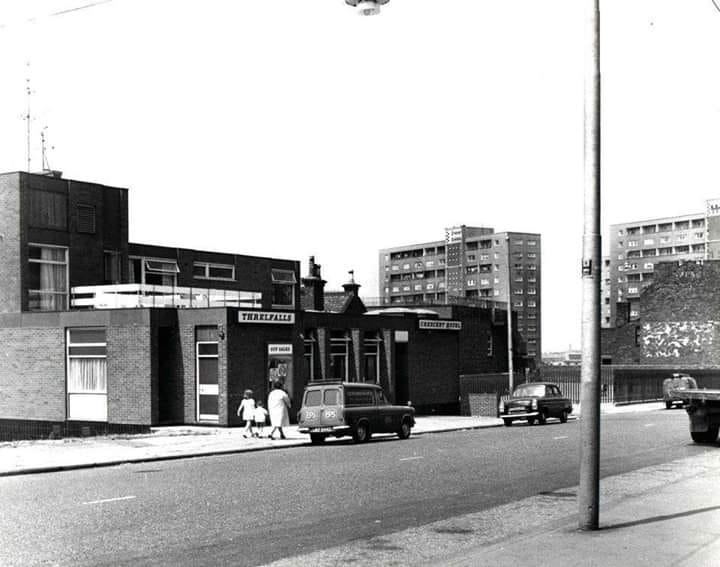
Denis Hargreaves upload: c1970 Crescent Pub, Netherfield Rd South, corner of Prince Edwin St
-
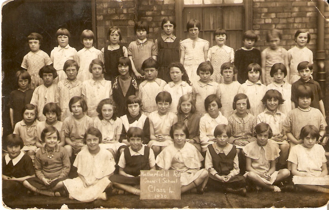
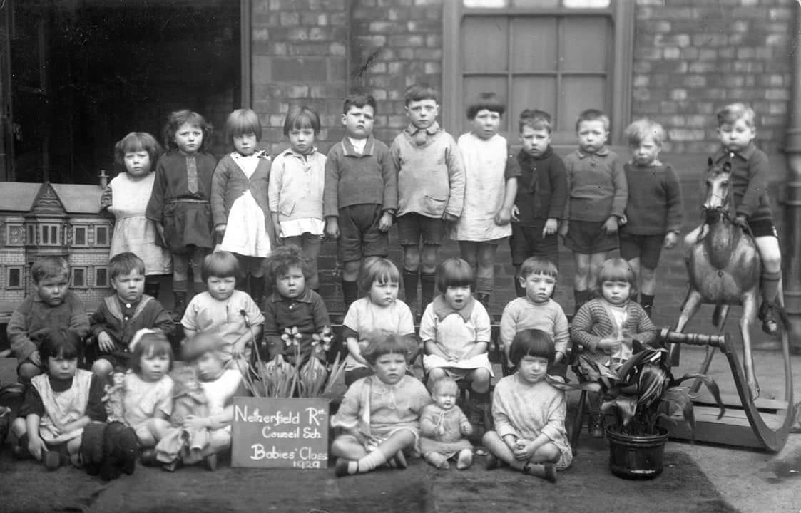
Netherfield Road school photo 1930. My mother Olive Nash is 4th from right on back row. She was born in 1920 and lived in Prince Edwin Street.
-
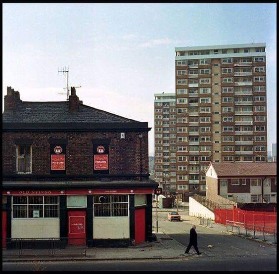
The Stingo on Netherfield Road
-
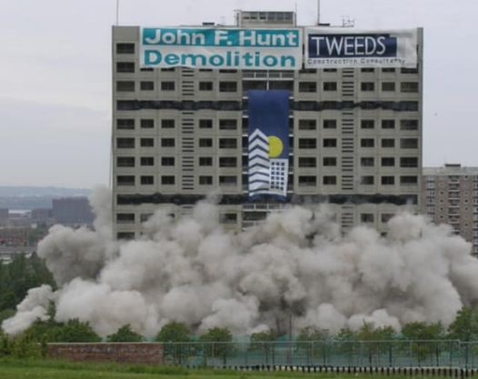
A dramatic image as Corinth Tower is demolished in May 2005.
-
Netherfield Road South 1960s/1970s with high rise blocks now dominant.
-
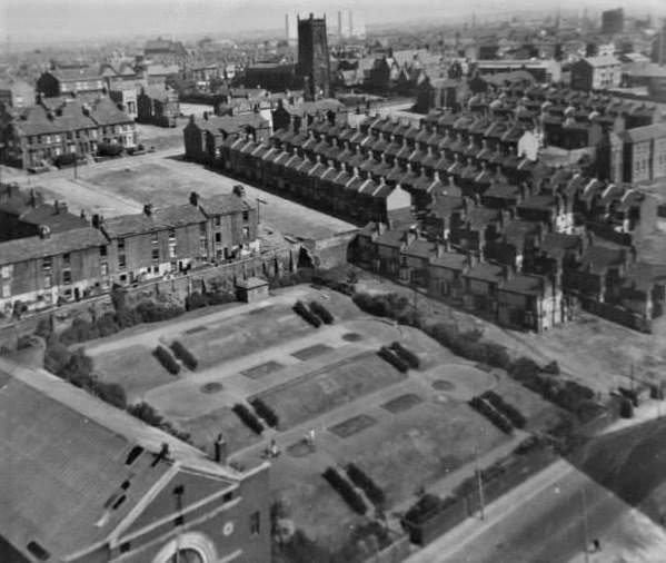
This is how the Victoria Settlement on Netherfield Road North looked when its buildings were actually amongst Everton's largest house, uniquely positioned on an elevated platform between Melbourne Street and York Terrace. Eventually, it became the district's most famous community centre and he gardens were filled in and levelled to become a football or games area.
-
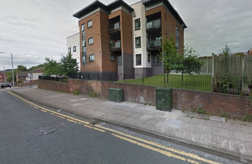
The rear of the New York Pub, now gone, on Netherfield Road North, looking up towards the modern Victoria Settlement flats that replaced the historic community centre that previously stood on that distinctive elevated plateau.

-
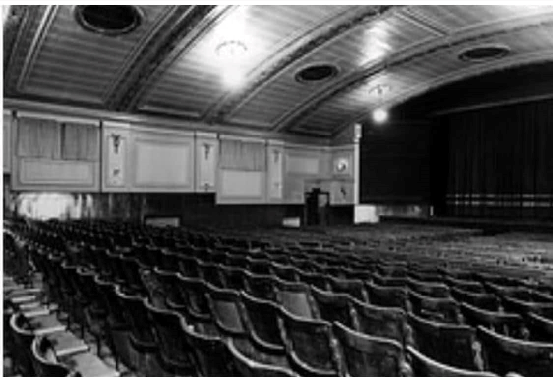
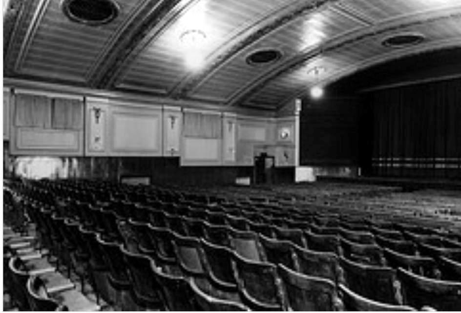
A wonderful interior shot of the Popular Cinema on Netherfield Road North, known by everyone as 'The Pop'.
-
Thank you, Alison Lee, for your heartfelt comments and the importance of retaining our own Everton memories for generati0ns to come.
-
Aftermath of WW2 in Everton. I found it hard looking through some of the photos and footage regarding the aftermath and demolition of the area of Everton following WW2. I was born there in 1960 and had a very good family and childhood.. I am following the Ukraine invasion closely. It brings me to tears watching the suffering and destruction of parts of Ukraine. I never thought I would see similar footage in my lifetime again, the difference is it is live footage and difficult to watch. All I can conclude is that families stayed together as much as they could in Everton whilst Ukrainians right now are being separated, homes lost, children traumatised etc etc. No matter what changes are made within the world we should always remember there are others worse off than us, we all have a role to play to address issues we deem unfair and should embrace democracy. I am proud the name Everton is on my u.k passport and always will be. Thankyou for keeping the memories alive, good or bad.
-
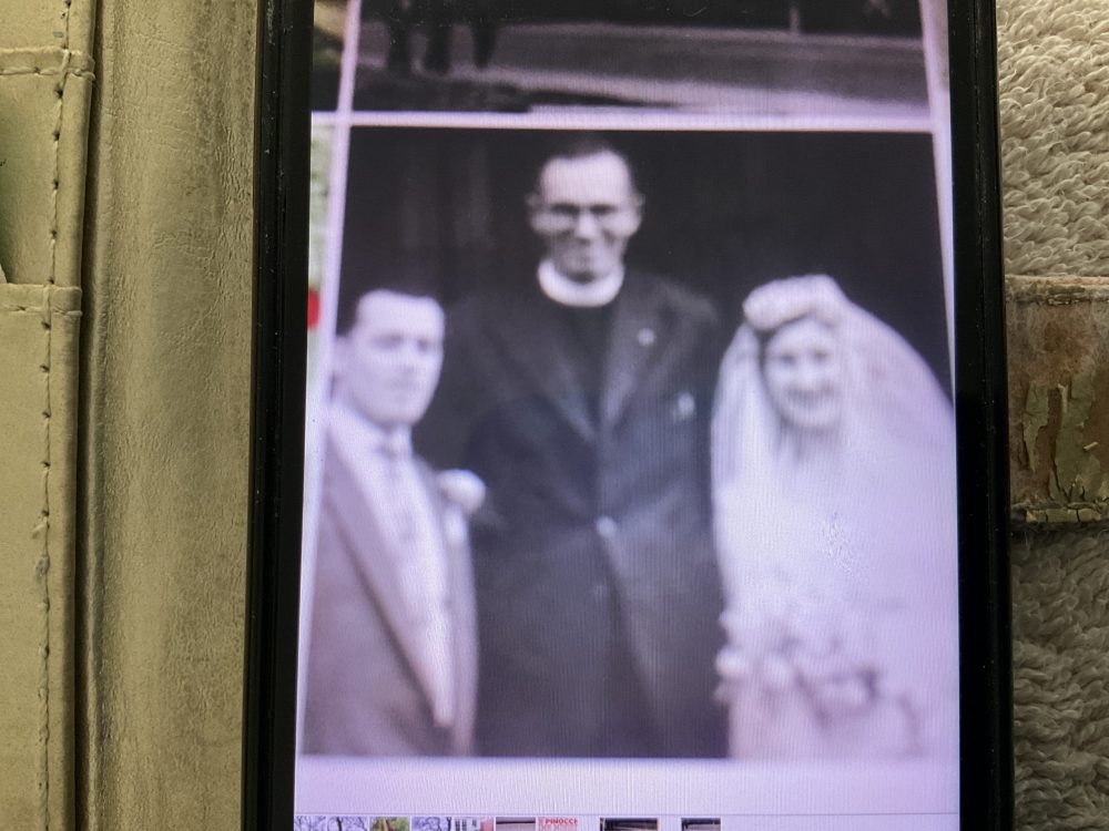
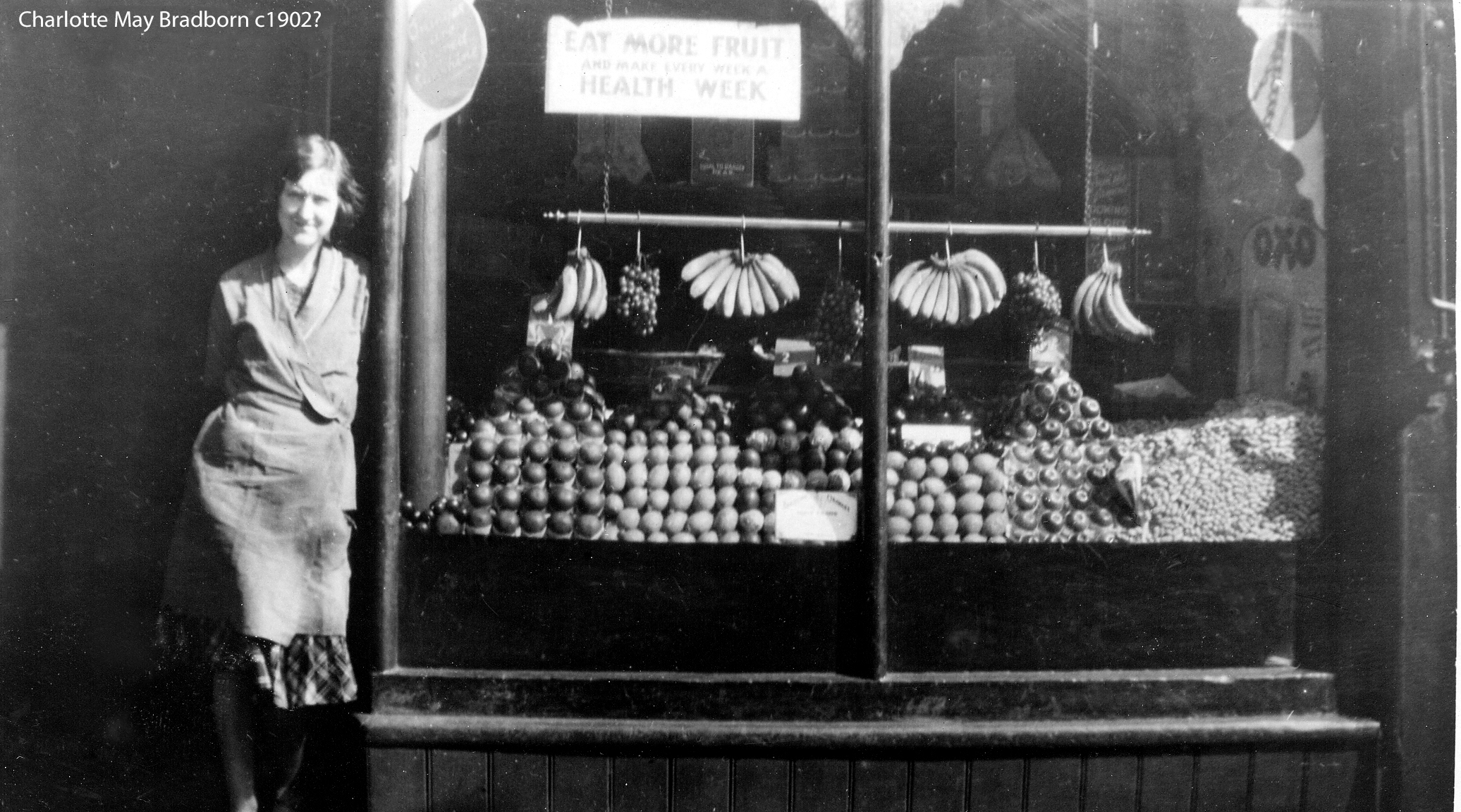
Irene’s ( nee Willis) wedding to Valentine Hanley at St. Polycarps church Everton 1956 the Vicar was Mr Snell. Did he marry you ???? Irene worked for Mary Cartner in the fruit shop Netherfield Road from 1949-1954 & 1957-1960 In May 1960 her 2nd daughter Alison was the first baby to be born in Netherfield brow number 145. Irene was interviewed by the BBC regarding where children could play as Irene & Valentine lived on the top floor. The Willis link ( Irene’s Father Albert) was the brother connected to Matthew Willis on the photograph of the ink well which was discovered by someone in a charity shop (photo on your web page) The other Willis link was Albert Willis was a cousin of Bobby Willis father ( Bobby married Cilla Black)
-
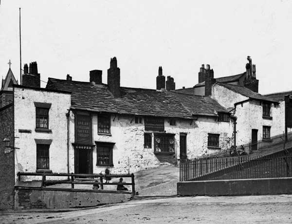
A rare photograph of the Everton Toffee Shop from Netherfield Road South, the business clearly still fully operational. A few visitors sit on the wall that encloses the Everton Lock-Up Tower. There is a further image further down the reel that actually shows the Toffee Shop during demolition. Why such a local treasure was lost is anyone's guess.
-
Hello Ken, Great photographs rightfully archived here for social history. I myself was born in Anfield, opposite the "Docker's Club", but my maternal grandparents lived in 23 Dawson Grove off Rupert Lane before moving to 9 Everton Terrace. I do a bit of genealogy, so seeing these photos has been a treat. I don't know if you're aware but for your own future reference a fantastic online map resource that may be of use to you can be found here. https://maps.nls.uk/geo/explore/#zoom=8&lat=53.69927&lon=-3.08107&layers=1&b=4 Keep up the good work.
-
Pat. I assume you are talking about Netherfield Road, not street. Unfortunately, the only point of reference we might have for Netherfield Road (North & South) is the 1960 Electoral Roll. We don't have any point of reference going back as far as 1904. You would have to look somewhere like the Ancestry family history site for 1904 details. I do believe the odd numbers on Netherfield Road (north & south) were on the west side i.e. the side on which the streets ran down to Great Homer Street. Sorry we can't help any further.
-
I'm helping a friend with her Family Tree and discovered that her Grandfather Charles Bourne - was living in 55 Netherfield Street at the time of his 2nd marriage in 1904. This was to Ellen Bolton who was the sister of his first wife who had died 4 years previously - she was Caroline Bolton. Would you be able to pinpoint no. 55??
-
Looking up at Netherfield Brow Heights from Netherfield Road South.
-
An unusual view of old Netherfield Road.
-
Looking across Netherfield Road North and picking up the famous Popular Cinema (The Pop) bottom left with the gardens to its right. Also many famous streets up the hill with St George's Church featured.
-
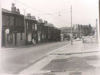
Netherfield Road North at Rose Vale showing Moneypenny's shop, 1950s.
-
Netherfield Road North between Anderson and Potter Streets showing Mary Cartney's well known fruit and veg shop where my mother May Rogers worked in the late 1950s.
-
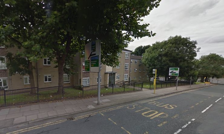
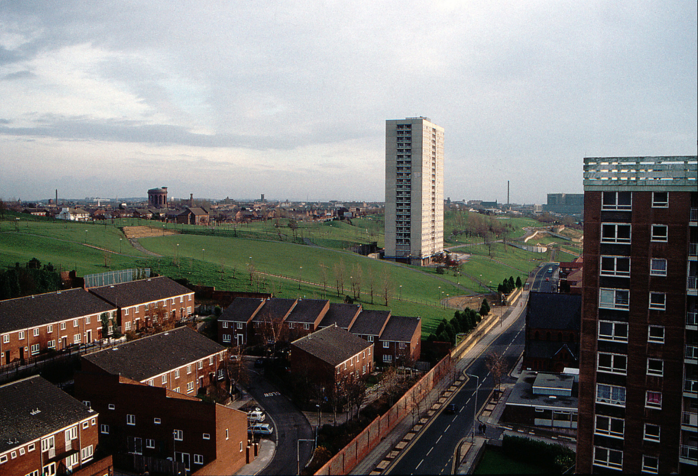
A modern view of Netherfield Road South, Everton Park's modern greenery on the right replacing the old terraced streets.
-
I was born in '52 and we lived just off Greatie in Potter Street. We moved to Mazzini House off Roscommon Street about 1960 and still remember it all like it was yesterday. Great days when everyone looked out for their neighbours and kids played everywhere. I went to St Gregorys School until about 1965 then shortly after I left and joined the Army. Fifteen years later and it's all been flattened, all my old haunts gone. I felt like a stranger. All the mates gone. I couldn't stand it and moved away to the Lake District where I still live today. Why did they have to flatten everything?
-
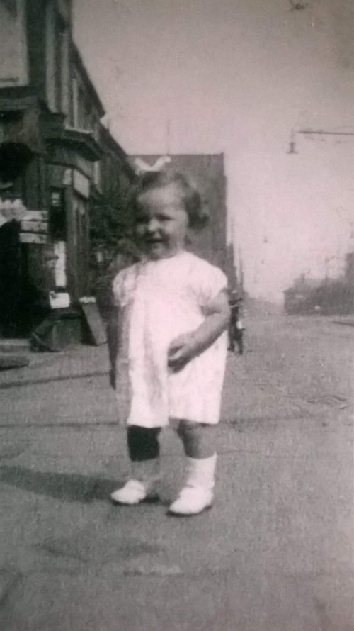
My first steps along Netherfield Road opposite Mountjoy Street
-
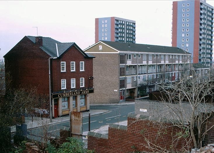
Behind the person who took this photo stood a block of Victorian houses, each with an impressive flight of steps up to their front doors. The 30 and 46 bus stop into town is on the left. Centre is the former Cumberland pub, the 'local' of my grandfather Adam Wareing. His (and my) old street (Melbourne) was facing the Cumberland which stood on the corner of Mitylene Street. On the opposite corner to the pub once stood a busy local grocer's where I would be sent on messages for basic items, always being told to 'put it on the bill' .Of course, my mother (like all the others) always paid at the end of the week. The Braddocks, named after 'Battling Bessi'e and her husband John have just been built in this image as the face of Everton began to change forever.

-
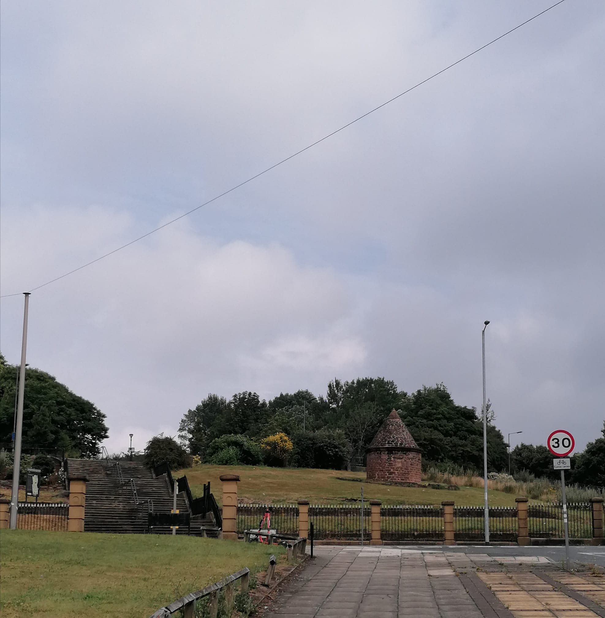
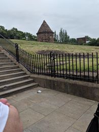
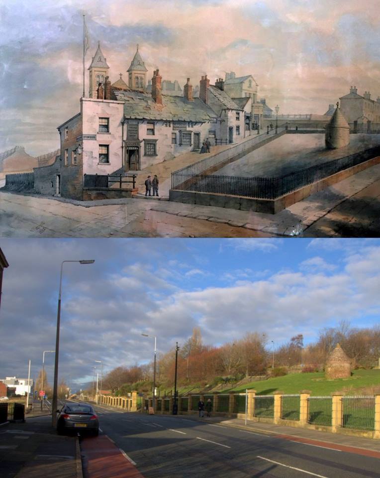
The Everton Lock-Up Tower on Netherfield Road was built in 1787. That means that people have been standing here and taking in this same view for 234 years. Isn't that amazing when you think about how much of our local heritage we have lost!
-
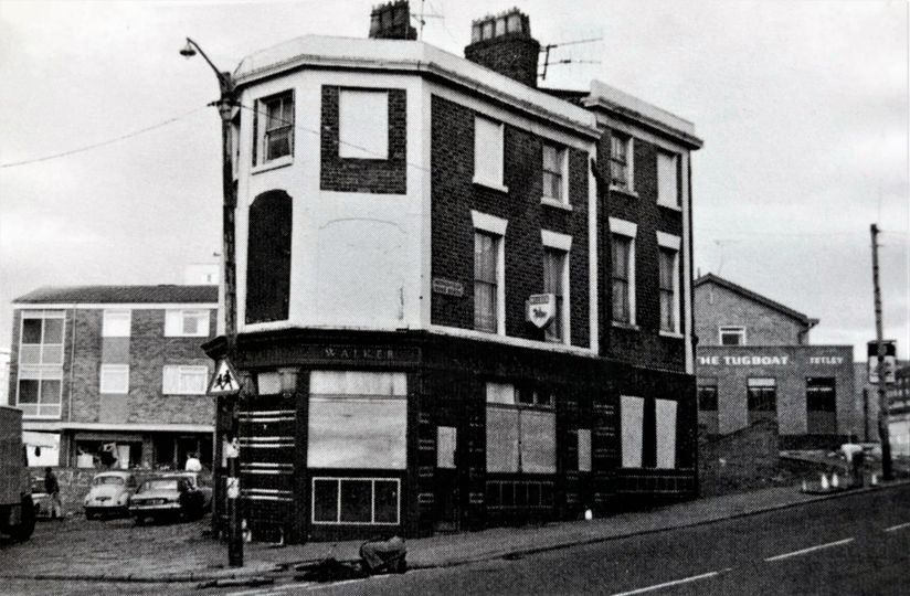
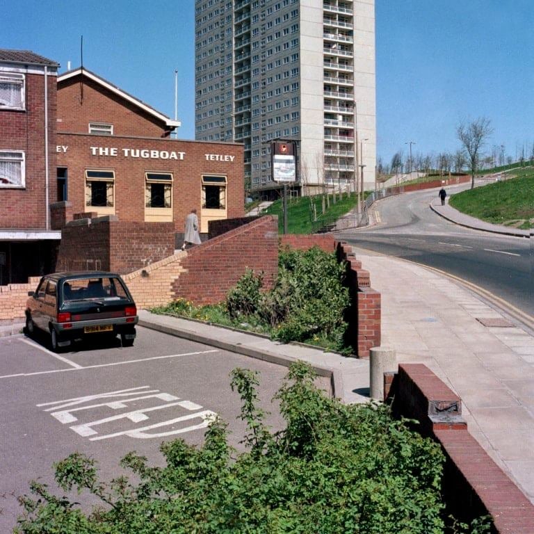
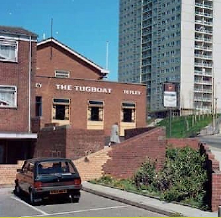
The King Edward Pub on Netherfield Road at the start of its demolition phase with the newer Tugboat nearby.
-
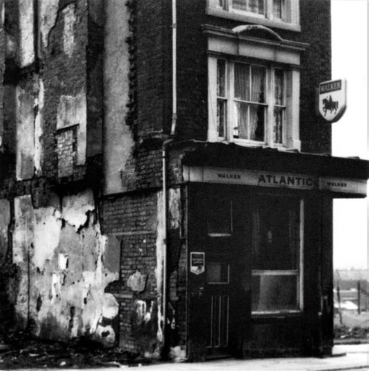
Atlantic Hotel on corner of Netherfield Road South and China Street.
-
The Tugboat pub on Netherfield Road North facing St George’s Hill. Uploaded to the Netherfield Rd Facebook platform by Denis Hargreaves.
-
The Anne Fowler Home was crucial for unfortunate local ladies who had fallen on hard times, but his image highlights that you had to get on with your near neighbours in the tightly packed dormitory. Of course, this building was formerly a famous and imposing Welsh Chapel. In these days when we treasure our heritage, we are reminded that his building should never have been demolished. It would have made a fantastic visitors' centre for the modern Everton Park in its prominent position on Netherfield Road South / Browside.
-
Denis Hargreaves describes this scene: 1970s Netherfield Rd South, with Netherfield Brow heights on the right and St Georges Heights in the distance, the people are between what was Cornwall St and China St
-
St George's Heights above St George's Hill and Netherfield Road with the Tugboat pub bottom left.
-
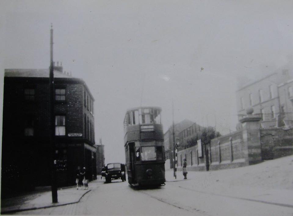
1960s on the corner of Netherfield Rd North and Kirkdale Rd, Denis Hargreaves of the Netherfield Rd Facebook is right to point out that only the numbers 30 and 46 buses used the Netherfield Rd route, and that this must have been a school run or some kind of special.
-
Denis hargreaves from the Netherfield Road & Surrounding Area Facebook pinpoints this fascinating shot as Netherfield Road North from Boyd Street.Great view of the old terraced houses on the west side of the road that ran down towards Great Homer Street and beyond Scottie Road. The prominent building is St Polycarp's, still standing today as a key landmark, but no longer a church.
-
My great grandfather John Woods, a dairyman, lived in Brunell Street with his wife and two sons towards the end of the 1800's. I can't find Brunell street on any old maps of Liverpool, nor the church - St Ambrose, where my grandad James was christened on 21st September 1898. Was it all bombed or demolished? I would be most grateful for any answers. Many thanks, John Sparling
-
Mazzini Heights from Netherfield Road.
-
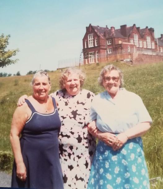
Sylvia Morgan uploaded this great picture to the Netherfield Road Facebook platform of her mam Jean Yates (middle) and Shay French (left. We can’t yet identify the third lady. It was on a Monday and they had walked up to the Derry Pensioners Club. Heyworth Street School can be seen in the background.
-
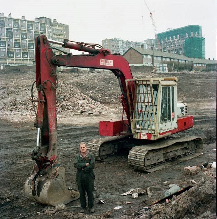
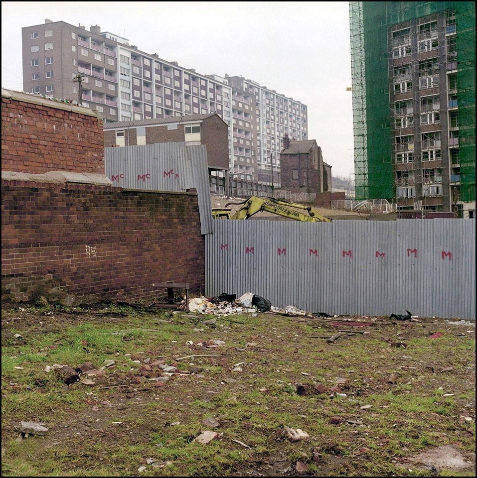
A job well done for the demolition man was also a community disaster for the people whose homes had to go along Netherfield Road.
-
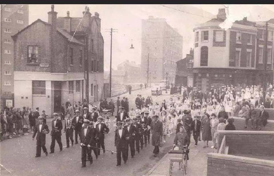
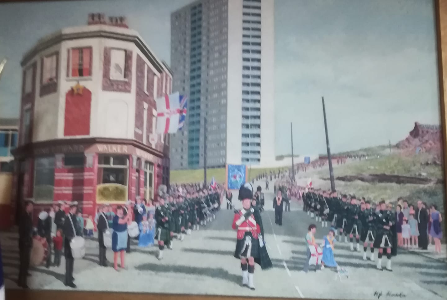
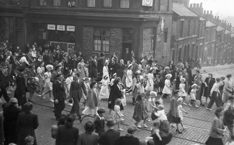
The Orange Lodge parade towards the city centre on Netherfield Road South in the 1960s.
-
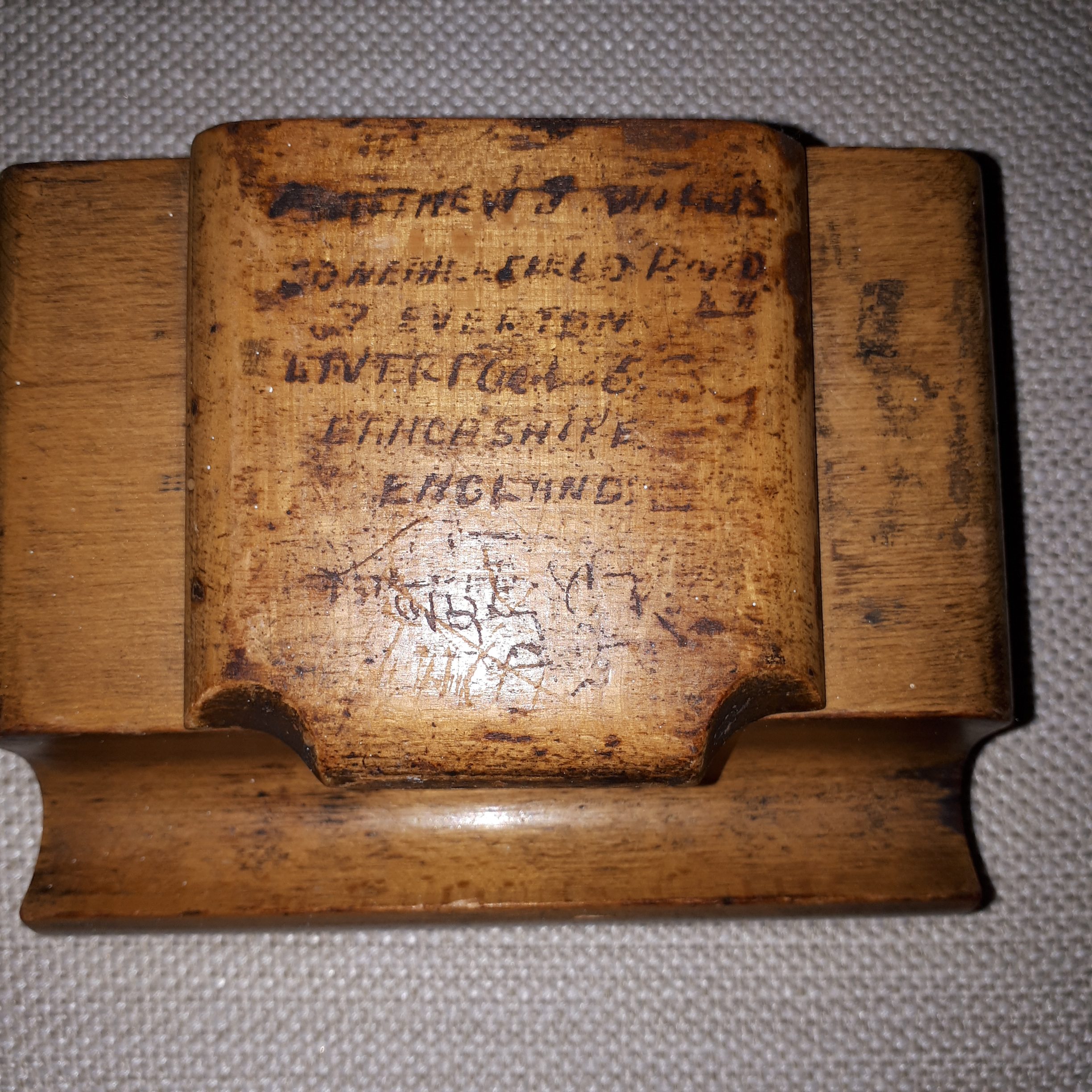
Hello, I found this ink well in a charity shop recently with the owners name Matthew Willis, 20 Netherfield Rd . Thanks Kelvin
-
Reference Witneys sweet shop. This is Whitneys which was on the corner of Back York Terrace opposite the telephone call-box. It was a tobacconist and sweet shop. It sold other things such as rock salt for winter use on the icy steps and pavements. James and Emma Whitney took over the shop when the well-loved Mary Milner died in 1945.
-
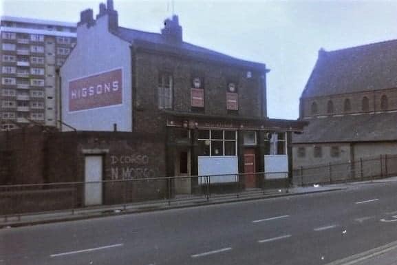
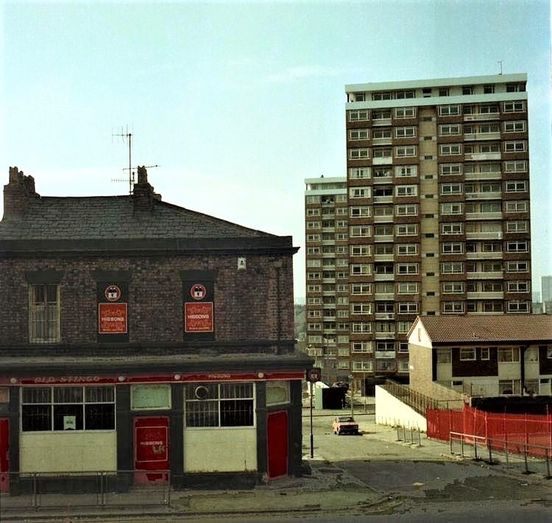
The Old Stingo on the corner of Netherfield Road North and Robsart Street with Milburn Heights in the background. Uploaded to Netherfield Rd & SA Facebook by Denis Hargreaves.
-
The York Hotel on the corner of Thomaston Street and Netherfield Road North. This image shows a youngster on the step of the pub, probably waiting for dad to come out. My real focus is the little shop next door. This was the nearest sweet shop to Melbourne Street where I lived.I would be sent their daily by my parents on little messages, or head over there myself for a sweet treat, nothing more expensive than a penny Arrow Bar.Of course, pub and shop were directly opposite the elevated site of the Victoria Settlement community centre. The old car poking its nose out onto the main road is exiting York Terrace.
-
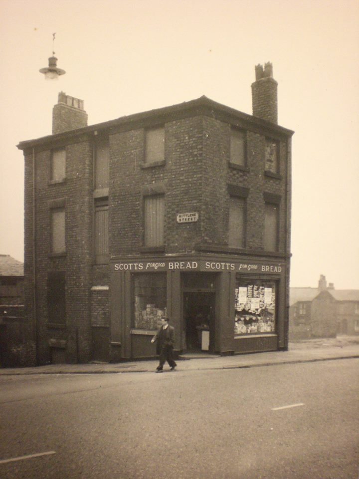
The shop on the corner of Netherfield Road North/Mitylene Street is the Scotts grocery store, run by the wonderful Miss Hill. This shop was across the road from the bottom of Melbourne Street. I would be sent there on messages most days, often to buy half a dozen cracked eggs and a bag of broken biscuits. I was always told to put it on the bill, something Mrs Hill did willingly, aware that the parents of the area would always pay up when the wages came in every Friday. This shop brings back so many happy memories for me.
-
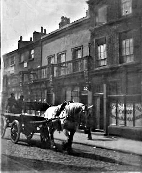
From Deborah Elliott: The Rainford Coal Co. making deliveries in Netherfield Road North, maybe 1905? You can see number 25, and next door, perhaps number 27 is the Netherfield Road Laundry, curtain and cloth cleaners. The photo was taken by Joseph Roberts, grandson of Robert Roberts who set up a plumbing business at number 26 in 1861. The company was still working out of Everton in 1908. Joseph was mad on horses, hence the photo. He grew up to serve in WW1 in the Royal Horse Artillery. He was a local solicitor, and eventually Coroner for Birkenhead.
-
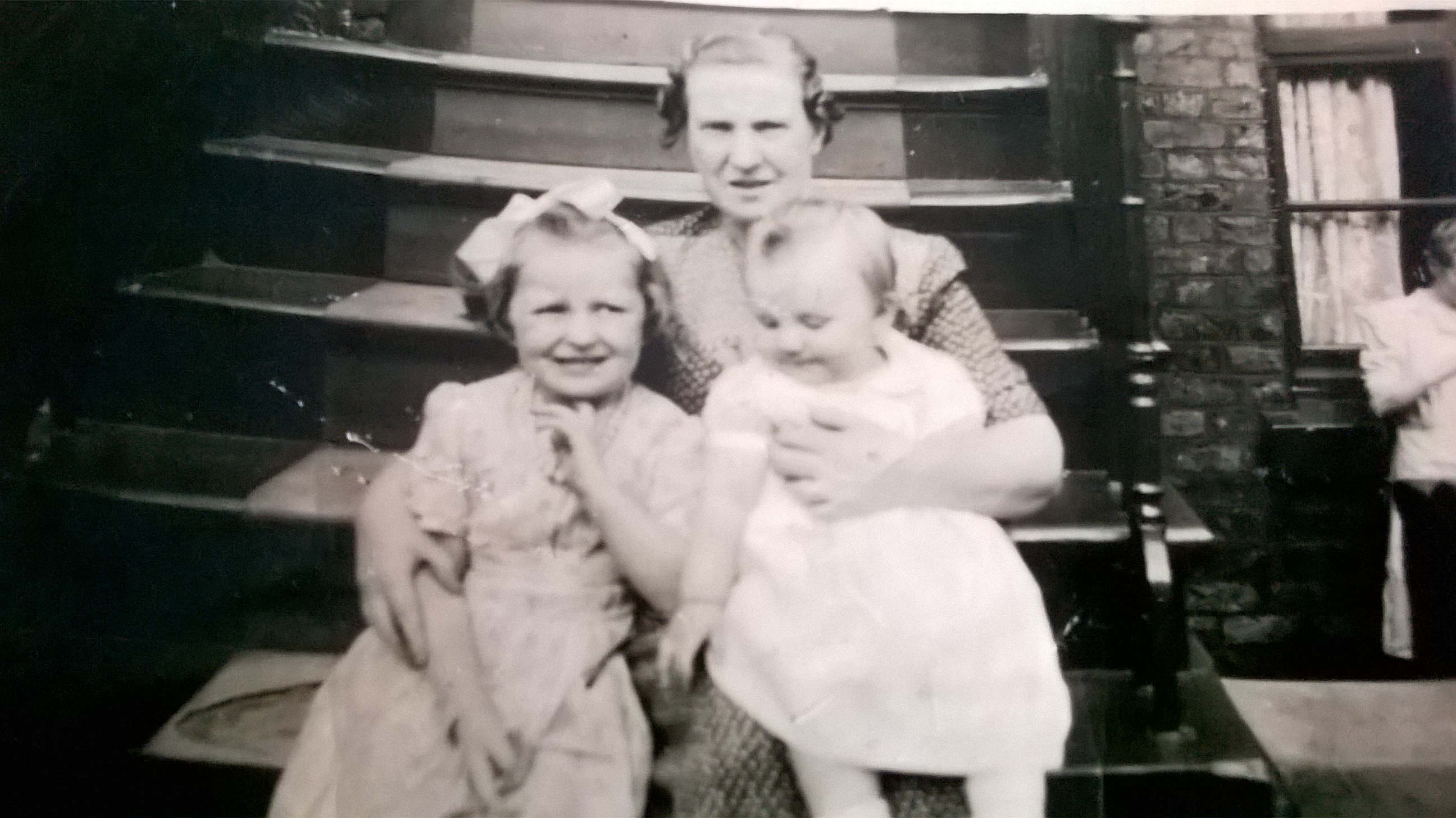
Taken on steps of 86 Netherfield Road at bottom of Fairy Street, Everton mid '50s Me and my cousin with my grandmother with my Great Aunt in background. Myers family
-
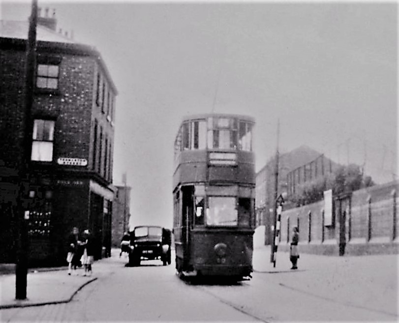
Brilliant 1950s picture of Netherfield Road North with Thomaston Street on the left adjacent to the old tram, image uploaded to the Netherfield Road & S.A. Facebook by Denis Hargreaves. The wall on the right is, of course, that of the Victoria Settlement community centre on its site between York Terrace and Melbourne Street. The door in the middle of the wall once accessed a staircase that led up to what was once the elevated gardens of of two of the oldest mansion properties in old Everton, one of them the home of the famous Canon Major Thomas Lester, vicar of nearby St Mary's in Kirkdale, who would later have two schools named after him (Major Lester and Major Street), plus the well known Lester Gardens that led to the Westminster Road baths. By the time I was growing up in Melbourne Street, the 'Seccy's' gardens had been concreted over to accommodate a five a side football pitch and play area. But that door in the wall always fascinated me as a kid. We could never access the 'Settlement' via this tunnel route, always using the side entrance on the extremely steep York Terrace.
-
Netherfield Road South looking north from the bottom of Brow Side.
-
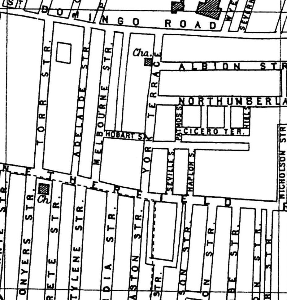
Map of Netherfield Road North including what I call the Australia streets . . . Melbourne, Adelaide, Hobart and Torr.
-
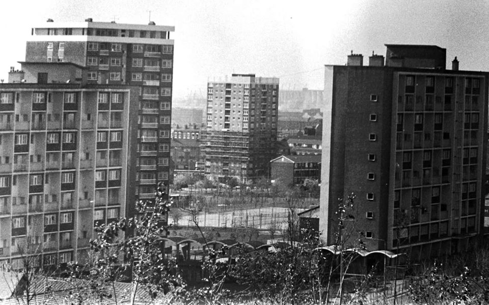
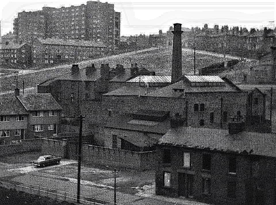
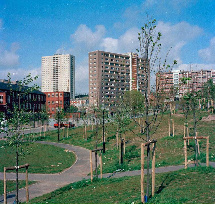
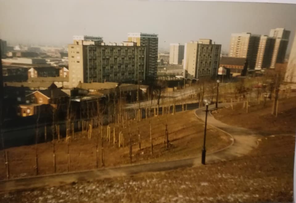
A sweeping view as demolition continues along Netherfield Road amidst the new High Rise dominance post 1960s. The old washhouse with its familiar chimney can still be see on the right with St George's Hill and Everton Terrace on the left, now all part of the modern Everton Park with its Englna dagship wildflower meadows. How times change.
-
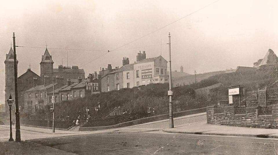
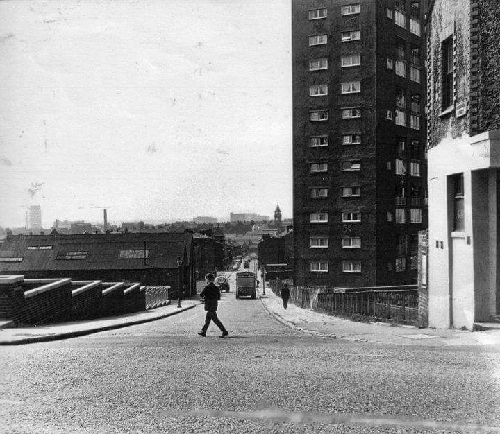
They say one picture is worth a thousand words. This one, taken from the end of Shaw Street where it becomes Netherfield Road South,shows Everton Brow continuing up the hill on the right with its corner church. The historic lock-up tower, the symbol of EFC, can also be seen on the right. Browside (or is it Brow Side) continues across the top with its impressive properties, all long gone. I like the advertising on the side of one of the walls promoting Lewis's suits. Of course, Anne Fowler's Home for Woman, run by the Salvation Army, is prominent on the left - formerly an impressive Welsh Congregational Church. Oh why did they knock it down. It would have been the perfect place to house an Everton history exhibition, but don't start me on that one. Right in the centre of this pictured would have stood the Olde Everton Toffee Shop.I suppose that's progress.
-
Wonderful memory from Alma below. As kids, we always played on a bomb site/oller almost opposite the Cumberland pub on Netherfield Road and Melbourne Street. I'm wondering if this was where that bomb dropped on the shop in the blitz, near the Victoria Settlement. Of course, there were many bomb sites along Netherfield Road. My granddad Adam Wareing and his sons all drank in the Cumberland after WW2 and into the start of the 1950s. I was lucky enough to take my son to have a drink there before it was demolished. The only shop I remember that sold herbal drinks was in Walton. close to what is now the Queens Drive flyover. It was famous for its unusual refreshments and clearly there was also a herbal shop in Everton as well thanks to Alma's memory. Incidentally, there is a picture of the Cumberland further down this reel.
-
My great aunt Maud Sefton had a shop at 249 Netherfield road north, it was bombed in the blitz , her eldest son Billy crawled into the rubble to rescue her brass till. He had a limp and wasn't called up but his younger brother Jimmy Sefton was in the Royal Navy. Their local pub was the Cumberland, and they lived in Candia street after the shop was bombed. I would love to see any old photos of the shop as my mum worked there with her Aunty Maud. I believe it sold herbal drinks , among other things.
-
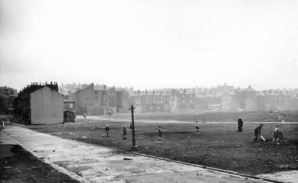
Looking across what was once Opie, Beatrice and Arkwright Streets below Netherfield Road North, kids improvise on an oller/debris area for a game of cricket. Loose bricks and rubble didn’t worry us in those days. These bomb site and demolition areas were out instinctive playgrounds.
-
My grandmother Muriel Stewart Mundy was born in 1894 at the home of her parents John and Mary Mundy of 69 Melbourne Street. John Mundy was awarded the British Empire Medal at the end of WW2. He worked on the liverpool docks for more than 50 years. He died in 1947. 69 Melbourne St. was damaged during the Blitz in WW2 and the family had to move out while it was repaired. I have included an old photo of Melbourne St. as well as an overlap of Melbourne St. before the war and present day.
-
Further down the reel 'Amy' asked for help regarding her three times great grandfather who had a sweet shop on Netherfield Road. She wanted to know the whereabouts of the various Netherfield Road sweet shops. Many thanks to those who responded to her query via my Lost Tribe Facebook page. These were the various options discussed. Mrs Lyons' sweet shop near to the Kirk Street chippy. Also the reminder that the last house on the left as Netherfield Road reached Everton Valley was a well known sweet shop run by the Styles family. There was also a sweet shop on Rupert Hill near Netherfield Road called called Payne’s. Mrs Stocks had a shop halfway down Aughton St, again off Netherfield Road. Further up the hill on St Domingo Road, people recalled Witneys sweet shop, just around the corner from Melbourne Street. I'm sure there were others, but many thanks to everyone who came up with thoughts for 'Amy' and her nan as they try to progress their family history.
-
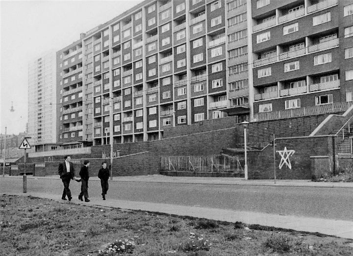
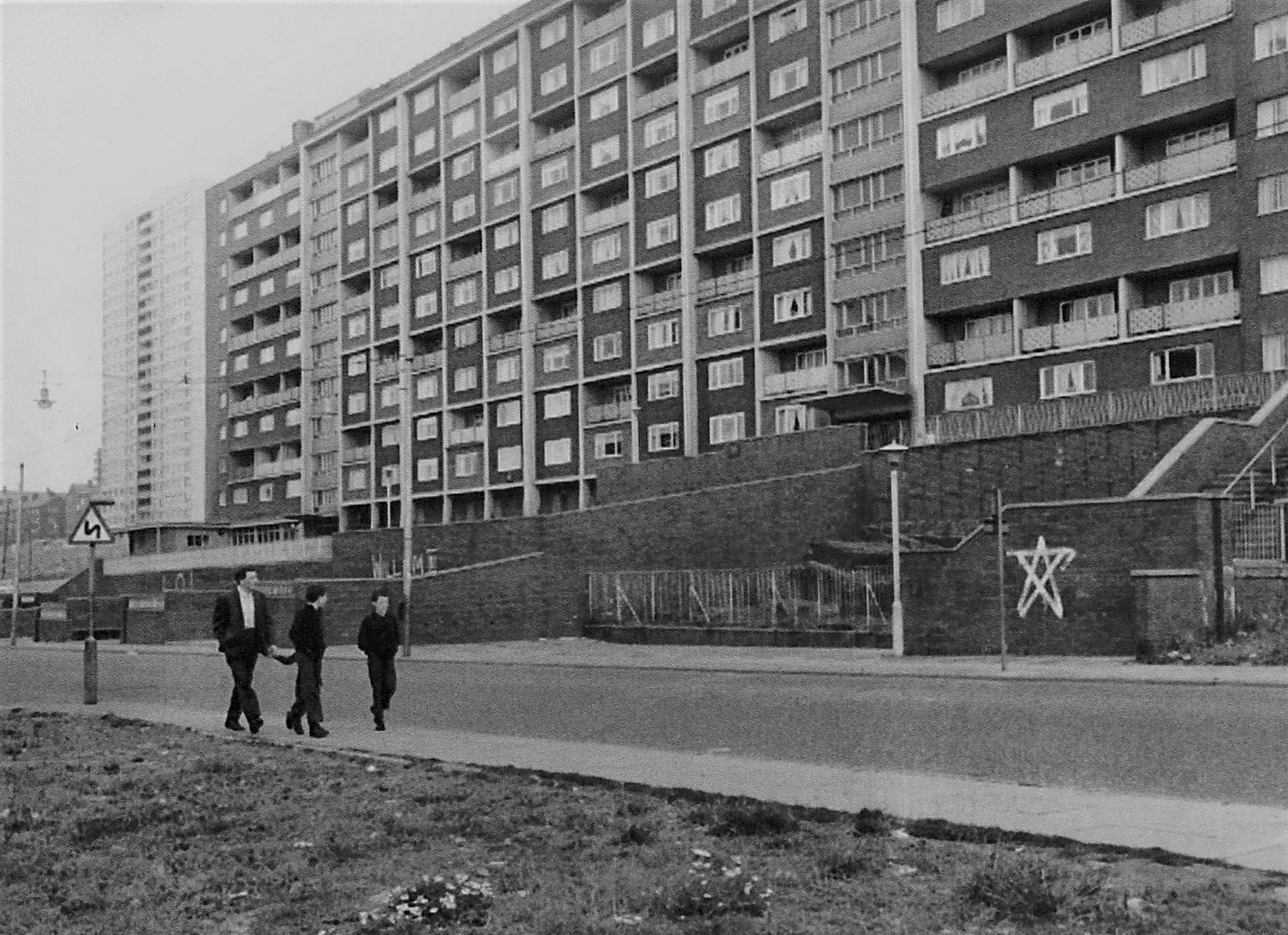
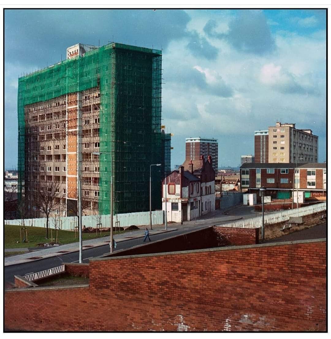
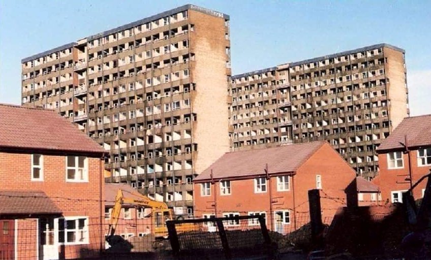
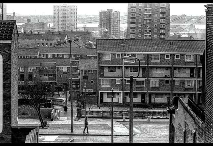
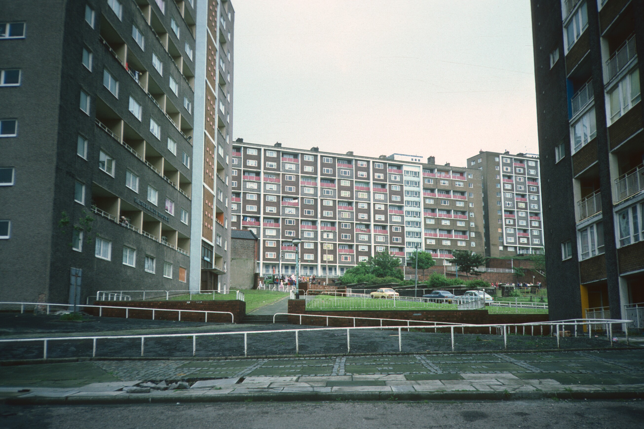
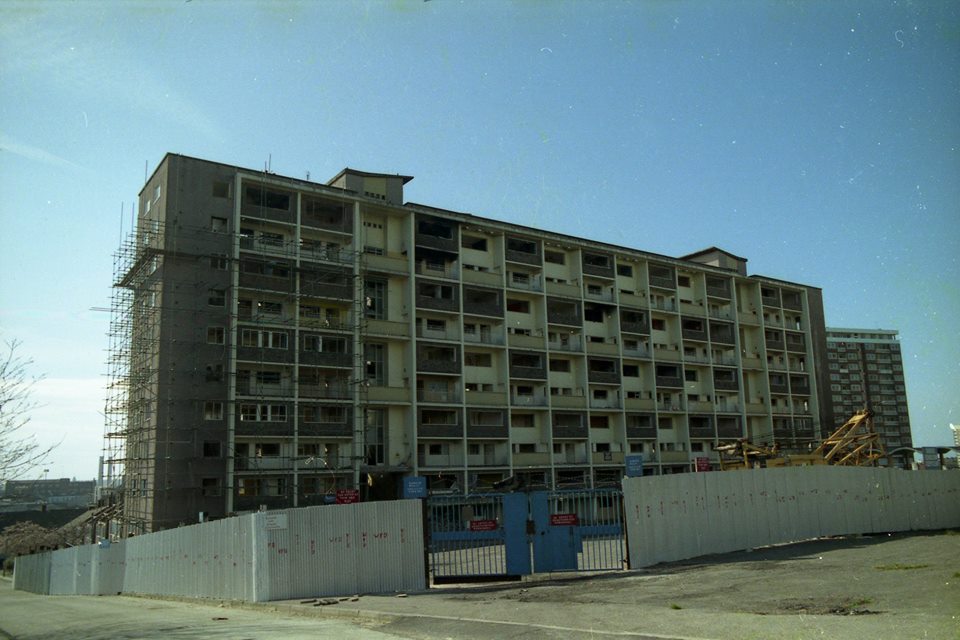
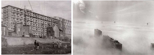
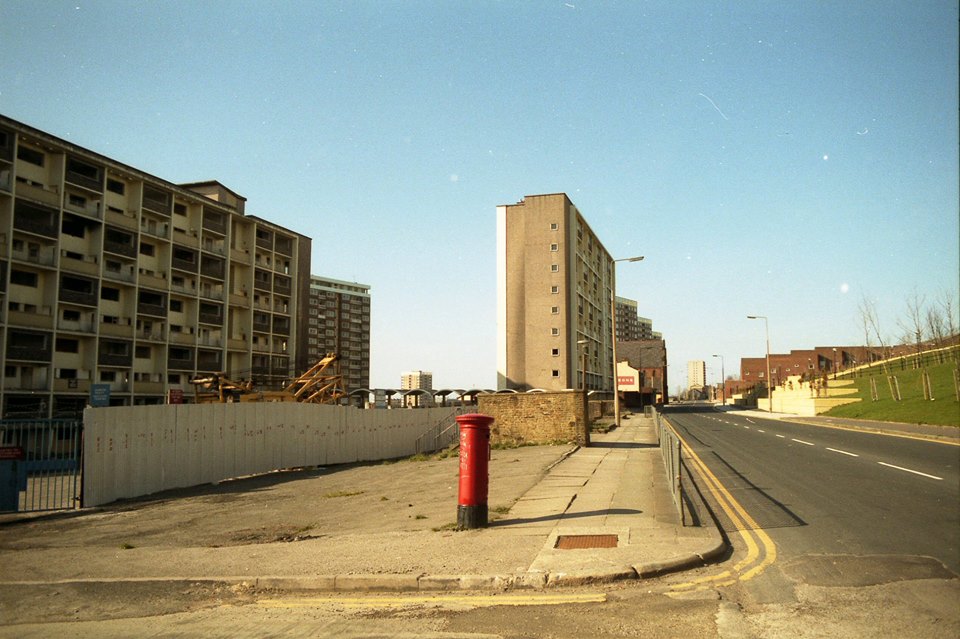
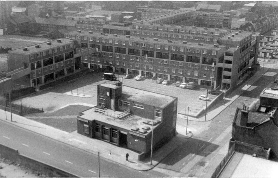
These three tower blocks, once proud homes for hundreds of Everton families, would later get the unhappy tag ‘The Piggeries’ as the council of the day’s so-called so called High Rise Heaven and ‘Streets in the Sky’ project turned into High Rise Hell. The blocks were Crosbie, Canterbury and Heigh Heights, seen here at William Henry Street off Netherfield Road South in the 1980s. This image shows the building of the kind of houses below that the local community really wanted.
-
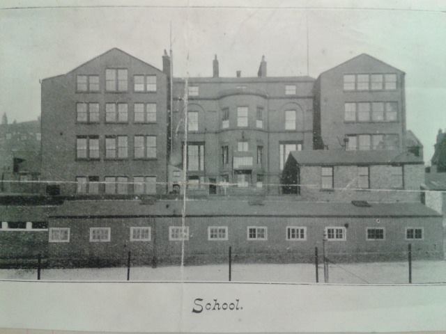
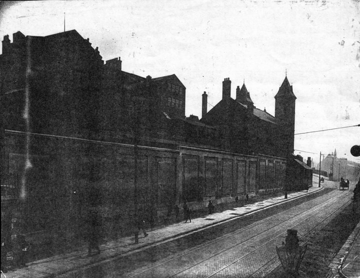
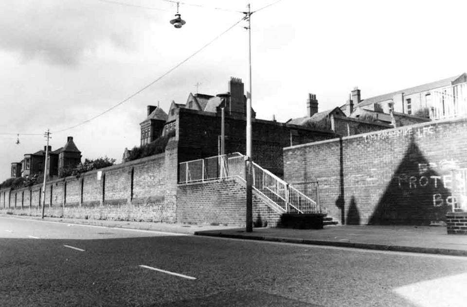
Everton Terrace Industrial School from Netherfield Road South. Originally uploaded to the Heyworth St Facebookm platform.
-
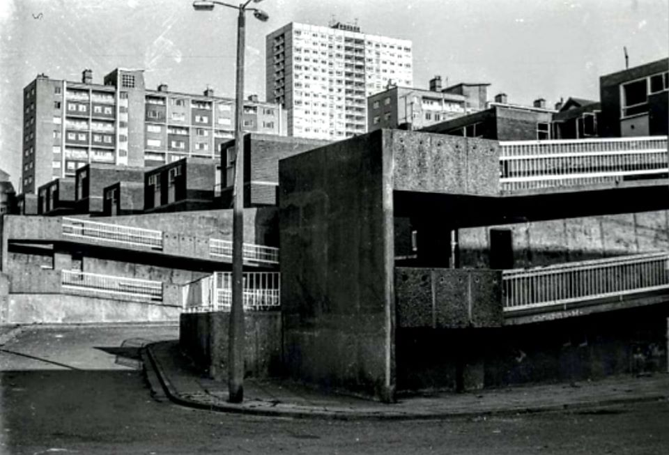
Netherfield Road high rise ramps in the area of the old Conway, Arkwright and Beatrice Streets.
-
Amy, regarding your query below. There were different sweet shops along Netherfield Road. I had a paper round in one called Moss's opposite the old Popular Cinema I don't know if this rings any bells. What was your three times great grandfather's name? That might jog someone's memory.
-
My Great Great Great Grandad used to own a sweet shop on Netherfield Road. My nan has recently been trying to find him and more about the sweet shop. Does anyone know what it's called or how I could find out? It'd be greatly appreciated!
-
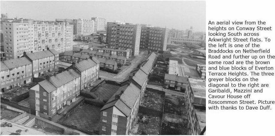
Intriguing aerial shot.
-
The Braddocks flats from an elevated angle across Netherfield Road North.
-
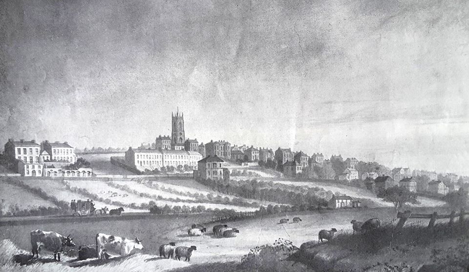
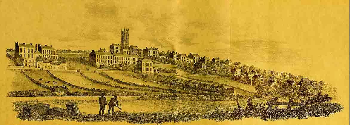
A remarkable insight into Everton's famous hill, drawn in 1818 from Great Mersey Street. The fields in the foreground would soon become a concrete jungle packed full of terraced streets. The first mansions seen to the left of the image stand on what is now Netherfield Road North. Indeed, these particular properties would later become the famous Victoria Settlement community centre. Canon Thomas Major Lester, a local vicar at nearby St Mary's Church on Walton Road, a champion for local poor children, lived in one of these elevated villas. His name would later be enshrined in the name of two local schools, Major Street and Major Lester. St George's Church is top centre, then just four years old, having opened its doors in 1814. The villa in front of the church tower belonged to James Atherton, the visionary who inspired the building of the 'Iron Church' and the man who later developed New Brighton as a seaside resort for Merseyside. The hill drops down to the right towards Everton Village. This artist's impression provides a remarkable insight into the Everton of that period with its grand houses and mansions, still very much in the countryside. Within 50 years the densely packed terraced street community I was brought up in would already be sweeping up the hill to dominate this scene. By 1880, my own street, Melbourne, was in place to the left of Canon Major Lester's villa, running steeply between Netherfield Road and St Domingo Road. Have you spotted the stagecoach (bottom left) making its way into Liverpool towards Scotland Road, ignored completely by the cattle in the fields. A separate etching with a similar scene is further down this reel.
-
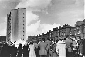
Crowds come out on Netherfield Road in the 1960s to see the new Braddocks high rise flats. What were these so-called 'streets in the sky' all about? These were amongst 23 towers that went up in Everton, most demolished in their own right as the predicted high rise heaven turned to high rise hell. It's intriguing to see the old houses still in place on the other side of the road. Of course, these would soon disappear as the demolition derby gathered pace.
-
Netherfield Road's famous Tugboat pub, seen here in glorious colour in the shadow of the former St George's Heights.
-
Hello, my grandmother was born in the Cumberland Arms in 1913, her father, Isaac, was the publican, as far as we know it was always called the Cumberland Arms.
-
A great aerial picture, enabling you to try and pinpoint where your street might have been before the clearances along main routes like Everton Road and Netherfield Road. Landmarks helping us include the Everton Water Tower (top left), Whitley Gardens opposite the big terraced houses on Shaw Street and St Francis Xavier’s church below right on Langsdale Street.
-
Brilliant picture. This was my family's local before the clearances, standing almost directly opposite our street Melbourne which is now, inexplicably, called Patmos Street. Patmos was actually further up the hill between Northumberland Terrace and Cicero Terrace. This always irritates me every time I drive along Netherfield Road and pass the site of the old Cumberland pub. It was one thing allowing the bulldozers to wipe out our old streets in the Sixties and another further erasing memories of the famous Melbourne Street with this council naming error. Anyway, having got that off my chest, thanks for this wonderful image. My granddad Adam Wareing on my mothers side and her brothers Joe,John, George, Adam Jnr and Bobby would have all been regulars in the Cumberland, during and after the war. Just before the pub itself was knocked down, I managed to take my son in for a final pint and make a toast to all those regulars, including my granddad, for whom this was once a home from home. On the opposite Mitylene Street corner once stood a famous local grocery shop where I would be sent for half a dozen cracked eggs and a bag of broken biscuits, always told to put it on the bill, My mother May Rogers would always pay up, along with the other customers, at the end of the week when husbands handed over their wages. Interesting days when there was clearly a very different definition of poverty.
-
Thanks to Denis Hargreaves from the Netherfield Road Facebook platform for originally conjuring up this 1946 image of the Netherfield Road North Protestant Reformers Memorial Church that once stood between Conyers and Crete Streets. It was founded in 1903 by Pastor George Wise, but was badly damaged in the WW2 blitz and later demolished. I lived in nearby Melbourne Street in the 1950s and into the 60s. Sometimes as kids we would cross Netherfield Road to the sloping bomb site between Conyers and Crete, probably linked with my school mate John Rimmer from Conyers. We would then play a full scale football match on this expanse of debris. I never realised for one moment that this remarkable church building once stood here. It is like all the local bomb site areas we played on. We saw them as our exclusive play areas as youngsters without ever giving too much though to the devastation that clearly went before in WW2. We would put our jumpers down for makeshift goalposts on this former church site without any understanding that they were probably on top of a former church altar or baptism font. Fantastic image.
-
Looking up to Netherfield Road North with a beautiful reminder of the Pop Cinema, closed but still untouched by the bulldozers at the start of the 1960s. The adjacent landmark church is also still intact along with the old Old Lady's catholic school top right.
-
Hi Mr Thompson. Regarding your query below about securing copies. We don't actually sell images because of copyright issues, but you are welcome to print them off to secure a valuable memory for you and your family.
-
hi I am joseph Thompson I find your photos fascinating I was born in abbey street of heyworth street xmas 1944 my family moved to 54 Netherfield rd south in1946 we lived there till 1954 and moved to huyton as part of clearance . I remember it all .I am now 75 and live in Hampshire.even we have much more now I would give it all to be back in those grey days. thank you all the effort you have put in to this article. I would like copies if possible .
-
Netherfield Road North at Howe Street n the 1960s. The building on the corner was J.W.Wells & Co, Baker's Sundries Manufacturers... Alice Hart's Greengrocers is next door on the left
-
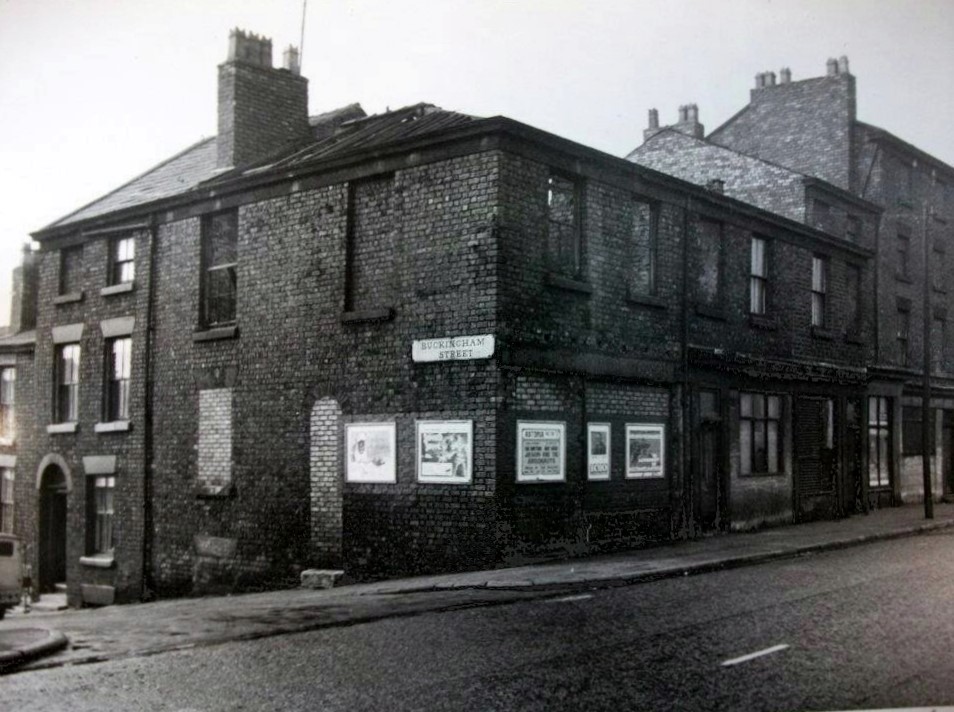
The Orange Lodge HQ on Netherfield Road North at the top of Buckingham Street.
-
Good view of the houses that replaced streets like the famous Thomaston, Candia and Potter, viewed from the bottom of York Terrace.
-
These photographs are amazing...I lived with my parents in Creswell Mount for about 6 months. We then went with the Army to live in Germany....I can remember my parents talking about a pub called "Lulu's" on Heyworth St.
-
Netherfield Road's large houses that stood opposite the old washhouse.
-
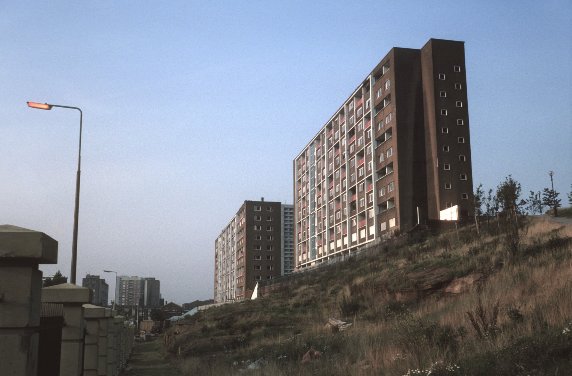
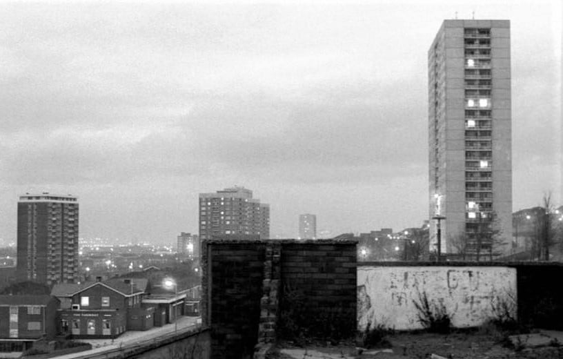
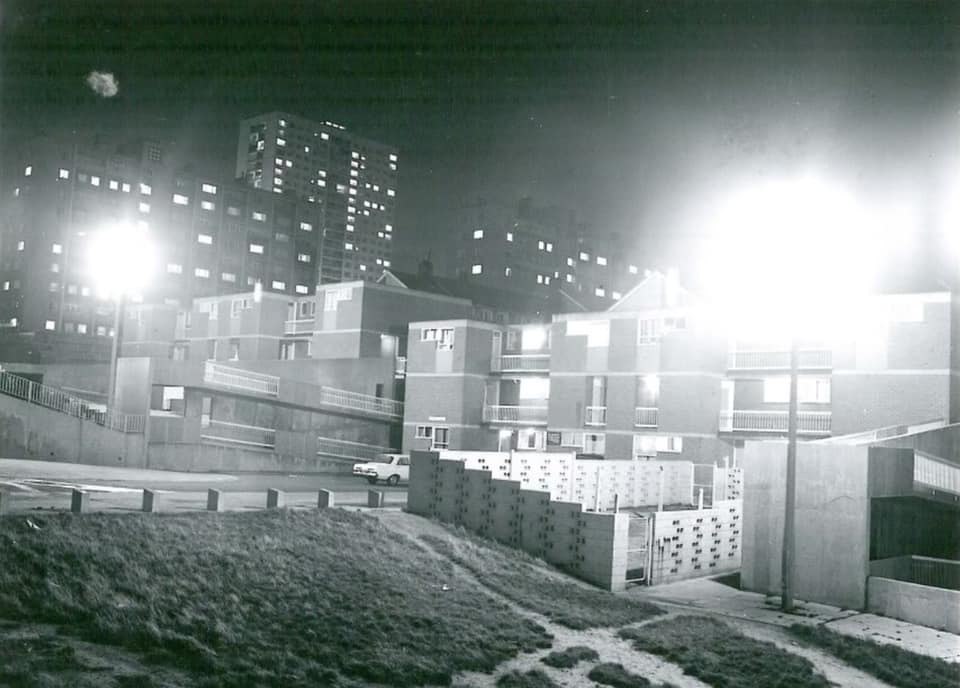
Looking up at Everton high rise blocks above Netherfield Road, an almost spooky night scene. Most of the 'new build' that replaced the original old terraced streets have now also gone, of course.
-
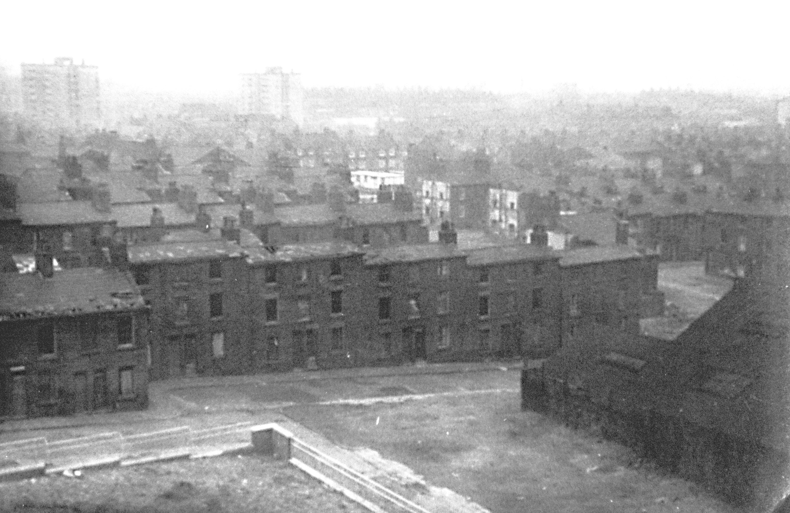
Roof lines in the Netherfield Road area, 1950s.
-
The Old Stingo photographed in the 1900s. This famous pub was opposite our old family shop at 104 Netherfield Road North.
-
Netherfield Road School'Babies' - looks like 1920 on the board.
-
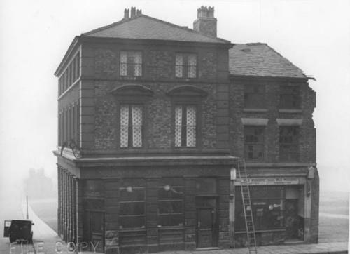
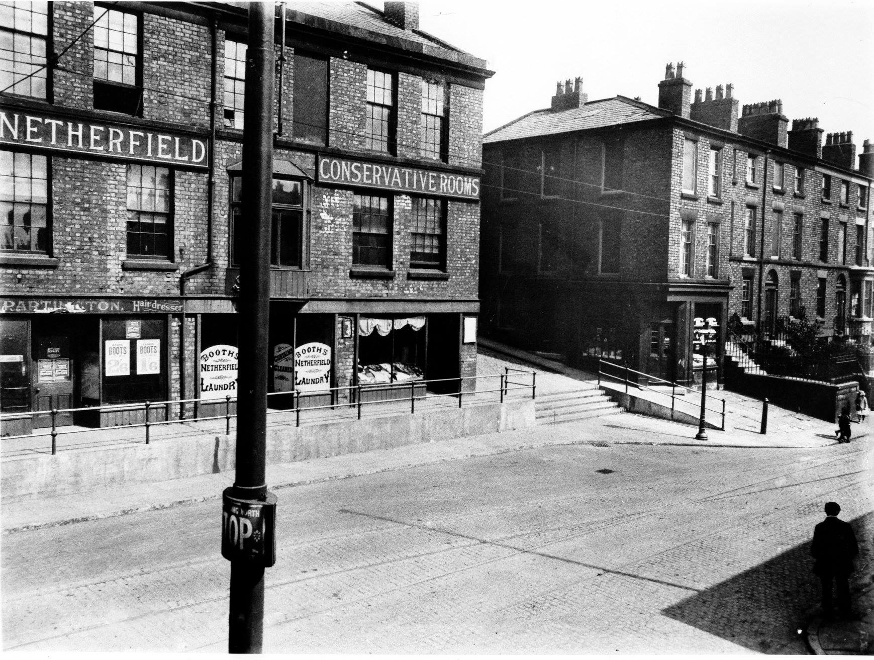
The photograph of the Conservative Rooms shows our former family shop at 104 Netherfield Road North. The family took it on c1900 when it was a grocery and general store. Later the frontage was changed and it became a drapery shop. The owner at the time was Edward Bradborn, my 2x Great Grandfather and he also ran a coal yard at nearby Arkwright Street. The little girl on the extreme centre right of the photograph is believed to be my Grandmother Doris Muir(nee Williams) or her sister Ada Muriel. The family moved in 1940.
-
An unusual shot of Netherfield Road from the school railings on Everton Terrace.
-
Former family shop at 104 Netherfield Road North. c1905. The shop was originally grocery and general when the family took it over c1900. It later changed to a drapery shop c1910
-
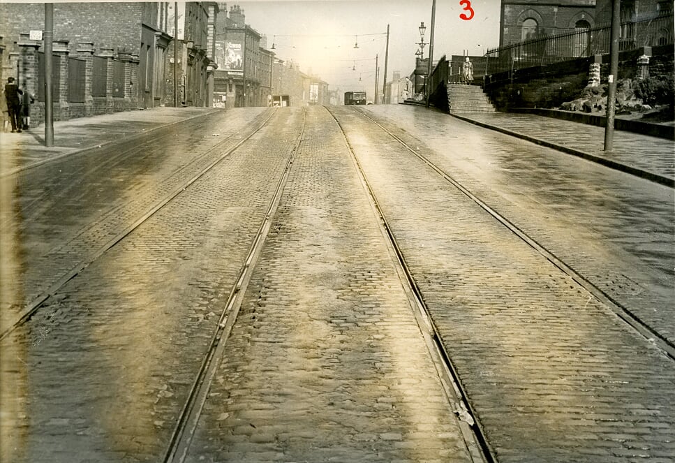
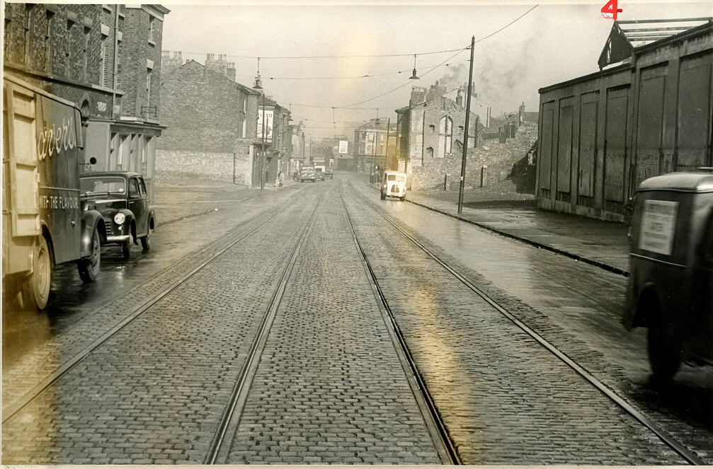
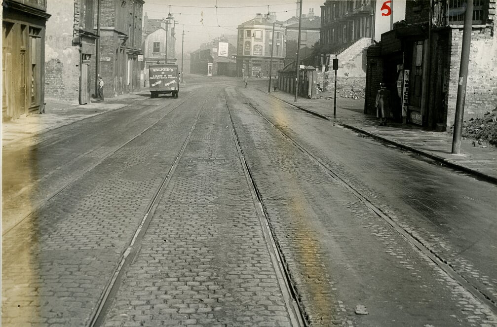
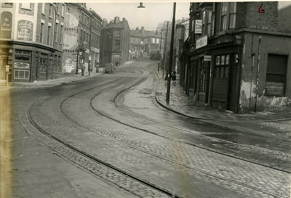
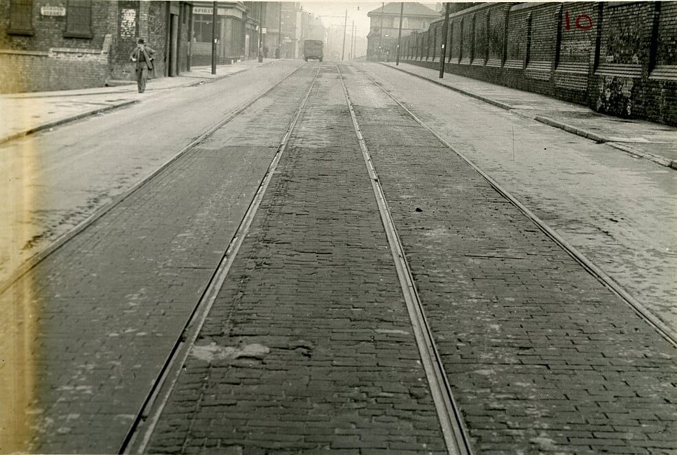
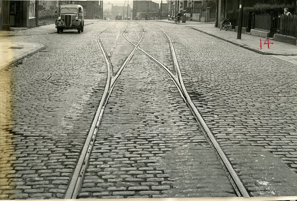
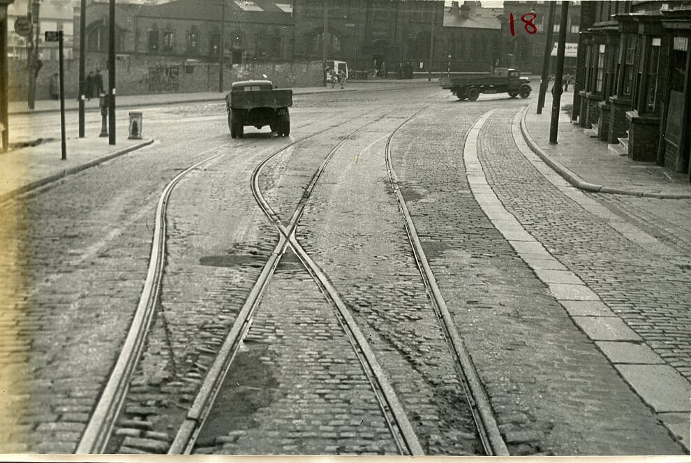
My heartfelt thanks go out to tram enthusiast John Williamson for his remarkable research below on the old tram route from Shaw Street to Everton Valley, taking in the famous Netherfield Road South and North along the way. You feel as if you are sitting on board, waiting for your stop along the way, but don't get off. These images provide a fascinating insight into the way it was before the 1960s clearances in heartland Everton. Of course, it also highlights the obvious fact that we suffered significant bomb damage during World War Two when the railings where removed by the Lock-Up Tower as the powers-that-be secured as much metal as possible for the war effort across the city. The consecutive pictures that follow will take you on an intriguing journey back in time. All you have to do is jump on board at Shaw Street, take your seats and trundle all the way to Everton Valley, looking out for any landmarks you might remember along the way of which there are many. Once again, many thanks John for providing this wonderful piece of social history. Of course, below these images you will find a fascinating reel of other individual pictures that demonstrate just how important Netherfield Road was to our famous old district with its steep streets and fantastic community spirit. Ring the bell and let's get our journey underway.
-
All aboard for the tram tide of your life from Shaw Street and along Netherfield Road South and North before reaching Everton Valley, showing manynof the old streets and properties along the way. Here Shaw Street reaches Everton Brow on both sides of the road with the historic triangle that houses the Everton Lock-Up Tower on the right. Of course, the Everton Toffee Shop once stood here and the steep steps led up to ancient Everton Village. Beyond the garden triangle you can see the large houses on Brow Side, sadly demolished along with Anne Fowler Building as part of the 1960s/70s clearances. All of this land is now taken up- by the modern and spectacular Everton Park. The one thing we lack in the modern park is toilet facilities and the like for visitors. With a bit of forward thinking, Anne Fowler's could have become a wonderful Visitor Centre in the heart of the park, able to put on exhibitions about Everton's rich history and providing the cafe and toilet facilities so desperately needed. The tramlines are two-way here, but as your journey continues you will see Netherfield Road narrowing and the lines becoming single track. All aboard. Enjoy the ride!

-
A fantastic shot of the Netherfield Road tram route with the steps up to Brow Side on the right and Ann Fowler's Women's Home just visible. These days you don't notice how the road slopes here, but a tram would feel the strain.
-
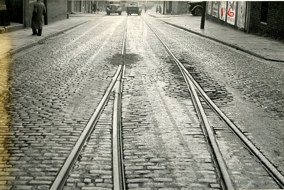
The tram driver could now see the expanse of Netherfield Road South opening up ahead, having past Anne Fowler's on the right. Prince Edwin Street, China Street and Cornwall Street would have been along the left-hand side in this area.
-
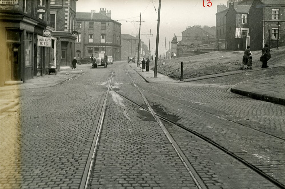
The last tram stop on Netherfield Road South before it swings up right towards Netherfield Road North. How wonderful to see more of the the big houses with their steep steps on the right with streets like India, Cornwall and Roscommon at this point on the left.
-
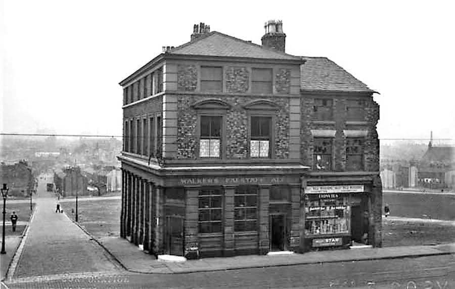
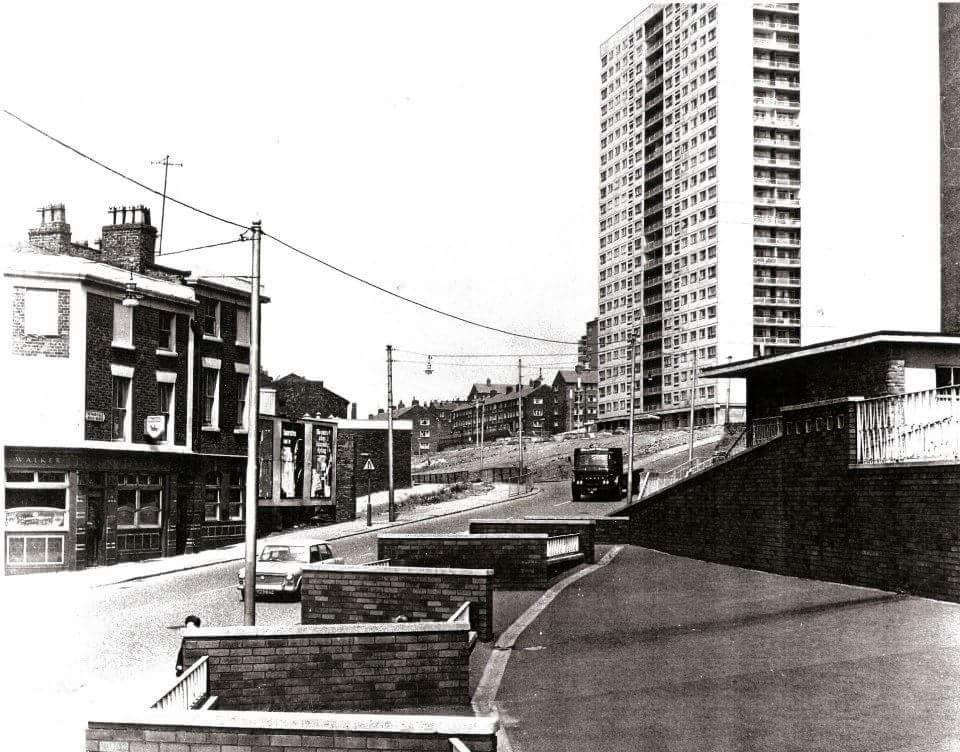
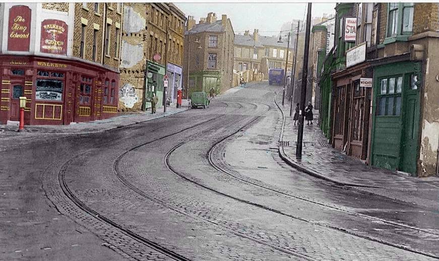
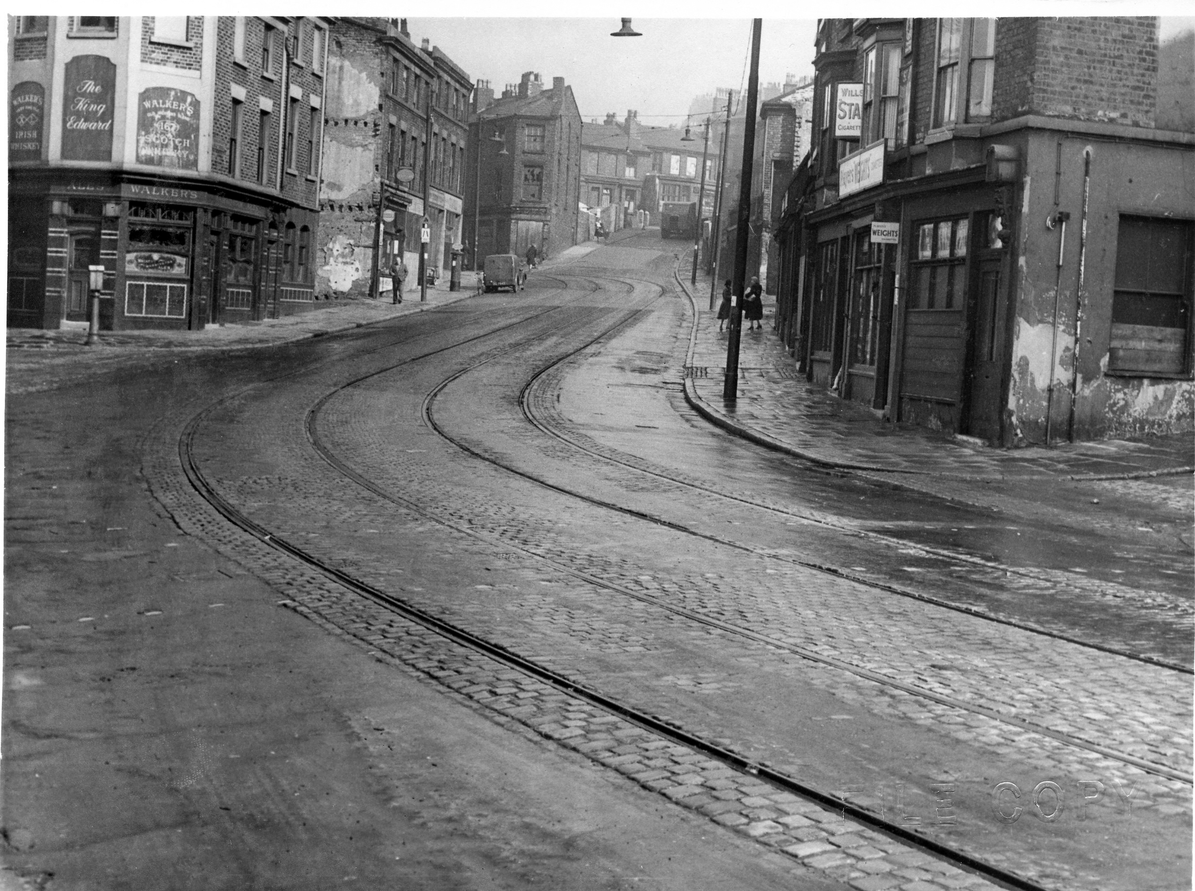
The familiar upwards curve in the road would have taken our tram from Netherfield Road South to Nethertfield Road North. St George's Hill is directly ahead and many will remember the famous Walker's Pub at this point on the left.
-
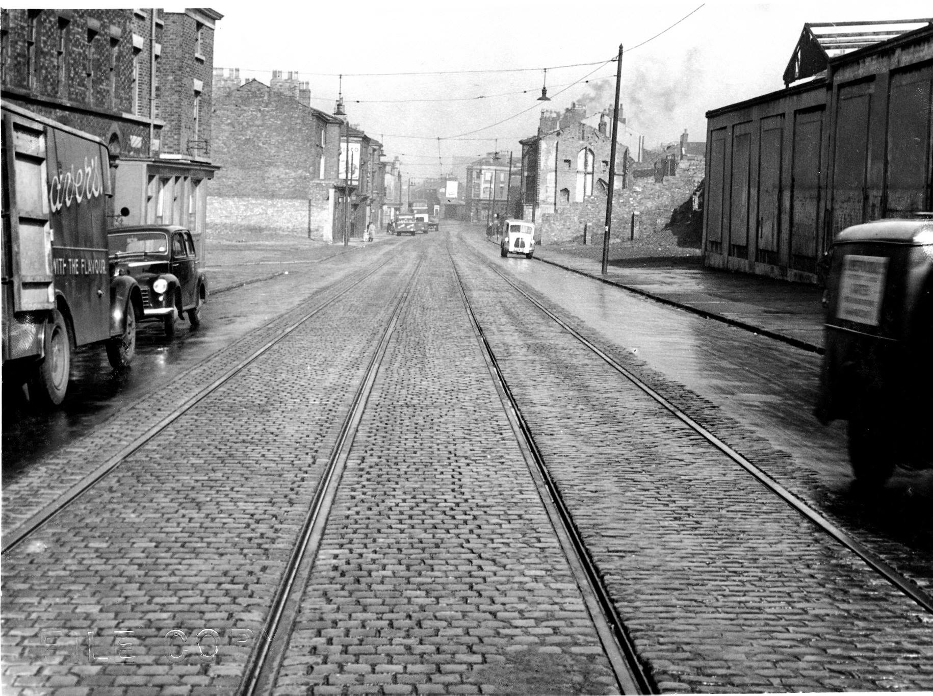
Our tram now enters Netherfield Road North with the famous washhouse on the left, used by just about every lady in the district, including my mother May Rogers. You can see the St George's Hill street sign on then right, above what used to be a famous corner shop. If you wish to see this shop with its distinctive 'toss-bar' used for street wise gymnastics by all the kids and want to view St George's Hill in all its early glory, just key St George's Hill into the site search engine.
-
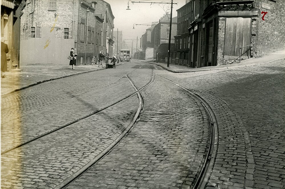
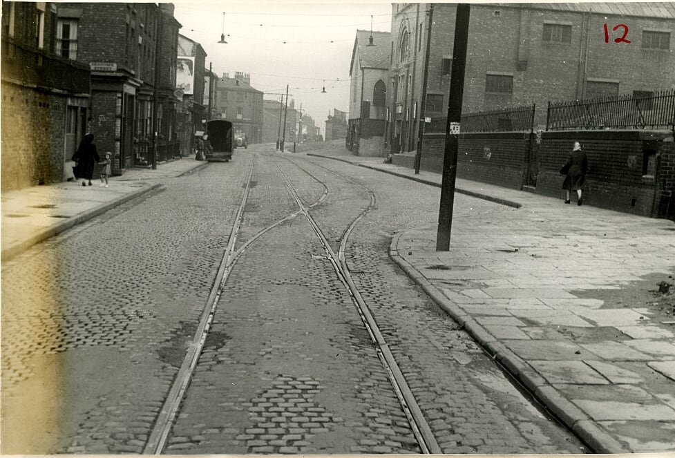
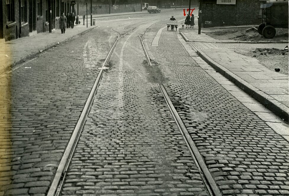
A fascinating portion of the Netherfield Road tram route, the houses and shops highlighting how important this road was at the heart of our community. Streets in this area, just beyond where Netherfield Road South kinks up to become Netherfield Road North had nearby the likes of St George's Street (beyond St George's Hill), Mountjoy Street, and Fairy Street on the right with Rose Vale on the left.
-
Its's strange, but I couldn't remember elements of Netherfield Road North being so narrow as it is here where the tram tracks once again narrow. Ahead on the left is St Polycarp's Church. The building still stands, one of the few original landmarks along Netherfield Road, but it is no longer a church these days.
-
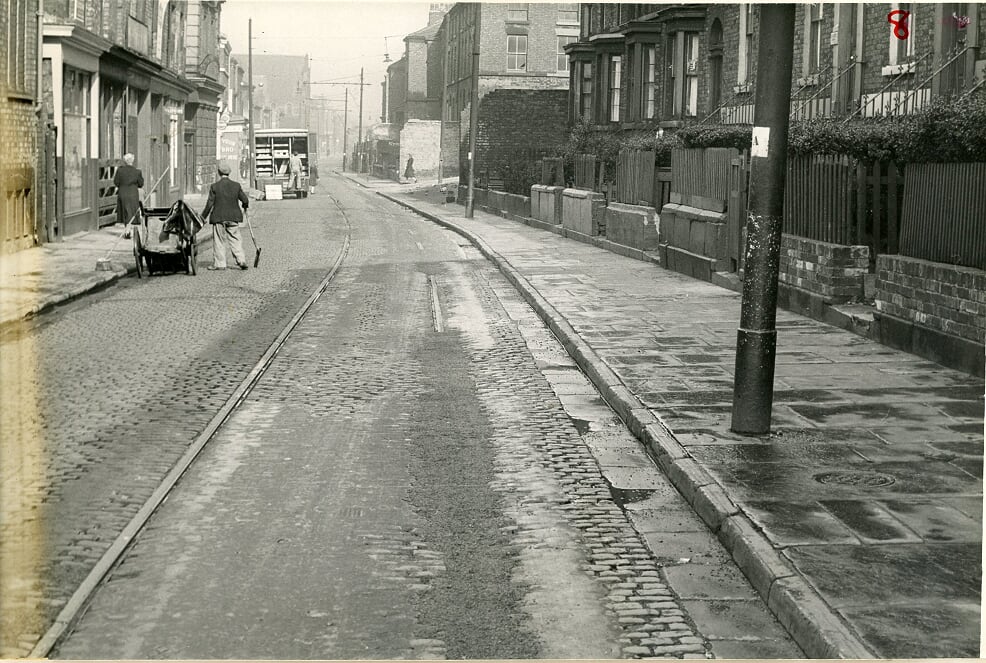
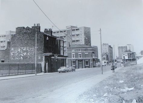
Anyone for Gordon Street as the famous shiny red wall of the John Bagot Hospital comes up on the right? The wall is still there although it is getting increasingly damaged. Of course, the hospital has long gone. Beyond Gordon Street is Elias Street with its pub on the corner, one of the many along Netherfield Road North and South.
-
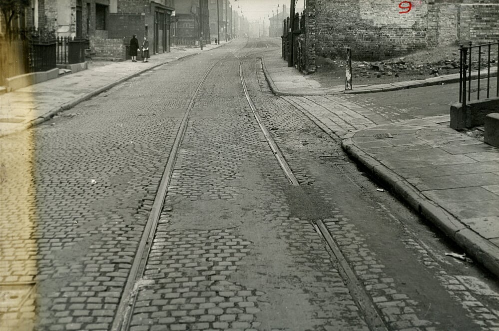
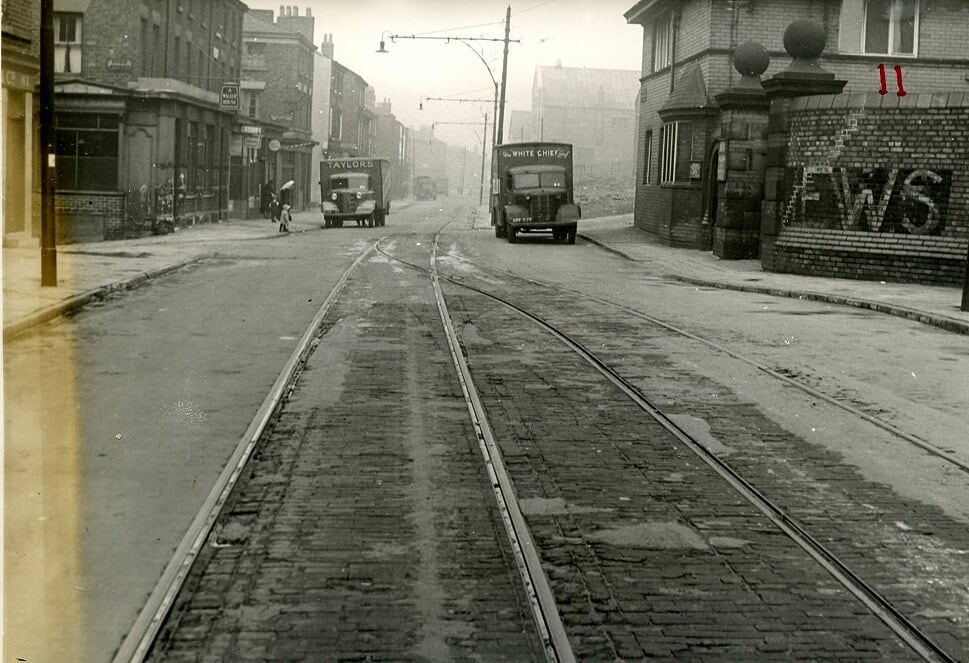
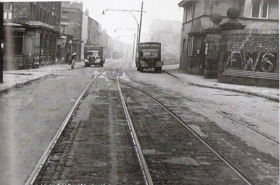
Ring the bell here if you want to get off our tram at the John Bagot Hospital. Streets opposite this old fever hospital included Conway,Gordon, Elias, Buckingham and Howe Street. On the other side of the road, the hospital stood alongside the very steep Mitford Street, featured on the cover of my first Lost Tribe of Everton & Scottie Road book. The tramlines widen into two-way at this point. Of course, I should mention Havelock Street just beyond the White Chief lorry on the right. It was so steep it needed a handrail up one side to help the older people make the climb up to St George's Church on Northumberland Terrace. You took your life in your hands if you attempted to race down Havelock Street on a steering cart, but many kids tried and lived to tell the tale. I ended my steep Echo paper round on Havelock Street and delivered the Football Echo as a boy, not realising that one day I would become Echo chief football writer and then sports editor!
-
Our tram now reaches a very important point on its journey along Netherfield Road North. What an image with the legendary Popular Picture House or 'The Pop' on the right where we watched the famous Flash Gordon pictures every Saturday morning. Alongside it stand the elevated gardens by Somerville Street. The church next to 'The Pop' stands on the corner of Hapton Street, On the left beyond the little girl is the famous Seacome Street with Aughton Street beyond that.
-
Our tram continues along Netherfield Road North with its sloping streets on the right and and left. Those on the right here were particularly steep like Hapton, Seville and the imposing York Terrace ahead with the Victoria Settlement Community Centre clearly visible in its elevated platform on the right. The Settlement was formerly one of then oldest properties in old Everton, once occupied by the legendary Canon Thomas Major Lester, after whom a local school and street were named. He was a champion for the poor children of the at the end of the 19th century and was vicar of the former St Mary's on Kirkdale Road where I was christened and my parents Harry and May Rogers were married. Anderson Street is on the left.
-
This shot as the tramlines split into two-way is a particular treat for me. It just catches the edge of Melbourne Street where I lived, highlighting the large Victorian houses on the right with their steep steps and cellars. Adelaide Street is looming on the right. A Polish cobblers had occupied the former pub site in the late 50s on the Adelaide corner. On the left is Mitylene Street with the famous Scott's grocers shop on the corner. I would be sent for half a dozen cracked eggs and a bag of broken biscuits with the instruction: "Put it on the bill." Miss Hill, who ran the shop, would always oblige and my mother would always pay at the end of the week. This was a routine for most people in the area when times were tough.
-
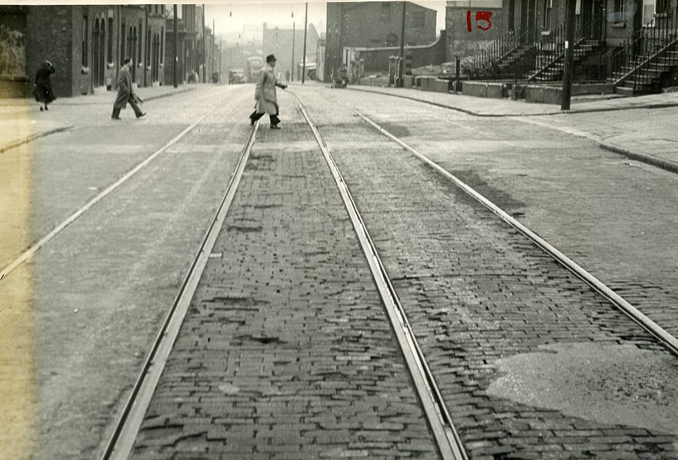
This gentleman takes his life in his hands to cross before the approaching tram. Streets on the right at this point included Melbourne, Adelaide and Torr with Devonshire Place beyond these three. The Valley begins to loom. You would get off here for Candia, Mitylene and Crete Streets on the left.
-
The end of Netherfield Road North is in sight as the tram drops down towards the Valley. I remember a fish and chip shop on the corner of the street on the left. The final streets on this side at this point were Conyers, Zante and Kirk.
-
The tram driver would have been applying his brakes as his 'Car - as they called them - heads down the hill towards the Valley. It's hard work for the man pushing the barrow up in the opposite direction. There was a well known sweet shop on the corner beyond the men on the left. This is where my granddad, Adam Wareing would walk me from our house in nearby Melbourne Street to get a Fry's Chocolate Cream treat. I still love them to this day. His breathing was bad and he would stop to sit on the window sills off the terraced houses on the left.
-
Our tram is now reaching the end of Netherfield Road North with the Valley ahead. It's good to get a view of the distinctive terraced houses on the right with the famous Valley Post Office building directly ahead. Where's the traffic? Just a couple of trucks competing at what is now a hyper busy multi junction.
-
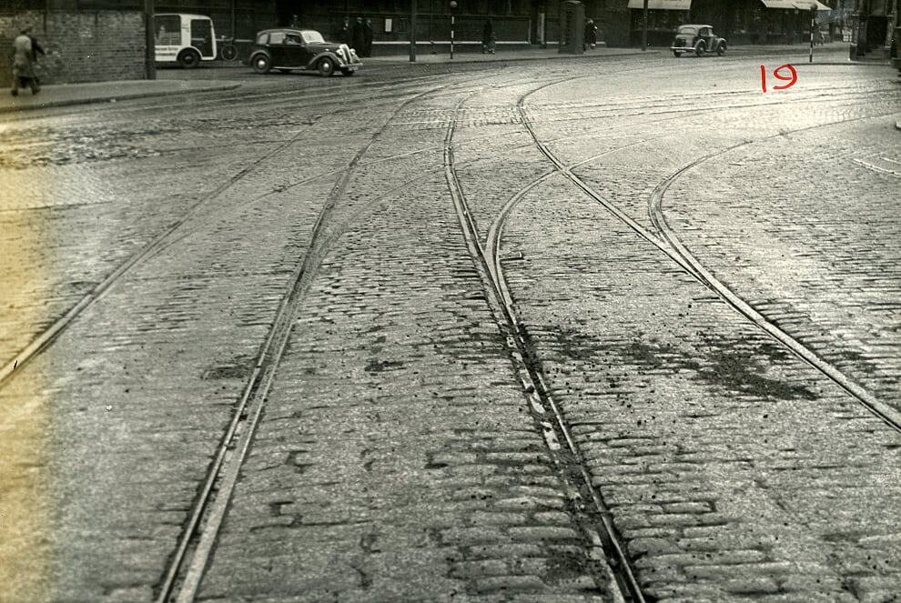
The tramlines approach Everton Valley, with these cross lines able to head up Everton Valley to the right or go straight ahead at Kirkdale Road.
-
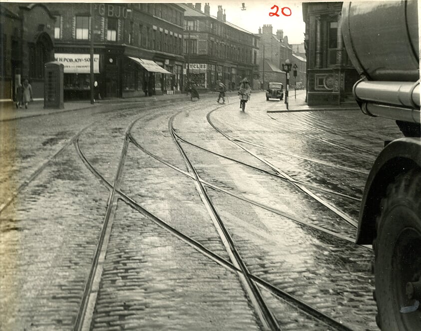
The tram reaches its journey's end along Netherfield Road South & North, now on Everton Valley itself with the old Derby Pub on the right and Kirkdale Road opening up to reveal Pobson's the jeweller on the left and the famous Harry Quinn bike shop beyond that. What a trip.
-
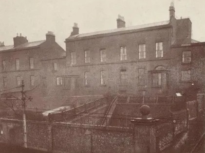
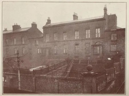
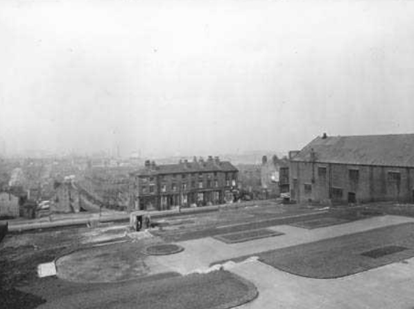
They don't look much in this grainy black and white image, but these were amongst the very first grand mansions built along Netherfield Road North. The site would eventually become the famous Victoria Settlement Community Centre. These large properties and their gardens had an elevated position above the road and would have been built in the early 1800s. Canon Thomas Major Lester would eventually live in one of them when he ministered from St Mary's Church on Kirkdale Road where my parents were married in 1947 and I was baptised in 1949. Lester would go on to be a great educationalist and protector of poor and vulnerable children across the district. I was proud to go to the school named after him on Everton Valley - Major Lester. The elevated garden could be reached from a tunnel and steps in a central position on the road below. I can remember this from my childhood days in the 1950s although it was blocked up by then. Ultimately, those gardens became a hard play area for kids, not least for football. Our yard backed onto the high north wall of Victoria Settlement, a place that is fondly remember by thousands of former community members.
-
Netherfield Road North at Anderson Street.
-
Hi all. I was only 7 years old when we had to move out of the area so my memories are very vague. Our family lived in Seacombe Street, Luther Street and Edinburgh Street where I lived. My childhood memories involved playing on the ollers and when it was raining we would have a race with lolly ice sticks down the gutters in the rainwater from the top (Netherfield Road end of Edinburgh Street right down to Great Homer Street. It would keep us amused for hours. My great grandparents . The Ashes ran chip shops, one in Edinburgh Street and one in Boundary Stree. I have vague memories of them. Although we left the area many years ago I still have fond memories of getting dragged around Greatie market by my mam as she did her shopping. Apparently I was a pain in the backside most of the time while my mam was shopping so whenever possible I would be carted off to my grandparents for the day . But yes i will always have a fondness of the area which i left 55 years ago and I never tire of seeing old footage and pictures of the area . Thank you. Billy.
-
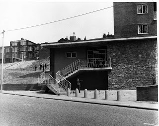
1960s steps from Netherfield Road lead into what would have been one of the new high rise blocks with Heyworth Street school left above Everton Terrace.
-
A tram on Netherfield Road North near Zante Street in 1949.
-
The Crescent pub on Netherfield Road.
-
Steps between the tower, and the former Toffee Shop site.
-
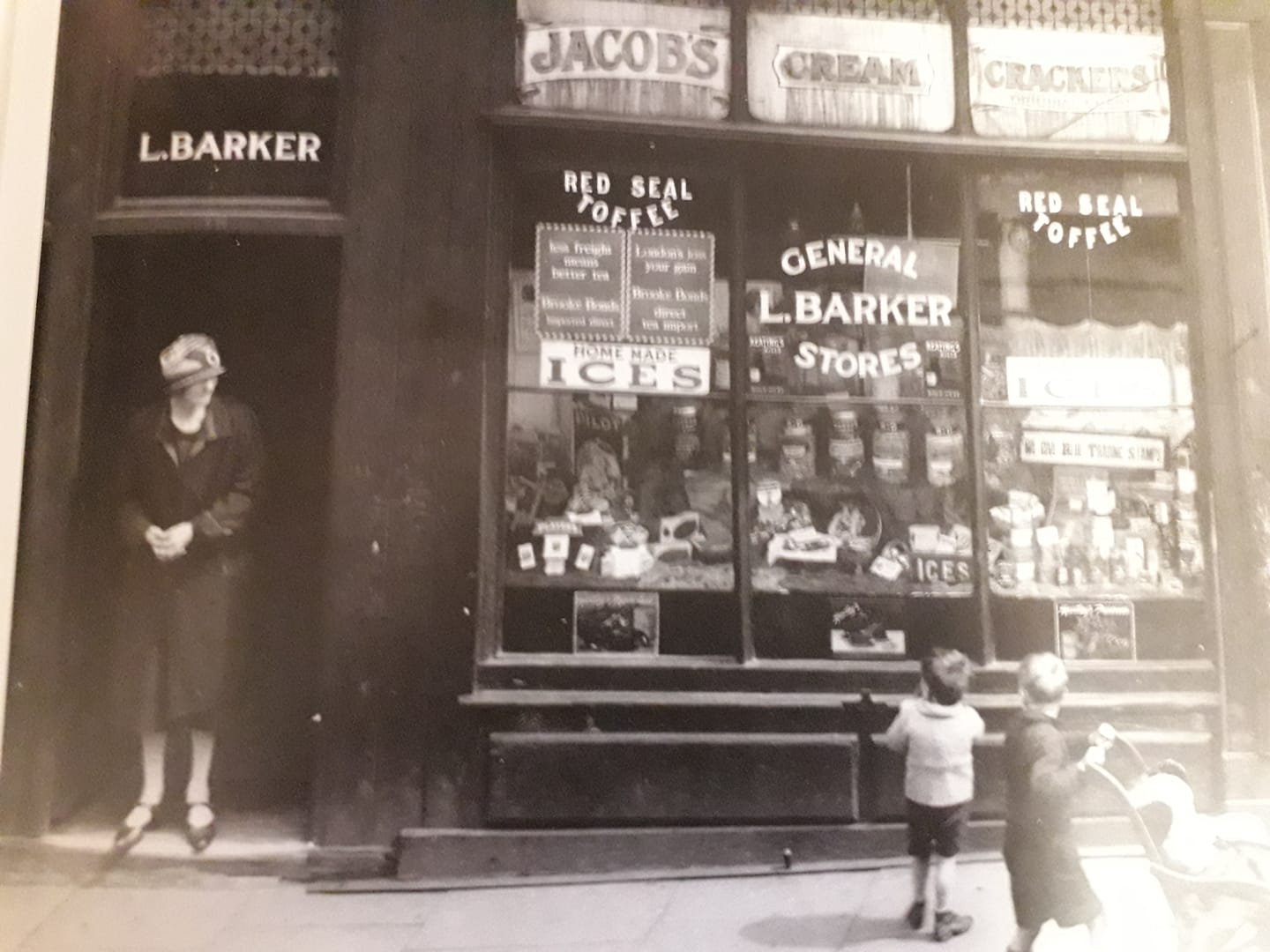
Barker's shop, Netherfield Road, 1927.
-
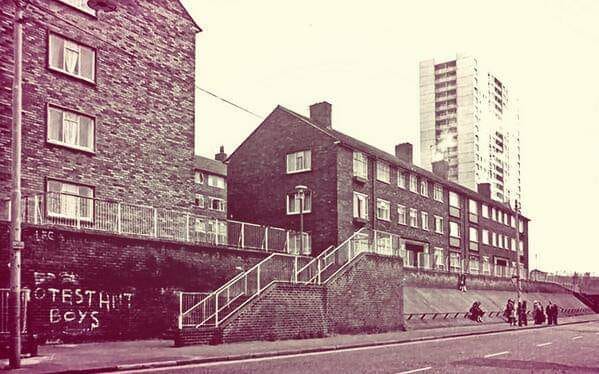
Netherfield Road graffiti in 1975
-
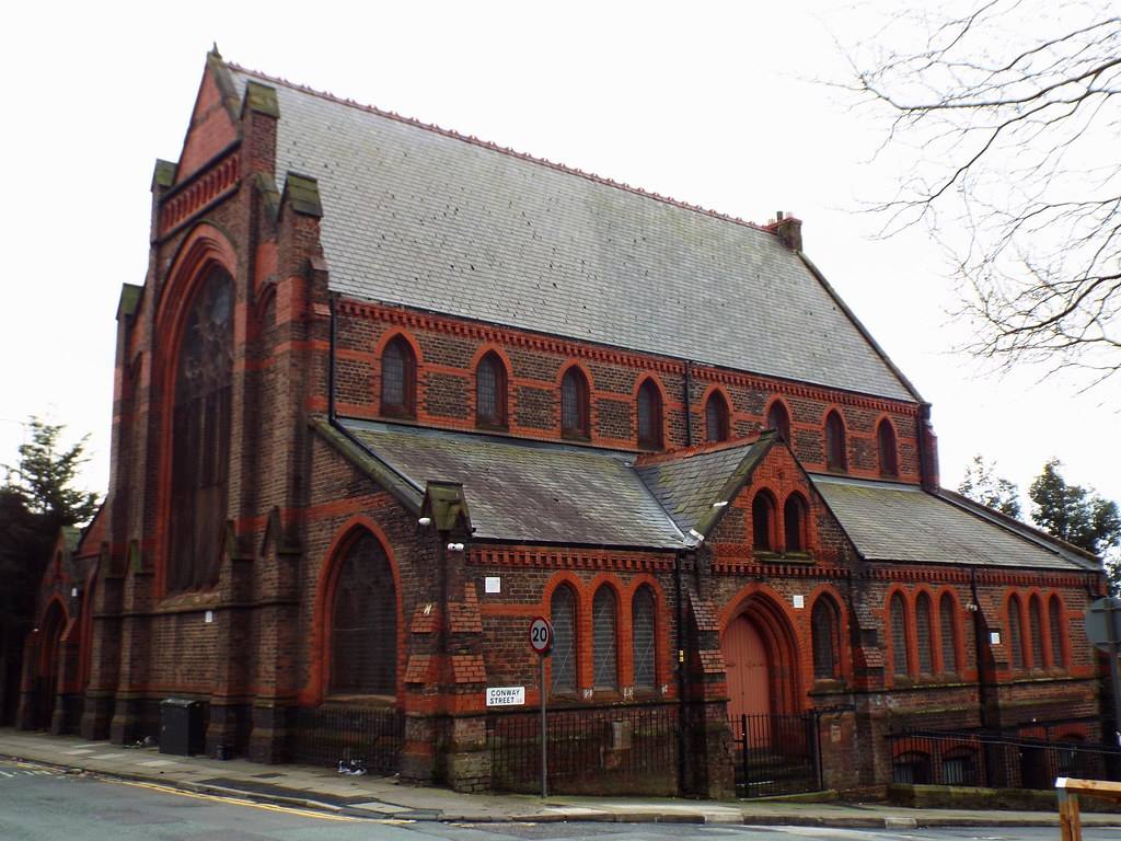
St Polycarp's Church, a residential property these days, was on Netherfield Road North on the corner of Conway Street. The building is a rare survivor from those pre-demolition days of the 1960s onwards.
-
Pretty much everything got knocked down from the Sixties onwards to accommodate the emerging HIgh Rise giants. That little building top right on Netherfield Road caught my attention on this image. It was suggested it might be the Queens pub at the top of Cornwall Street, standing alone like a welcoming beacon.
-
Old Stingo pub, Netherfield Road.
-
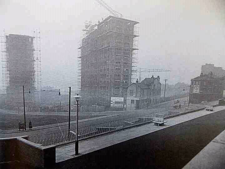
Netherfield Road high rise blocks under construction in the 1960s.
-
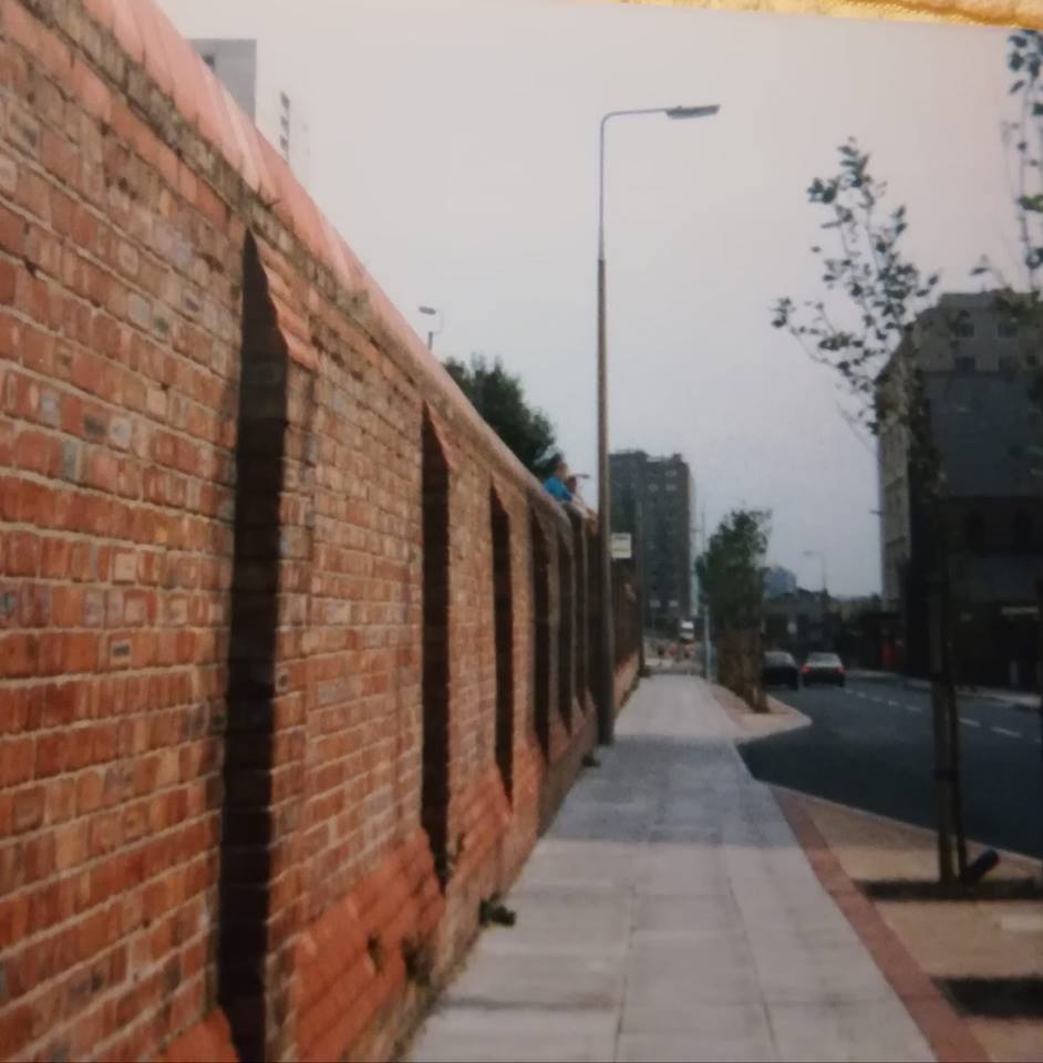
A stark shot of the old John Bagot Hospital wall looking south.
-
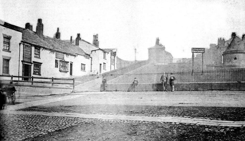
A superb 'Then & Now' comparison of the famous Everton Toffee Shop and Lock-Up Tower on Netherfield Road South. The Toffee Shop has gone, but the tower still stands as the definitive symbol of ancient Everton.
-
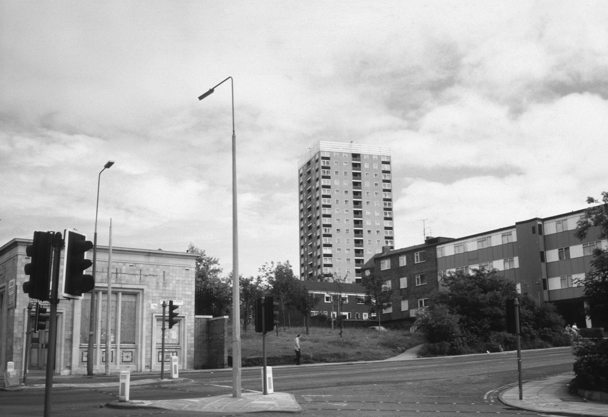
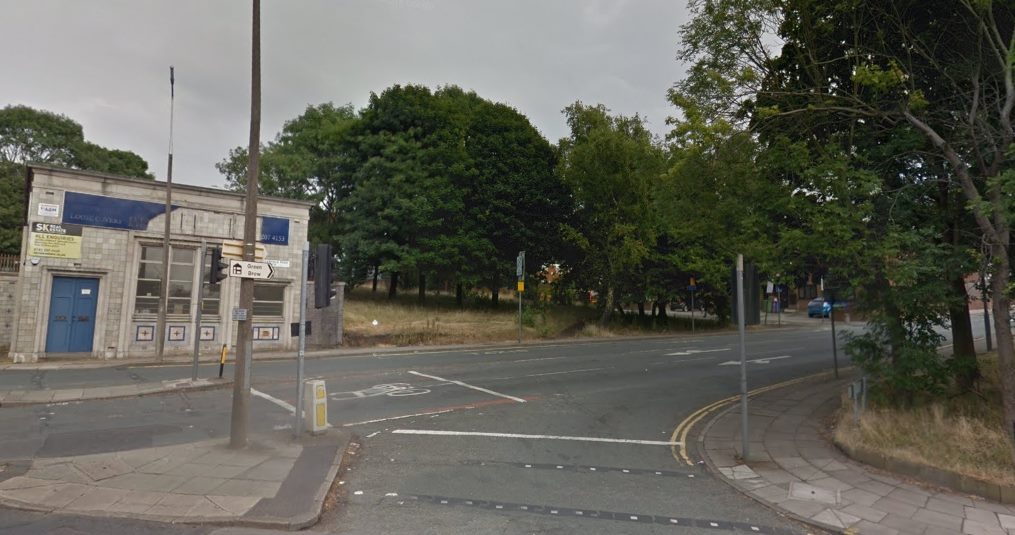
The bank at the bottom of Netherfield Road North by the Valley has long lost its cash vault. See below.
-
The bank site as it is now, captured by Brian Rea (see above).
-
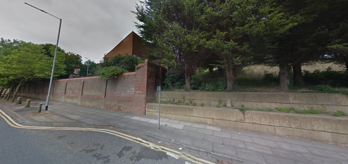
John Bagot fever hospital towered over Netherfield Road North. My father Harry Rogers was once a patient there in the 1930s. Many will remember the steps that led up to Mitford Street, How things have changed, see below.

-
If only walls could speak. Brian Rea took this current image of the famous main road perimeter wall of what was once John Bagot Hospital (see the way it was above).
-
Netherfield Road North at its junction with Robsart Street as thousands will remember it.
-
A fascinating current image of Netherfield Road North at its junction with what was Robsart Street, taken by Brian Rea.
-
Netherfield Road North now, looking towards Devonshire Place. Brian Rea's excellent comparison is below.
-
Netherfield Road North now by Brian Rea, looking down towards Devonshire Place
-
The last block on the left on Netherfield Road North, heading towards Everton Valley. What a contrast to Brian Rea's 'Now' picture below.
-
Netherfield Road North as it is now on the left hand side leading down the the Valley as Brian Rea continues his superb 'Then & Now' quest.
-
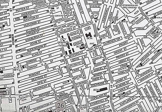
This map image doesn't paint the whole street picture across Everton (for that go to Home Page and Maps Section), but it does show the central streets off Netherfield Road and Heyworth Street and will help you with your imaginary wanderings to remind you of the way it was in our famous district.
-
The tramlines and the distinctive shape of the cars and vans point us back to the 1950s in this picture of Netherfield Road South with the sharp turn up towards Netherfield Road North and St George's Hill in the distance. Brian Rea has compared this beautifully with his modern picture below, first used on the Netherfield Road & Surrounding Area Facebook platform.
-
Brian Rea's excellent 'Now' image.
-
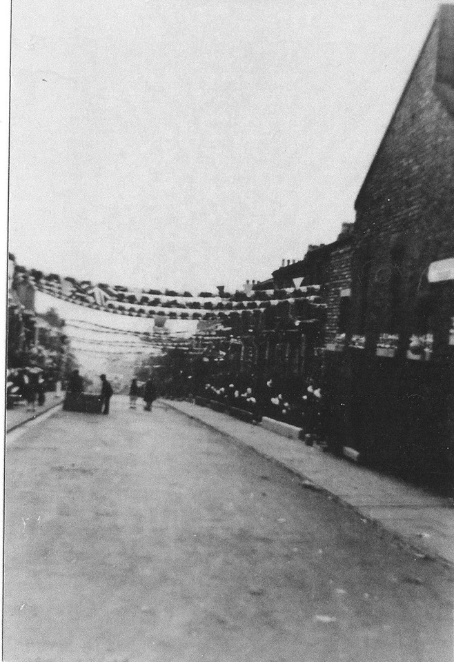
A familiar and stirring sight is captured in this artist's impression on Netherfield Road on Orange Lodge Day, 12 July, in the 1950s.
-
Brilliant picture. I was a Pop regular as a kid, this cinema being fairly close to Melbourne Street where I lived off Netherfield Road North. I remember when the Pop or Popular closed in December 1956. I was just one of many local boys who climbed into the deserted and decaying building. We would go to the back in the gods and balance on the exposed roof beams above the curved ceiling you can see, right to the stage end, high above the auditorium. How dangerous was that, almost as exciting as the Flash Gordon films we used to watch.
-
Joan Gallagher Netherfield Road & Surrounding Area Facebook uploaded this picture. Denis Hargreaves reminds us that this is the former Welsh Independent Chapel, converted to the Ann Fowler Salvation Army Hostel for Women 1907, address listed as number 2 Netherfield Rd South. Denis adds that the houses, actually on Browside, were demolished in the late 1960's.
-
Netherfield Road North looking up St George's Hill to the sky high St George's Heights.
-
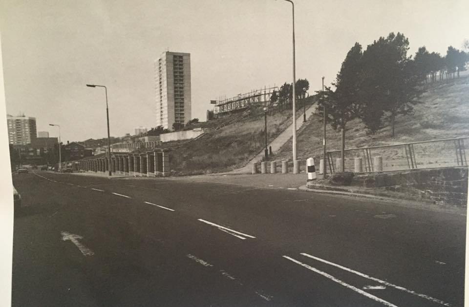
St Georges Heights stands alone pictured here in 1997.Three years on and the tallest high rise in the city would have vanished from the landscape forever. It's a shame it wasn't refurbished as the views would be outstanding in today's Liverpool.
-
Denis Hargreaves provided this 1960s picture on Netherfield Road and Surrounding Area Facebook. 1960's, Featuring Netherfield Road South, it shows the gable end of the Atlantic Vaults pub on the right and a view through to China Streeet where you can see a can parked. The waste ground behind the young girls and boys was once two shops that were converted into a social club. The club moved to a new home into what was once the Salvation Army Hall in China Street.
-
Netherfield Road at Ellison Street. From Gerard Fagan's inacityliving site.
-
The Albion pub on the corner of Netherfield Road North and Edinburgh Street.
-
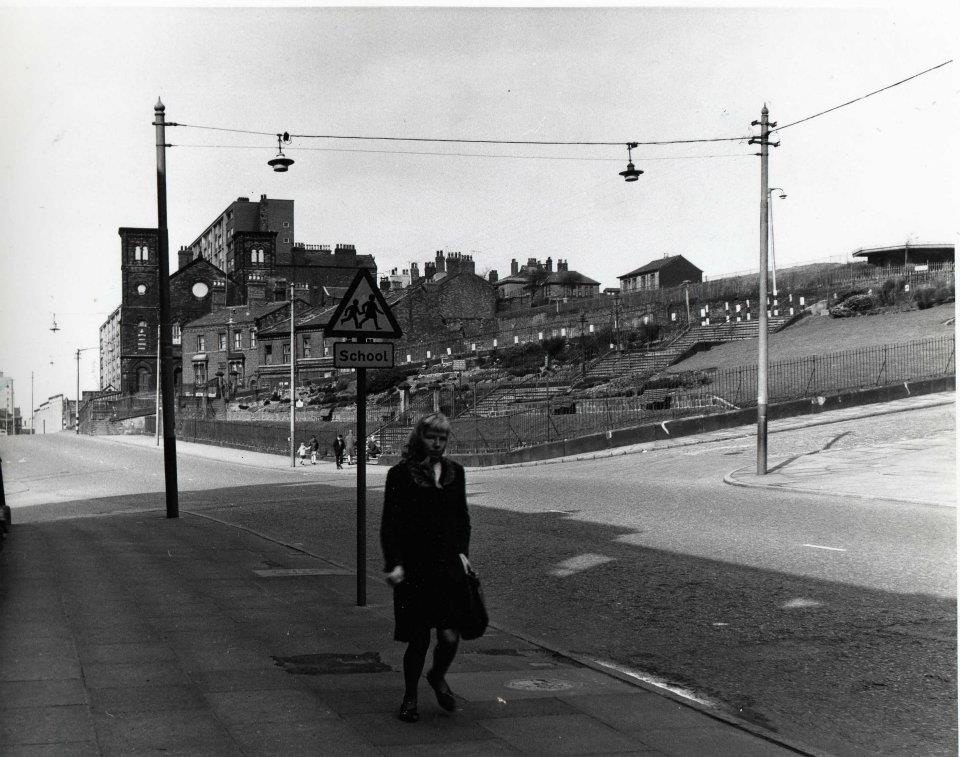
A lady walks past Everton Brow on Netherfield Road South with the Lock-Up Tower garden triangle behind her.
-
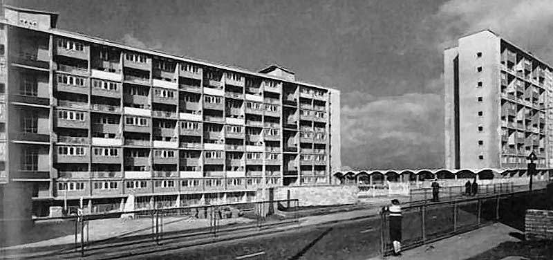
A classic image of the Braddocks flats that went up on Netherfield Road North at the start of the Sixties, named after Bessie and John Braddock, two prominent local politicians.
-
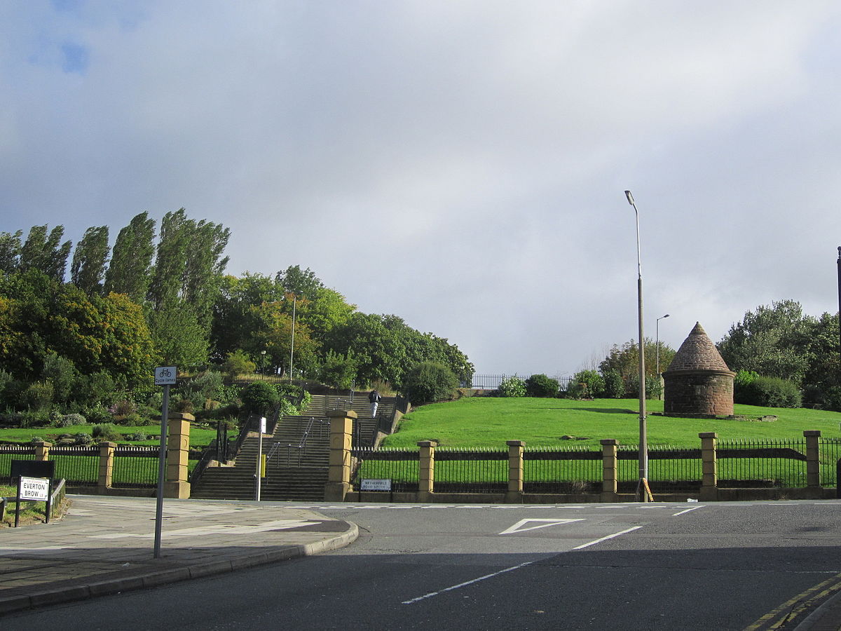
A beautiful modern picture towards the impressive Everton Park looking up at the Lock-Up Tower and famous Toffee Shop site on Netherfield Road South, taken from Everton Brow.
-
A really intriguing picture of the terraced gardens alongside the Pop Cinema on Netherfield Road North, the roof of which can be seen to the left. The houses coming down the hill to the right of the gardens are on Somerville Street. The street above Somerville and slightly to the right is Daniel Street. The houses top left are on on Northumberland Terrace, leading to the prominent St George's Church. Cicero Terrace is immediately above the gardens.
-
The rear of the old washouse that stood at the junction of Netherfield Road North & South. The upper diagonal street to the left is almost certainly Fairy Street and the one to the right is St George's Hill. Mitford Street flats are below the Cresswell Mount High Rise. A grainy image, but quite fascinating.
-
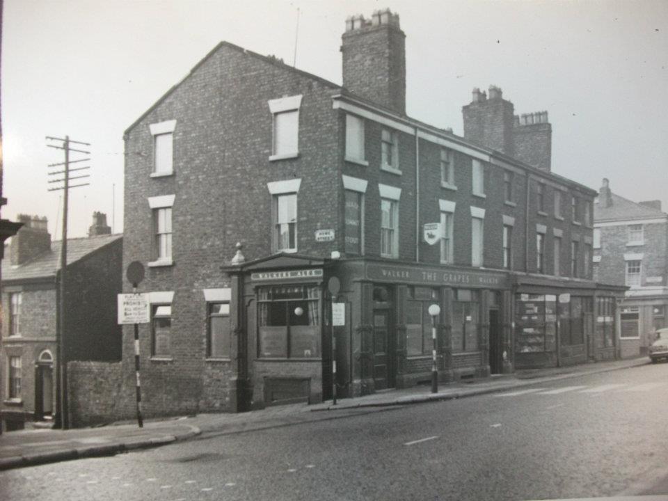
The Grapes Pub on Netherfield Road North on the corner of Howe Street.
-
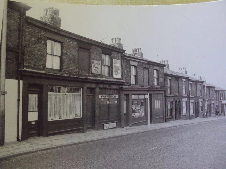
A good shoto f the terraced properties that ran down towards the Valley from Netherfield Road North. They include the S.J. Lyons shop with another sweet shop further down at the end of this block.
-
The former and impressive Netherfield Road Conservative Rooms above the Partington Hairdresser and Booths Laundry. It’s remarkable to even think about a Conservative stronghold in Everton now.
-
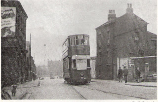
A fantastic picture of an old tram trundling past Thomaston Street on Netherfield Road North with the famous Victoria Settlement on its plateau to the right.
-
Garibaldi and the Everton Terrace blocks.
-
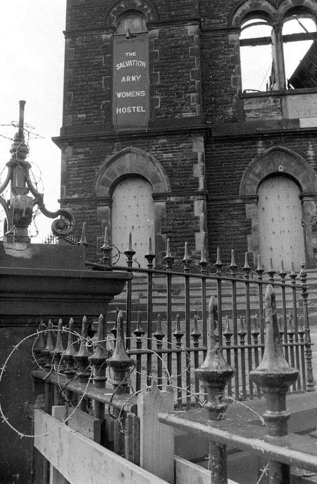
An unusual angle of the Ann Fowler Home for Women in Netherfield Road South, looking over the railings at a sign declaring: The Salvation Army Women's Hostel.
-
Netherfield Road South looking up towards Cornwall Street.
-
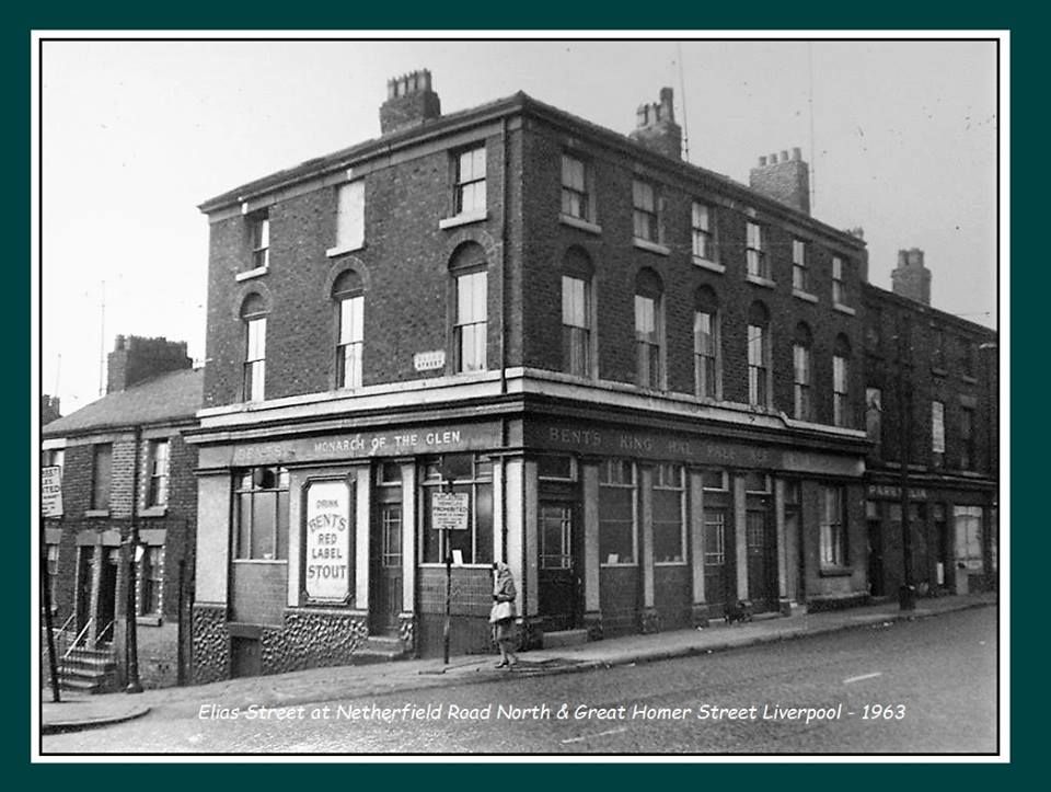
Netherfield Road had many pubs including the Monarch of the Glen on the corner of Elias Street.
-
The imposing St George's Heights tower over St George's Hill and Netherfield Road. A good early shot of this famous tower block.
-
The Orange Lodge on the march on Netherfield Road. There were once over 40 bands walking along this stretch in the 1950s and 1960s.
-
We often only think of High Rise Hell, but here is a pretty shot of many of the Netherfield Road blocks seen through the early planting of Everton Park. Many people have great early memories of movng from the old streets into the 'Streets in the Sky' during the clearances, but it would ultimately all go wrong with few of the towers left today as a legacy of that era..
-
Netherfield Road High Rise demolition by Alan Lee as the district begins to change again.
-
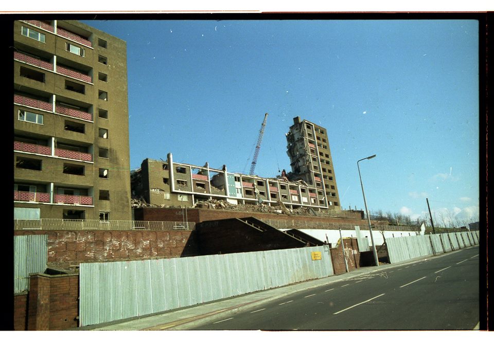
A dramatic shot of the demolition of Netherfield Brow and the Braddocks high rise blocks by Alan Lee.
-
A wonderful shot looking up from the former China Street below Netherfield Road, showing the 22 storey St George’s Heights to the left and the first of the two Netherfield Brow high rise blocks. This is a great picture, demonstrating what a wonderful view the people had of Everton Park, the city and the River Mersey. Ultimately the line of high rise towers would block the generic view from the ridge, but we should remember that these properties were mainly greeted with very welcoming tenants when they first moved in. Certainly this image, with the park greenery around, paints the opposite picture of the High Rise problems that followed years later as many of Everton's blocks deteriorated.
-
Netherfield Road North with its old tram lines and the entrance on the right to the famous John Bagot Hospital. The wall is still there to mark this well known elevated site.
-
Everton Heights on Netherfield Road pictured by Echo photographer John Davidson with his haunting comparison of High Rise on a foggy day across Everton.
-
A haunting picture looking across Netherfield Road during the 1960s slum clearance.
-
Netherfield Road in the High Rise era by Alan Lee.
-
Fantastic memory below from George Tiesteel. We clearly lived in a very special district. Thank you, George, for sharing your thoughts.
-
Persons Chippie. I used to live at 289 Netherfield Road next to the Royal Mail Van Garage. Many a time I would be sent to the chippie with a note and the money and my goal in life was to be able to see over the counter as I was so small. Mrs Lyons sweet shop was 2 doors down and I think and she took any money i got on sweets. I cant remember Ken, but i must have known him. We are the same age and went to Major Lester at the same time. I went to the Church at the bottom of Adelaide street (well Sunday School). I have read all the books and still get upset about what the council did i was 13 when we moved all my friends were split up and sent to different parts of the city never to be seen again (no internet, no bus fares, no cars to take you. It was like you ceased to exist. I lost one of my best friends at Hillsborough. so sad i had lost touch. he lived in Devonshire Place. I never looked at the area as being slums. women sand stoned the steps, washed the windows regularly and if your house was scruffy the neighbours let you know it. Maybe at the age of 13 (57 years ago wow) i was blinded at what was around me but i don't think so. I went out to play in the summer holiday at 9 in the morning and came home when i was hungry, traveled down to the dock road, ate lumps of brown sugar on the back of the 3 wheel lorries coming up Sandhills, bunked on the ferries back and forth without paying. never a worry. we were street smart (poor kids today get taken to school and picked up long lines of cars at the schools). Anyway it just brought back memories when i saw the pictures. thanks Ken i don't know were you get them from.
-
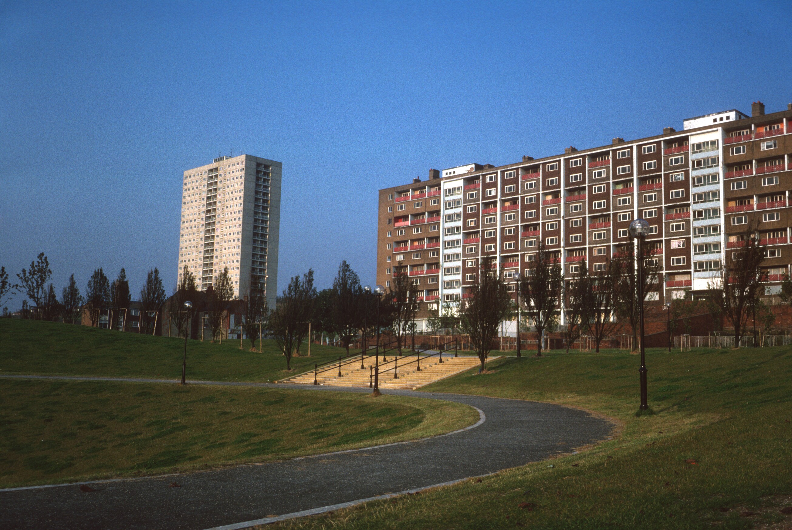
"From little acorns grow" is the saying. How Everton Park has flourished down the years although not with oak trees. John Hutchison from the Friends of Everton Park provides a fascinating insight into this picture. He explains: "The trees are largely Poplars, now forming what we call the Blue Bell Woods in Everton Park, planted up by the Friends of Everton Park. The blocks from left to right are as follows: The Braddocks 1, then the connecting 'wibbly- wobblies' - a walkway which connected the two blocks and was a fine playground for the more adventurous. Then the Braddocks block 2. These homes were maisonettes which surprisingly for flats had open fires, I think. Poking up behind these are Brynford and Milburn on Conway Street, which, along with Medea Towers in the far distance, still stand and are refurbished and popular homes. Then the Old Stingo pub and Saint Polycarp’s (now a home) on Netherfield Road. And then Edinburgh, Ellison and Seacome and the white 22 storey Corinth towers, immortalised in the explosive footage available elsewhere on this site (see films and Everton Park drone footage). You can just see a corner of St George’s Heights to the far right of the photo, the other 22 storey block, which was, I think, the last block to be demolished in the early 1990’s.”
-
Netherfield Road at its Roscommon Street junction with the Cavour high rise block as a backdrop.
-
The Crescent, another of Netherfield Road's famous pubs.
-
The Cumberland Arms on the corner of Netherfield Road North and Mitylene Street. This was my grandfather Adam Wareing’s local and that of his sons Joe, George, John. Adam, and Bobby in the 1940s & 1950s. I lived in Melbourne Street opposite and, as a kid, whenever I went to one of the doors, it seemed like a real man’s pub (with a snug for the ladies). People would stand outside at closing time (10.30pm) and continue to chat (and sing). My friend Graham Jennings lived in one of the big houses opposite and broke his arm when the Mitylene Street side was covered in scaffolding. We were leaping like monkeys to grab the steel crossbar and he missed. Thankfully, I took my own son to the Cumberland before it was demolished to remember my grandfather and his great grandfather Adam Wareing Snr, a great man who I will never forget.
-
Netherfield Road North at its junction with Kirk Street. I was regularly sent to the fish and chip shop on the corner from nearby Melbourne Street.My granddad Adam Wareing would walk me past this block towards Everton Valley. The terraced houses fronted right out onto Netherfield Road and he would sit on the windowsills to catch his breath before taking me to the sweet shop on the corner a bit further down where I would always get a Fry's Chocolate Cream treat.I still love these and whenever I get one, it brings back warm memories of my granddad.
-
This is a grainy image of the Anne Fowler Memorial Home for Women to the right, probably from a newspaper cutting, but it's nevertheless fascinating to look at the giant retaining wall that supported this and other buildings along Everton Terrace to the rear. I love the horse and cart on Netherfield Road, the complete lack of cars,and the tramlines that were once a feature of this famous thoroughfare.
-
There are other pictures of this famous building within our Netherfield Road section, but none as pin sharp as this wonderful image of Ann Fowler's. Some called it a home for destitute women, or fallen women, but we are able to clearly read above the entrance: 'The Salvation Army, Ann Fowler Memorial Home For Women'. I like to think of these ladies as former grans, mums and sisters who suddenly found themselves in a difficult situation and in need help, possibly after losing their husbands. They certainly found vital shelter in this former Welsh Congregational Church, another desperately sad loss for Everton when it was demolished during the clearances. Who could even think about knocking down such a classic building, almost a mini version of the Notre Dame in Paris?
-
A towering sight on Netherfield Road with Cavour, Mazzini and Garabaldi to the left with the Braddocks behind the bus stop.
-
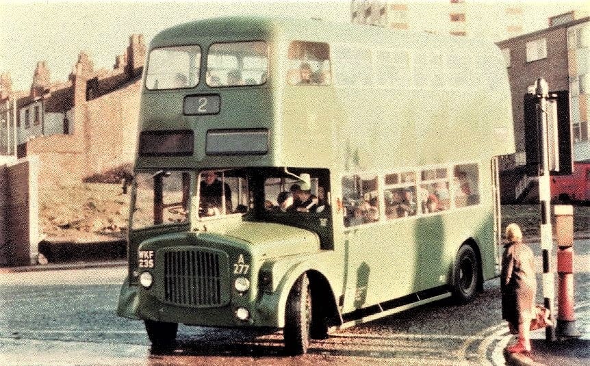
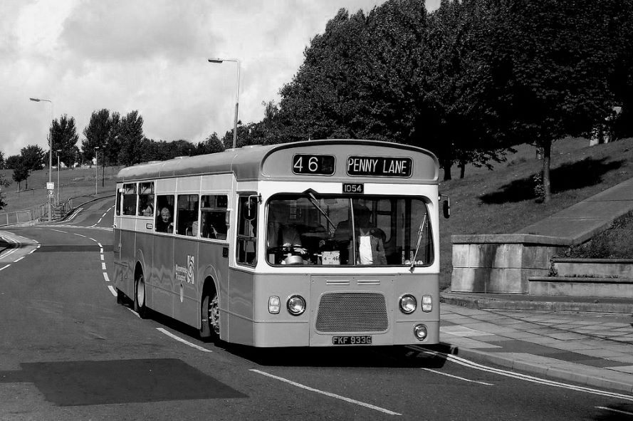
A 46 bus glides along Netherfield Road en route to Penny Lane. Of course, Netherfield Road's other famous service was the number 30 that started in Aintree and ran into the city centre.
-
The many WW2 bomb sites across Everton and Scotland Road provided unorthodox play areas for the local kids who saw these as their own special places. Here kids congregate below Nethertfield Road. Youngsters used sites like this for traditional games, plus full scale football and cricket matches.
-
The familiar junction of Netherfield Road South and North, featured in black and white elsewhere in this photo reel, coloured by Brian Rea of the Netherfield Road & Surrounding Area Facebook group.
-
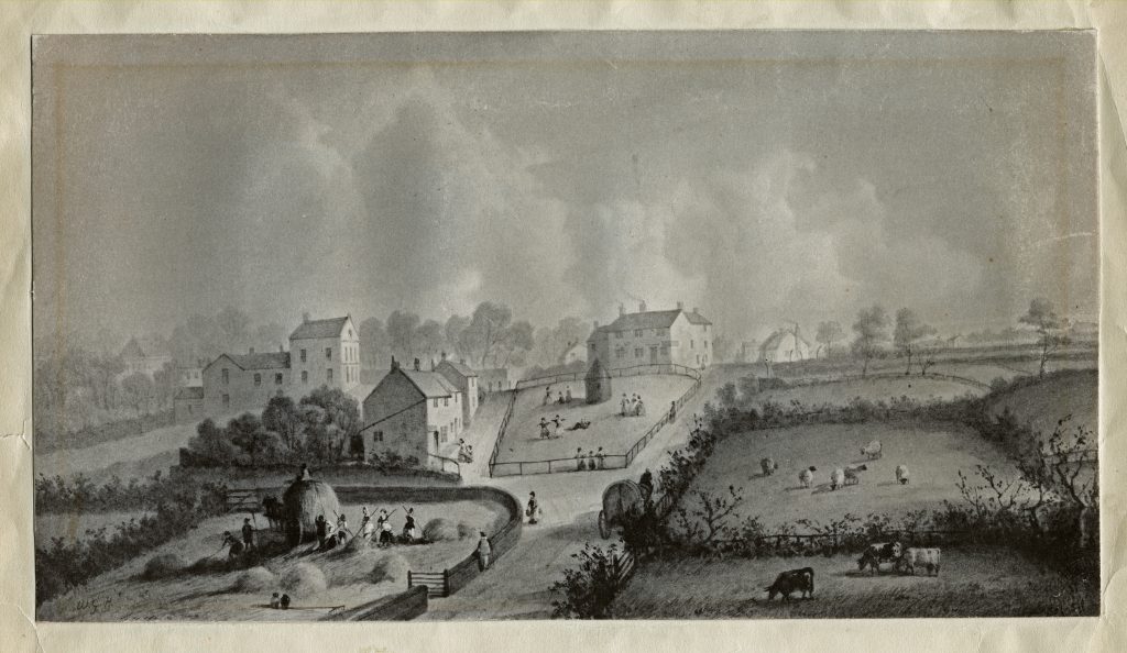
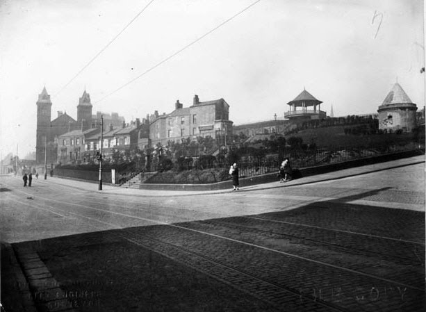
It's still a spine tingling moment when you pass the 1787 Everton Lock-Up Tower that stands between Netherfield Road South and Browside, but this image shows a dramatically different and awe inspiring scene in those days when the tower was surrounded by fields. Here the Everton villagers literally make hay while the sun shines, captured in this Herdman drawing. Shaw Street has yet to be built to the right of the road below the tower which was then nothing more than a country lane. People have fun around the tower, just as they do now in the modern Everton Park. The 'Nether' in Netherfield Road means lower in the same way that the 'Nether' in Netherlands (Holland) means low lying land. Clearly Everton's 'Netherfield' was crucially important to the village people on the hill.
-
These large Victorian Houses on Netherfield Road North had Adelaide Street on one side and Melbourne Street on the other. They immediately faced Candia, Mitylene and Crete Streets.These main road giants had a steep flight of steps up to the front door and each had large cellars front and back. The mirror style properties on the other side of Melbourne Street were destroyed by German bombing during World War 2, but then all of the area was subject to significant damage at that time. Thankfully, the large houses pictured survived.
-
Netherfield Road South meets Netherfield Road North with St George's Hill straight ahead.
-
The elevated garden that was alongside the famous Popular 'Pop' cinema on Netherfield Road North. I worked as a paper boy in Moss's newsagent's opposite, the steepest paper round in Liverpool! The 'Pop' closed down as early as December 1956 and was finally demolished at the start of the 1970s.
-
An etching that tells you more than a thousands words about the way it was in Everton circa 1820, in particular the famous ridge that became home to some of the city's most influential merchants at that time. St George's Church, opened in 1814, remains the dominant structure on what would become Northumberland Terrace. The third mansion from the right this side of the church is almost certainly the home of James Atherton, the driving force behind the building of the church and many of the impressive properties you can see. He would later be the inspiration behind the development of New Brighton. As you move down the hill, you can see on the left the impressive mansions on Netherfield Road North and South. On the left in its impressive elevated position is one of the district's finest mansions that would become the home of education visionary Canon Thomas Major Lester and later the famous Victoria Settlement Community Centre. I'm particularly interested by this building because by 1880 the field to the left would become Melbourne Street where I was brought up in the 1950s. The fields continue to sweep down towards the path that would ultimately become the bustling golden shopping mile of Great Homer Street. Two men are working on the land that would eventually become well known local streets like Boundary, Nursery and Skirving as the concrete jungle of the late Victorian era and early 20th century changed this scene from a sleepy rural idyll to to a district packed with hundreds of back to back terraced streets with a population of over 150,000 people.
-
Everton Brow from Netherfield Road in 1927
-
St Polycarp's on Netherfield Road North, overshadowed by the High Rise blocks.
-
A rare photo of the Everton Toffee Shop on Netherfield Road South and Brow Side.
-
John Bagot Hospital Netherfield Road North on its elevated site. The old wall is all that remains.
-
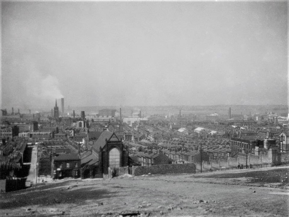
A remarkable aerial shot the length of Netherfield Road and Heyworth Street. The grand houses are still standing on one side of Fitclarence Street (bottom left) running down from Everton Road to Eastbourne Street. Village Street, one up from Fitzclarence, still has some properties intact including the well known People’s Church which can be clearly seen. While the High Rise flats are beginning to dominate along Netherfield Road, much of the terraced street housing further up the hill is still intact.St George’s Church is visible top right. How many other landmarks can you pinpoint?
-
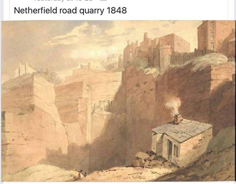
This fascinating 1848 image of the old Mark Street quarry off Netherfield Road North (near to the Valley) shows the former sandstone source that would eventually become the site for the well known Wood Floors yard. The quarry's imposing cliff face was still clearly visible when I was a kid in the 1950s. Some boys would even try to scale it with ropes, an extremely dangerous adventure. My father Harry Rogers worked at the Wood Floors for a short time. So did my uncle Sam Evans.
-
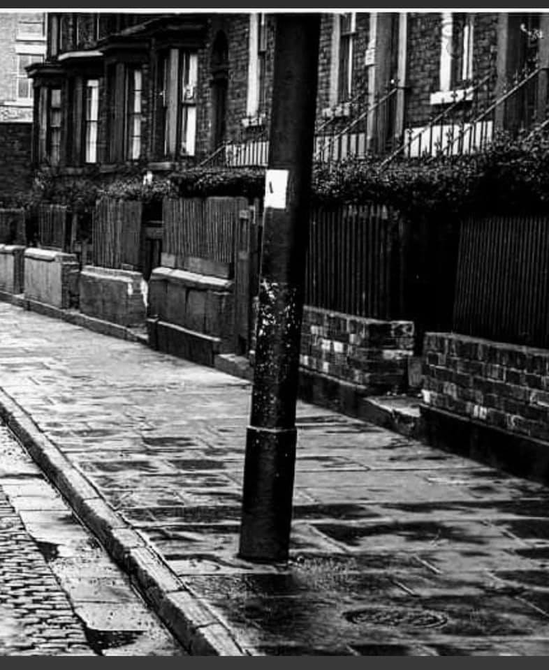
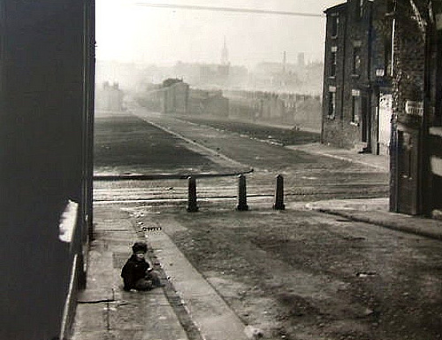
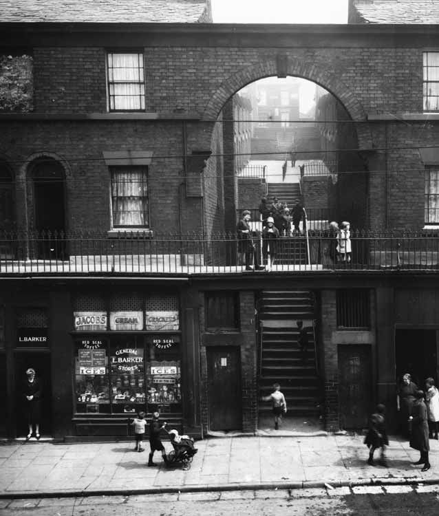
Netherfield rd steps picture. My sister had this on her wall. My 85 year old dad was seen looking at it and seem to be crying. He said it brought back the memory of when he was 10 years old his mum had been commited and his dad had left him with his gran, and gone to live with another woman. Dad found out he was living on the steps and went to see him. He knocked on the door and his dad opened it. He said "hello dad" and his dad gave him two pence and said dont come back. Years later when I was about 8 on Boxing Day my dad would take me to a flat in Thomas White Gardens. We would go into a bedroom where a very old man lay in bed. My dad would lean over him, kiss him and say happy christmas "pop". This was the man who had dump him all those years ago
-
The famous steep Netherfield Road steps that once led up to Everton Terrace, pictured here in 1927. Many people remember and comment on them. They disappeared during the clearances.
-
Netherfield Road looking towards the Ann Fowler women's home with the Atlantic pub on the right.
Thank you for your contribution!
Please check back in 24 hours to see if your photo has been approved.
Return